In this episode we have an encounter with authority (well, a Taswater ute), unadvertised climbs, beautiful weather and another slithery encounter which causes me to adopt a new walk rating.
 |
New rating. A snake for each walk sighting.
|
As stated above the weather today was absolutely perfect - warm without being too hot. Bob was our leader for the day.
After parking off Proctors Rd. we crossed under the Southern Outlet and started the walk at the gate on the right.
 |
| The starting gate |
 |
| The camera had difficulty in dealing with today's bright sun. |
The track was an old, rough firetrail that led gently up hill until we came to the first advertised descent. This was steep and took us down to the bottom of a valley and a dried up creek. The worrying thing was the unadvertised equally steep climb on the other side.
 |
| And down we go |
 |
| Julie's being very careful. |
 |
| Notice the slight uphill grade on the other side. |
 |
| Bob waiting while we cross the first dry creek. |
 |
| Valve in the top of the small dam over the creek. |
The creek had a small dam over it with this old valve set into it. Walking up hill from here we met the Taswater Ute coming down with a couple of fellows in it. They agreed to pick me up on their way back up. However, I don't think they made it as the trail we walked down was too overgrown and rough even for a 4wd, and there was no where we could see that they could turn a vehicle. They may still be there!
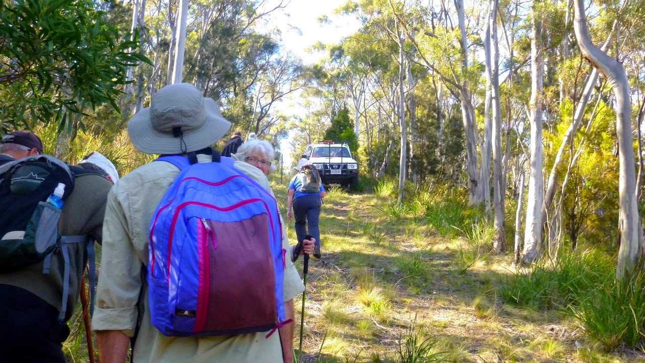 |
| Meeting with authority (they didn't stop) |
 |
| Looking back |
 |
| Oh look. We're going down again. |
 |
| And over another creek |
At the top of the climb, we started down into another valley and found another dry creek with exactly the same setup of valve and dam.
Up and down before turning off onto another track to find a place for Morning Tea. This was under an unexpected radio antenna array in the bottom of the valley. On the map this is marked as a Commonwealth of Australia Ionosphere research station. Who knew? I certainly didn't know it was here.
 |
| After going up again we got our bearings... |
 |
| ... and started down. |
 |
| I wanted to give an idea of the angle of slope, but this doesn't do it justice. |
 |
| Morning Tea. Sorry about the over exposure on the left, at least Sally's alright. |
 |
| Ionosphere research antenna. |
 |
| And the associated station. |
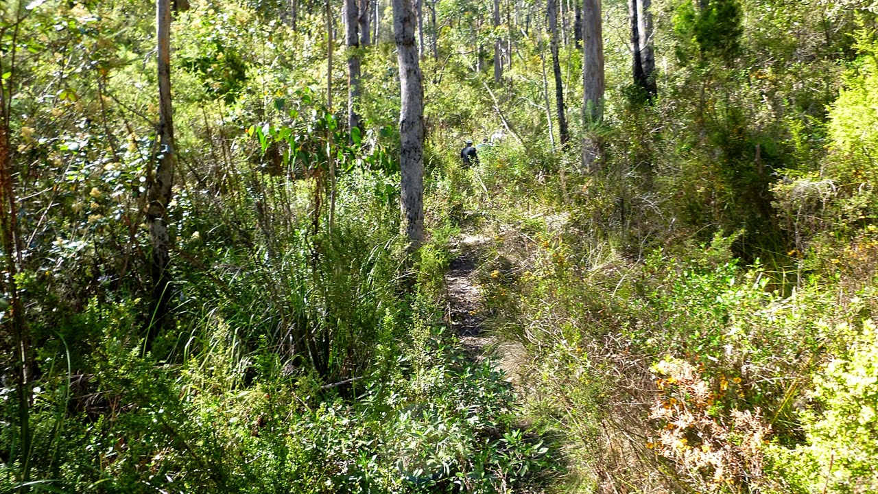
After refreshment, we returned along our track and crossed over the original route from the second creek and continued along beside the creek bed on a small, overgrown trail. I believe this was where the snake was encountered by the front runners in our group. It was long gone by the time the backmarkers caught up.
Passing under a large fallen top of a gum tree, we continued over and under various obstacles before crossing over the creek and going - you guessed it - up hill!
 |
| The new track after tea. |
 |
| Top of gum tree over the track. You don't have to salute it, Peter. |
 |
| Overcoming all obstacles we ... |
 |
| ... continue on before ... |
 |
| ... crossing the creek and starting up hill. |
A slight diversion here, unlike last week this bush didn't have the profusion of flowers and I saw no orchids. That doesn't mean there weren't any blooms and below are a couple.
Continuing up hill in a zig zag fashion, we came to another gate that required crossing to another track that led towards the top of Mt. Nelson.
 |
| Rocky outcrops. Someone thought it would make a good bushranger hideout. |
 |
| Another gate |
Getting near the top of the hill, we saw a fenced in area with an antenna tower and a couple of portable buildings beside it. One of our walkers - Lyn - was making a call at the time, and I heard her say something like "Look outside and you'll see some disreputable looking walkers". Turns out her husband, Brian, and a couple of others were working on site.
This site is used by Transend as a radio relay site, but they also had kindly offered room for another group and space on the tower for their antennas.
This group known as Tas Maritime Radio is an all volunteer organization providing safety communications for mariners around Tasmania. Transend have 4 antennas on their tower, Tas Maritime have 13!
After getting the grand tour from Brian, we continued on our way.
 |
| Transend site with Tas Maritime Radio. This site connects the Maritime Radio with all the other sites in Tasmania. |
 |
| Leaving after our very interesting guided tour. |
 |
| More flowers |
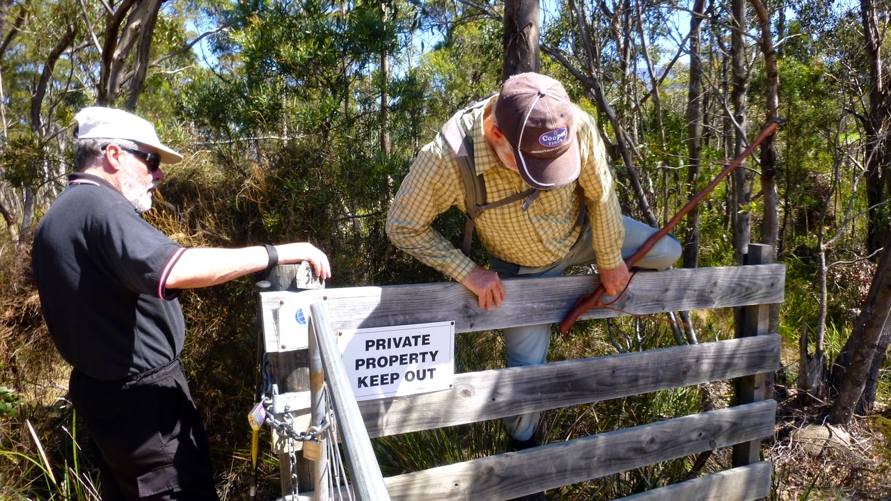 |
| Sign? What sign? Anyway, it was on the wrong side for us to see. |
We came to a gravel road and followed it until it turned paved and led to Nelson Rd. Walking down, we passed what used to be Mt. Nelson Tavern, but is now a construction site for luxury flats, before turning off at the recreation ground for lunch.
 |
| Lunch |
Lunch finished, we continued on down the road until turning off into the bush again. On a rough, washed out track we headed down until we rejoined our original track in, following this back to the cars.
We had (I think. I forgot to count) 12 walkers and covered 10.45km in 4:27hrs.
Everyone enjoyed this walk and found it very interesting.
Next week, we are going to see some of the old hut locations on Mt. Wellington. While doing some research, I came upon this website, which is a quality one about Tasmania. They did an article about the huts which is in the link below.
The Tasmanian Geographic site is one worth subscribing to. It's free, and they will notify you when there is a new online edition out.
For the hut article:
Click here.
There is also another website selling a book on the History of Mt. Wellington, and they have information on a number of huts online, just see the list below book description. There's also a Youtube movie about the huts you can watch. Unfortunately, the sound track has been removed.
Click here for that site.
 |
| Walking with the U3A hint no. 146... |
 |
| ...There's a finite number of times you can complain about Bobs choice of hills! |


No comments:
Post a Comment