Today was to be a walk from The Springs to the Potato Fields, with an option to continue further. Sharp eyes will have noticed I've called this "The Springs - Milles Track - Potato Fields -
and Beyond". There's a reason for that which you will find out.
While poor NSW was copping extremely bad weather, here in Tassie it was perfect for walking. Pleasant temperature on the mountain with some cloud. We would be walking on the Milles Track, the Wellington Falls Track and some others as it worked out.
 |
| Springs Car park |
 |
| Nice wide comfortable track |
 |
| Everyone looks happy |
 |
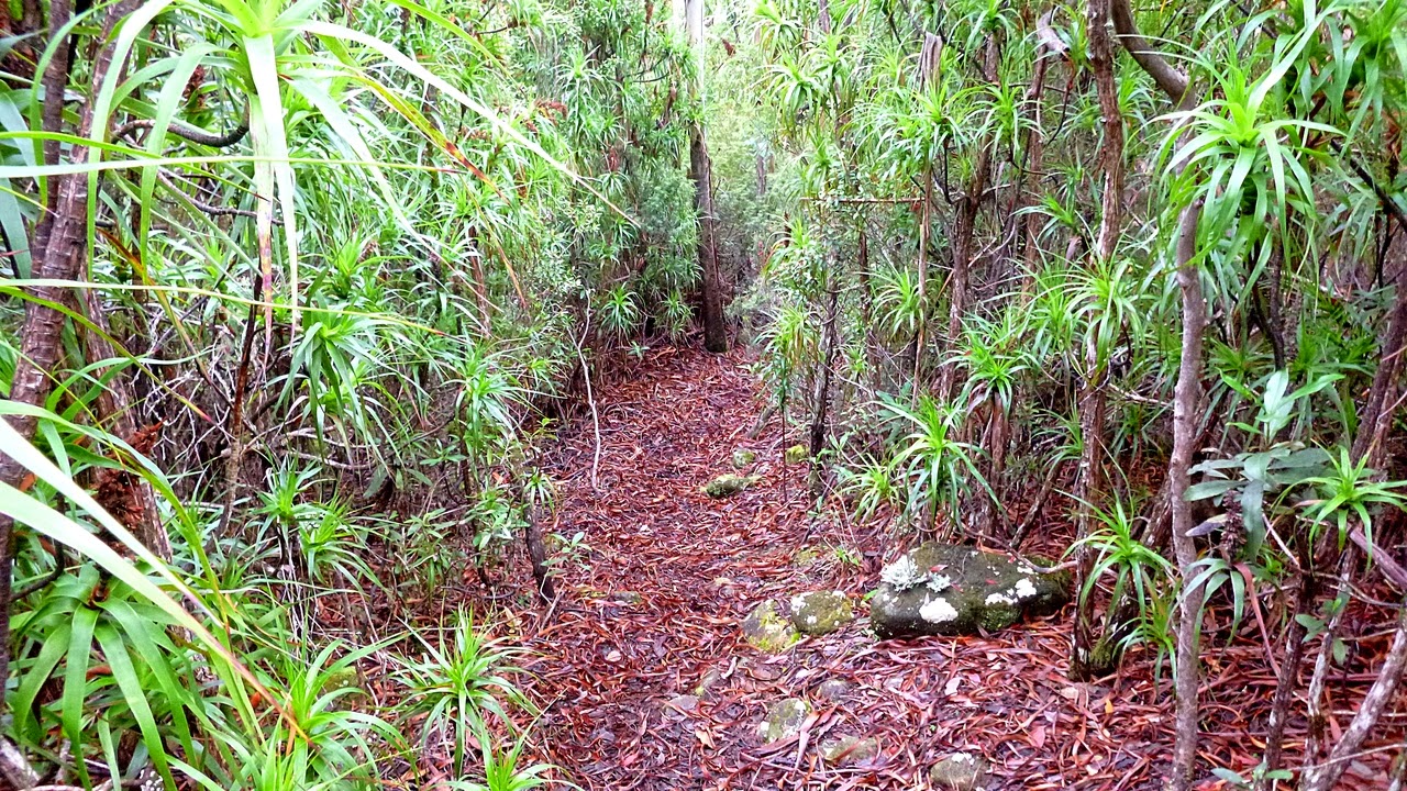
| The track narrows down as we go along |
It's very pleasant walking along the Milles Track, soon it will open up in a couple of places for a view.
 |
| Looking east over South Arm |
 |
| A better view of South Arm and beyond |
 |
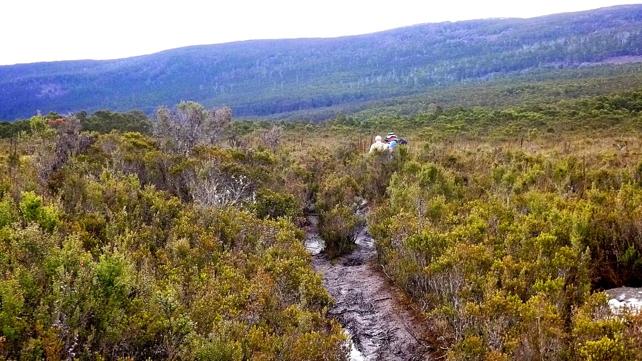
| We're getting into some of the scree fields, but the track is clear |
 |
| Small spring coming out of rocks beside track |
 |
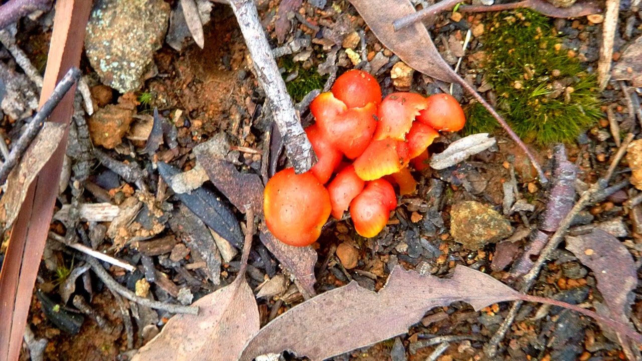
There's a lot of colour in the bush, as you will see.
Snow Berry (Gaultheria hispida) |
The track is mainly level with a couple of very short climbs.
 |
| Looking left |
 |
| I think they found a view... |
 |
| ...of Kingston |
 |
| The bush is prettier than Kingston |
 |
| This is how the track looks now |
 |
| Peter pointed this out to me |
 |
| Lots of lichen on the trees beside the track |
 |
| A couple of wet places appear on the track |
 |
| More colours of the bush below |
There is more rock on the track now, and we pass the start of another track called Snake Plains. It might be a good idea to remember it.
 |
| Older style track marker. A rock cairn |
 |
| Start of Snake Plains running down to the Pipeline Track |
 |
| Older markers |
 |
| Almost looks like snow |
We continue on and find a place for Morning Tea.
 |
| Morning Tea on convenient rocks and logs |
Tea finished, we continue on past some more colour, and catch a first glimpse of Cathedral Rock across the valley.
 |
| More colourful gum bark |
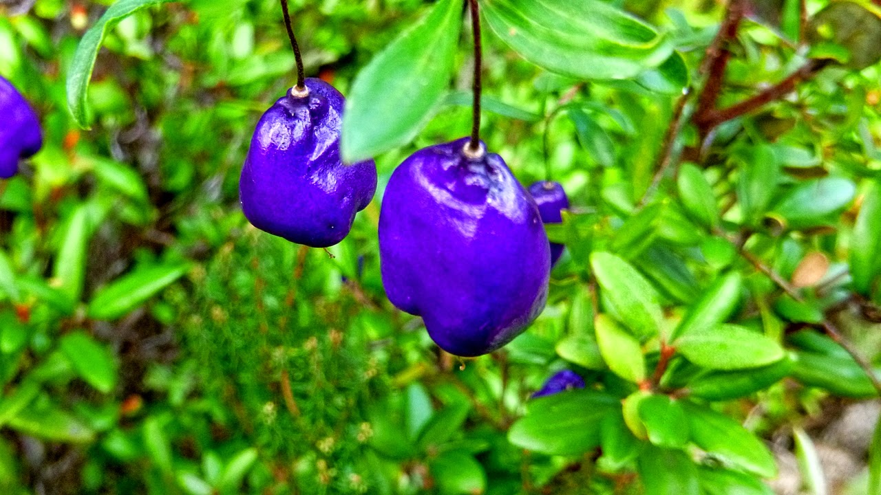 |
| Mountain Blue Berry (Billardiera longiflora) | |
|
|
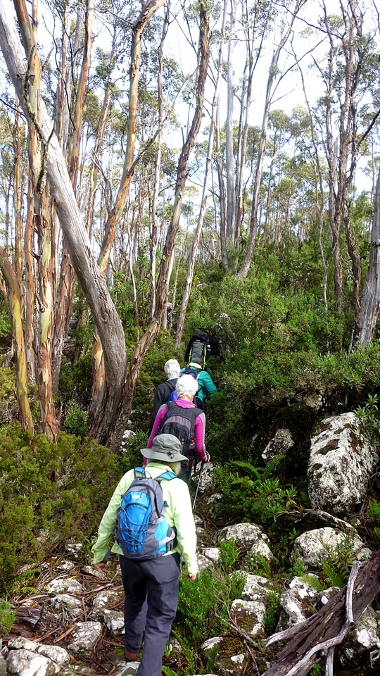
We continue on, finding more rock on the track.
 |
| Impressive collection of young trees |
 |
| On we go |
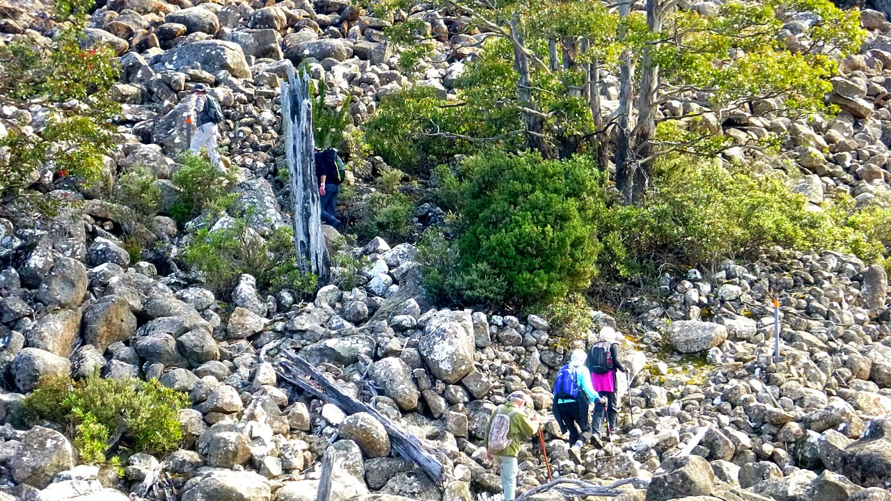
We're starting to do a bit of boulder hopping now, as we get nearer the Potato Fields.
 |
| Flowers among the rock. I don't know what this is, someone will no doubt tell me it's introduced and I should have pulled it out |
 |
| Cathedral Rock again |
 |
| Looking south |
 |
| Decision time |
At the beginning Bob expressed an interest in continuing on to Wellington Falls. He wasn't sure how long it would take, so a discussion took place to see who was interested. I definitely was, as were several others. In the end, five of us decided to go on and the rest would return to the Springs. A couple had work or organizational commitments and others were not comfortable walking on the boulders which is understandable. It would get worse from here!
The following are photos of the Potato Fields and the track we followed. It's well marked with posts and arrows, plus the remains of stakes and cairns from earlier times. I don't mind boulder hopping, but it's not for everyone. Now the rest can see what they missed!
 |
| The Potato Fields |
 |
| Near the top of a ridge |
 |
| Looking back |
 |
| Nature will always find a way to fill a gap |
 |
| The track at my feet |
 |
| Looking back from higher up, another scree field in the distance |
 |
| Now we're getting near the edge of the field and going back into the bush. |
We now get back onto a bush track which is a little wet in places, but not too bad.
 |
| Back in the bush |
 |
| Several large boulders to get around |
 |
| One of several large ant nests on the track |
 |
| Water hazard |
 |
| Sometime in the past, someone constructed a paved track from the other end. |
Now we start down towards the Falls. The track zig zags down and becomes fairly steep. One of our party, who's seen the falls before, decides to wait for us to return to save climbing down and up again.
 |
| Going down |
 |
| First glimpse of the valley where Wellington Falls is located |
 |
| First sight of the falls |
 |
| Wellington Falls |
 |
| Rock formation opposite the falls |
 |
| The track from Wellington Falls to the Pipeline Track |
At the lookout we have lunch and a discussion. Due to changing plans, I didn't get any photos of us there. We decided that as our fellow walker was getting tired, Bob would walk back up the track and bring them down. We would then walk out the Pipeline Track as it was much faster then climbing back up the original track and boulder hopping, plus it was much less tiring.
The cars, of course, were back at the Springs, so our idea was that 2 of us would walk out to Nieka while the other four would step out ahead along the Pipeline Track, pick up the Snake Plains Track (I told you to take notice) climbing up what appeared on the map to be a moderate walk, back to the Milles Track and back to the cars. We would then pick up the others at Neika.
It was, as they say, a plan, with unanimous approval.
The Pipeline track is, after all, a road so we made good time to the start of Snake Plains Track. It's a rocky climb up, passing through what appears to be an old logging camp. According to the map, the top should be nearly flat before a short climb to Milles.
 |
| Start of the Snake Plains Track from Pipeline Track |
 |
| Old logging coupe |
 |
| Last photo I took showing the track as it becomes increasingly wet |
As I said above the track was becoming very wet with large water filled hollows that were bypassed in some places.
I was running out of energy by this time, having had only a very light breakfast and lunch. I ignored knowledge of years ago when I used to carry scroggin (trail mix) and hard candy. I also ran out of water as I had told myself in the morning that we weren't going far and it would be a waste to fill up my water bladder.
Well, you live and learn. Usually. At one point when Ron and the others were well ahead of me, they shouted a warning about a deep hole I was coming to.
I found out how deep when I slipped and went in up to my knees! My army training then kicked in and I applied the survival technique I had learned so long ago. Tactical Swearing. You can get a lot of energy out of a good, solid, original curse. Mumbling under your breath between times helps you to continue on and takes your mind off things.
I think some of the others ahead of me must have had the Australian version of this training, as several times when they were in view, a head would drop suddenly out of sight and I could hear, if not the words, a familiar cadence floating through the air.
A word here in praise of bamboo socks. Once you get over the
stiffness and the odd splinter (just joking), they remain warm and comfortable even
when you've tipped a bucket of water into your boots. They will,
however, take six months to dry.
It was a bu**er of a track, in fact, hardly a track at all as it was very overgrown with cutting grass and scrub. I had to keep looking out for footprints as the others got out of sight and there were several choices on where to go. Tonto would have been proud of me.
No matter, I had the EPIRB.
Finally, I heard a shout that the Snake Plains Track marker (remember that?) had been found and we were back to the Milles Track.
When I got there, we took off towards the cars. I felt nearly normal and had no problem keeping up as we powered back.
It was getting dim in the bush by the time we got back, but it wasn't that late. We picked up the cars (after removing sodden boots) and drove to Neika to pick up the other two.
I think we've wisely decided it will be a cold day in some place or other before we ever do that track again.
We had 11 walkers at the start, and my GPS covered 18.8km in 7:07 hours.
An adventure.
Next morning I felt fine and took the boys on their usual 4km. There was a little whining but the boys told me to shut up and just keep walking. Good advice.
 |
| "The Boys" Bryn & Dermot |
Click here to download GPX file


Lots of lovely fungi, good to see. 🍄. What a marathon, well half a one , nearly. I love the Snake Plains track...in summer and downhill.
ReplyDelete