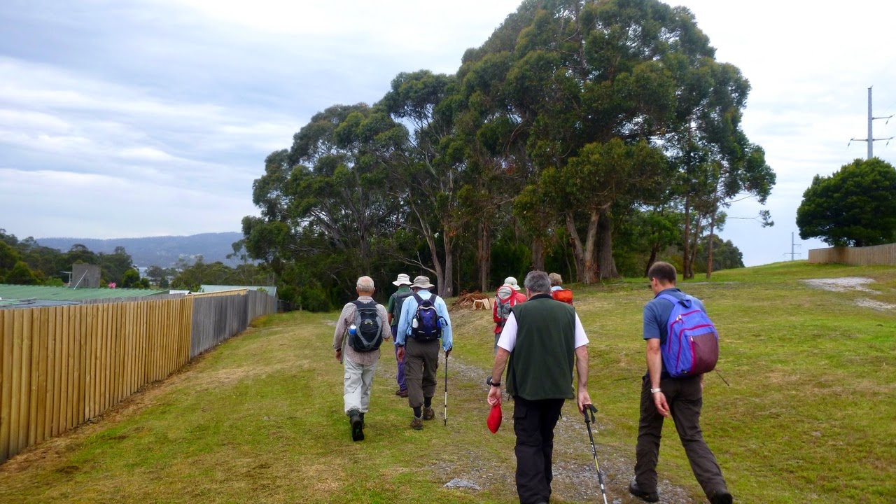
Today’s walk was on Mt. Wellington in
search of some of the old hut sites that are numerous on the
mountain.
Back in the late 1800s and early 1900s
it was popular to build a hut on the lower reaches of Wellington, to
escape the summer heat and provide a break from bustling Hobart.
Click here for a link to Tasmanian Geographic's article on Wellington's huts with photos.
Most of these are just ruins, and have
been explored many times by others in the past.
The weather today was warm with rain
called for later in the morning and possibility of thunderstorms. We
were very lucky to to have it dry during the walk, with some distant
thunder. It only began to rain just when we got back to the cars, and
that was only a few drops.
Sally was our leader, taking us from the top of Old Farm Rd. onto the Main Fire Trail
heading North. The beginning is quite pleasant walking along (thanks
to wallabies) a manicured green lawn. It wasn't too long before we
reached the site of the first hut, which was reached by a short climb up from the trail.
 |
| "The elite" |
 |
| Looking back. |
 |
| Side view. Towards Knocklofty? |
 |
| Water for firefighting beside the trail. |
 |
| Looking down at young growth beside the trail. |
 |
| Up we go to the first hut site, just a short climb. |
 |
| Lyn beside the remains of a wall. |
 |
| Ernest discussion over map. |
 |
| Better view of remaining corner. |
Not everyone was game to see what was
on offer and three stayed down on the trail, pouring over a map and checking where we were going next. Not
much left of the hut, just a jumble of stones and remains of a
corner. However, Gordon said he had been along the faint trail that
continued on about 8 years ago to another hut farther up. So Bob,
Gordon and I decided to explore – Lyn had better sense!
 |
| Lots of young growth, and several fallen trees to get over. |
 |
| Bob following faint pad. |
 |
| Remains of stone edged steps... |
 |
| ...and a retaining wall. |
 |
| Very thick piece of glass, nearby was a broken bottle from Melbourne, but not enough left to identify what it contained. |
 |
| Gordon negotiating a couple of fallen trees. |
We followed the track and found a
couple more artificial level places, and more indications of this
being a major track of the time. It had been well constructed with,
in places, large steps fronted by neat stonework. We continued along
getting farther from the others, until my phone rang with Tas
wanting to know where we were! So we turned back, mainly because the
track appeared to cross a gully which was blocked with a number of
fallen trees. This looks like a job for another time.
I must say, I enjoyed exploring the
bush as did Bob & Gordon. It made a change from the trails. With a combined age of over 220 years, we could handle it!
When we returned to the Main Trail, the
others had moved on (slowly) and kindly left an indication of where
we were to go. We caught up with them going down a slope before we
climbed another. I had heard talk of how steep this part of the trail
was, now I believe it.
 |
| Now, which way did they go? |
 |
| Here we caught up with the rest. They had slowed down due to the effects of the MORNING TEA they had. |
 |
| Looks like a pretty little slope, doesn't it? |
 |
| Looking back and taking in the Wrest Point Tower and the eastern shore. |
We climbed up the steep, slippery slope
until we came to a junction of three other tracks.
One went down, so I knew we wouldn't
take that, and the other was flat, so that was out. The third one
went up and, surprise, surprise, we took that one. We were heading up
to Junction Cabin for lunch. Did I mention everyone had taken Morning
Tea while the intrepid three were exploring?
 |
| About the only wildlife I saw. Look closely, he blends in very well. |
 |
| An invitation we didn't take up. |
 |
| Junction cabin is in sight. |
 |
| Junction Cabin |
 |
| Lunch |
Another steep climb awaited us and it
was a while before we reached the cabin. After lunch we walked the short
distance to the Myrtle Gully track and started our decent. This is a
good, old very pretty track. Lots of ferns, water and rocks, but it
is a way's down. I forgot to mention the two young fellows that passed us, having come in from another track. I first thought one of them had thongs on, and now I'm not sure what he was wearing. It looked like some sort of thin covering fitting like a thong in the front, but tied up around his foot at the rear. It didn't even appear to cover the entire length of his foot. I can't find anything in a quick look at Google. Anyway, back to the Myrtle Gully track.
Along the way we took a short detour to
another hut ruin which included what appeared to be a cutting out of
solid rock. They were tough in those days!
 |
| Guy Fawkes rivulet. |
 |
| A real fern tree bower. |
 |
| Farther down the rivulet. |
 |
| Another hut just off track |
 |
| This was at the bottom of a cut out section of rock. It first appeared to be an outlet, but on a closer look was probably a geological feature. |
 |
| Rock shelf cut into a flat area. |
 |
| Moving on. |
 |
| Fair size tree that's been across the track. |
Back to the car, and the first raindrop
fell just as I opened the tailgate, but as I said it didn't amount to
anything, until I got to Snug on the way home when the heavens opened
with a vengeance. Very heavy rain at times. At least we
didn't have hail like Hobart.
Despite all the complaining about
climbing and shouts of “Bring Back Bob”, this was a good walk
with interesting side trips. And it was nice to do a little exploring.
We had 8 walkers (the 'A' team) and covered 8km in 3:33 hrs. I should deduct the distance Bob, Gordon and I covered alone, but as it's Christmas, I'll be generous.