Today we're walking around Nierinna Creek and Margate Rivulet, and what a difference from last week.
Last week the walk was rained out, the second time I remember that happening in seven years. Today is cold, about 5C at the start, but sunny and clear. Perfect walking weather.
We arrive at the back of Margate, get ready, and set off on a slightly wet track.
 |
| Almost ready |
 |
| Cold enough for a spot of frost behind us |
 |
| Nierinna Creek. Signs of flooding after our heavy rain |
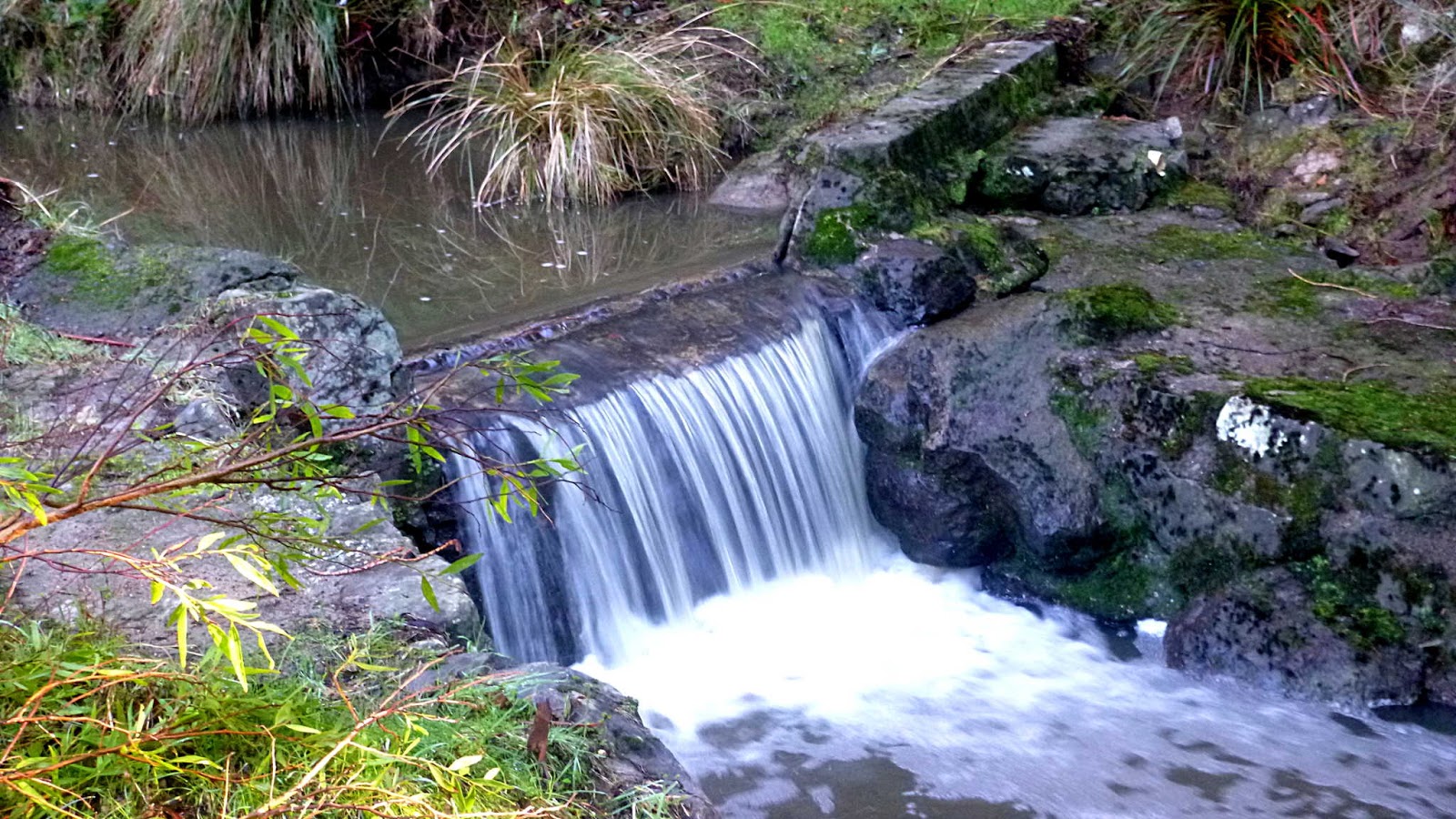
 |
| Just enough water to make this old weir attractive |
 |
| The flooding would have rushed through here, but there is little sign of it |
 |
| Now we start our first climb |
As Peter remarked, the recent flood has cleared out some of the bark,leaves etc., and our surroundings offer a different picture from other times we've walked here.
 |
| Off track |
After I took the above photo, Peter pointed out some attractive fungus next to the track.
 |
| This, and the one above were next to each other |
Peter also pointed out the sunlight coming through the bush.
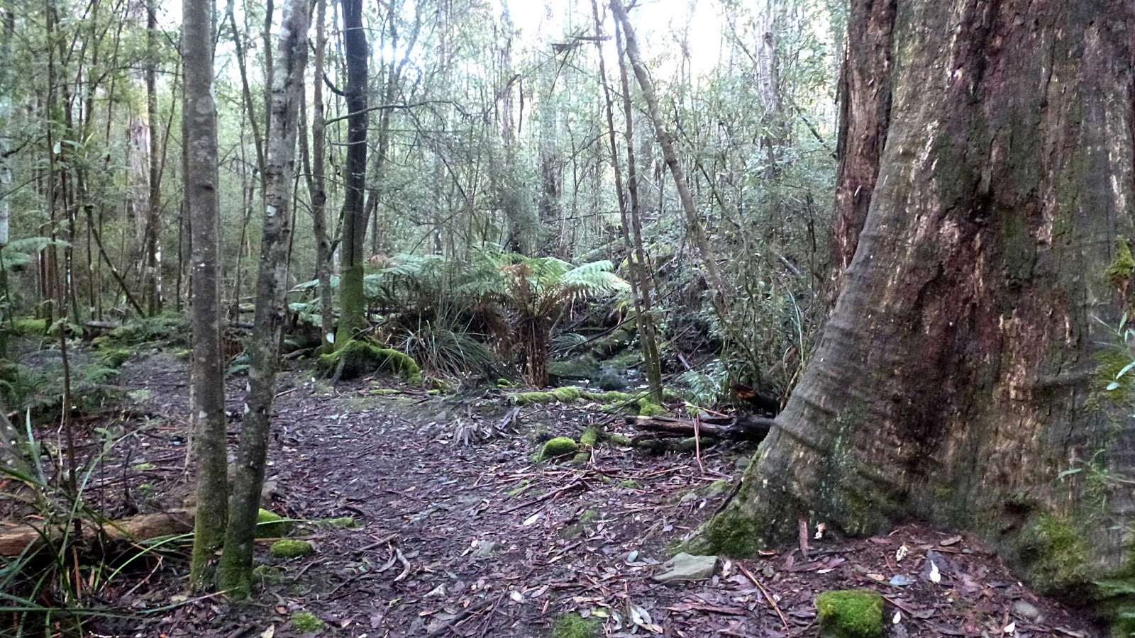
On we go, down into a little rain forest section. Also the home of
healthy leeches which might explain why the group didn't stop here.
 |
| Nierinna Creek |
It's only a short climb up to the Lawless Road where we turn left and head to Nierinna Road for a short walk to Tabors Road. Morning Tea will be late this morning as a dry spot to stop isn't available. Instead, we head towards a shelter near the start of the Tramway Track, off Tabors Road.
 |
| Looks like an interesting story |
 |
| Good views |
 |
| Pleasant country road |
There are some nice places around here, most with horses in attendance.
 |
| At last! The mumbling can stop and we can have our Morning Tea |
The sun is out and we have plenty of seating for all. After our break, we walk towards Van Morey Road via a nice track.
 |
| Leaving the shed and heading for a short track |
 |
| Blue hills in the distance |
That would make a nice name for a radio serial.
Heading down the track that runs closely behind some houses, we pass a couple of signs.
 |
| I supposed they had complaints from other walkers |
 |
| After reading the sign in the previous photo, the teachers among us started beating the bush looking for a missing "o" and an apostrophe |
This is something they want to do and won't give up until they've found them.
Meanwhile, we're still heading down.
It's not long before we're accosted by a trio of local beggars.
 |
| They are well dressed |
 |
| I wonder if the one closest to the camera is named Pauline? |
On we go, passing some other locals who crave our attention.
Unfortunately, horses are old hat and everyone passes by, giving them no attention at all. I was left to apologize for the rest of our group.
Reaching the bottom of the track, we make the short climb onto Van Morey Road and head towards Margate.
 |
| Along the road we pass this |
Connected to a cable that disappears under the road, I hope no one farther up the road is relying on this for their phone communications.
The others have left us behind, so we hurry on.
 |
| Van Morey Road |
Bob takes us onto Brook Lane and the start of the Margate Rivulet Track.
 |
| This seems to have expanded since the last time |
On we go, crossing the rivulet and a flat field.
I've made a detour to look at some features, the others are in the distance about to start a short climb up and onto another track.
 |
| Years ago, there was a tramway heading down from the hills |
Coal from the mine was brought down the tramway via steam engine. Later timber, fruit and freight was carried on it. This appears to the base for some of the trestle supports, but I've read in the past these were possibly convict built. This doesn't sound right as the tramway was built in 1906.
I'd better hurry up and catch the others. On the way I stop to say hello to some horses. As I stop I hear something heavy running down behind me which turns out to be another horse.
He was very like our whippets.
What did they get?, Where's mine?
Unfortunately, they didn't get anything and neither did he.
We make our way via a side street and Van Morey Road to the Margate Oval where we have a comfortable lunch on the deck in front of the pavilion. Finished, we head down the Channel Highway through the busy centre of Margate, to turn off next to Nierinna Creek and make our way back to the cars via the track we left earlier.
 |
| Turning onto the track just before the bridge |
 |
| Nice flow of water in the creek |
Bob supplied a perfect day for walking and 12 walkers took advantage of it. We covered 13.27km in 4:25hrs.
Click here to download GPX file