Friday 26 November 2021

Harts Hill - 23 November 2021


Just as we were about to start the walk todays leader Bob sprung a surprise on the group when he announced that we would go in a clockwise direction - all previous walks to Harts Hill have been the other way.

With the prospect of a warm day forecast to be in the mid 20's, 15 people attended.

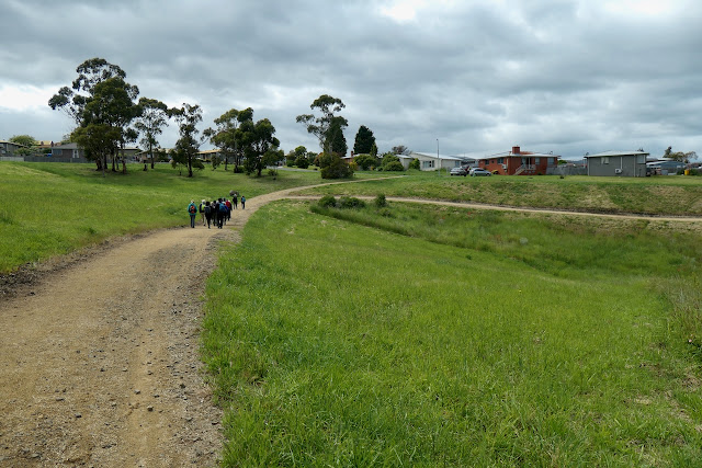
We set of on the first part of our journey to Dru Point.

Interesting sign on the gate - is it meant to say .."No Barking over Driveway..."

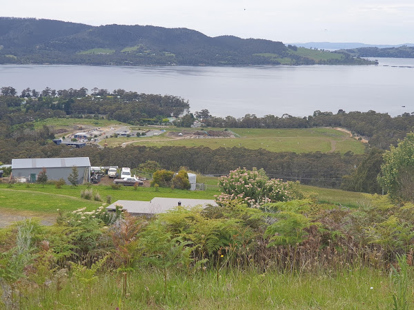
View accross North West Bay towards Mt Wellington (on the right) and Cathederal Rock on the left of the photo - we were there at the top three weeks ago on 2nd November.

Our first glimpse of Harts Hill - the little white dot at the top of the hill is the Trig Point and the highest part of todays walk.

Does anyone know what type of tree this is? The flowers intrigued some of the walkers.

On Dave Burrows Walk

Morning Tea. The photo shows a hive of activity but actually everyone was only looking for their perfect spot to sit.

Well organised crossing of Channel highway!

The origin of this trail name generated a fair bit of discussion among the group with the  consensus being that it is Tasmanian for Sauvignon Blanc.

We continue along the well marked track until we reach the Pademelon Run.

The climb up Harts Hill

Maurice spotted this Onion Orchid. It was disappointing that todays walk leader didn't stop to discuss the merits of this fine specimen with the group!

Finally at the Summit and a good spot for lunch.

View looking towards the recreation ground where the walk started. those of you with sharp eyesight will be able to see our cars.

Looking over Barretta Waste Services

Walking along Hickmans Road.

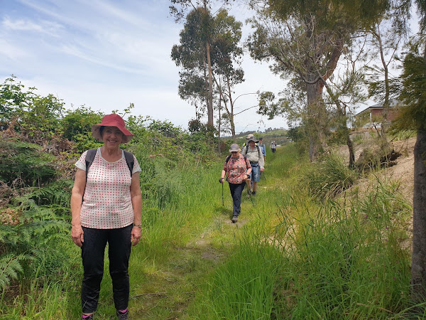
Making new friends on the Margate Tramway Track.

Completion of the track and back to where it all started.

Due to an unfortunate human malfunction the sensitive scientific equipment used to map the course failed. I recreated the route from memory, therefore it is only an approximation of todays walk.

Today's walk took us about 4hrs to walk 10kms - the high point was the Trig Point on top of Harts Hill at 145 metres above sea level.

Thursday 18 November 2021

Bridgewater Jetty - 16 Nov 2021

This walk leaves from the Bridgewater Jetty and follows the walking trail downstream on the Derwent River to the entrance of the Jordan River returning to the Jetty. 

From there Bob has added on an extra link which involves crossing the overpass through Bridgewater and walking the track that follows the railway line to Boyer.

With a forecast for some rain and a cool breeze we set off down the river.


Looking downriver towards Mt Direction.

Mt Wellington covered in snow.

A flight of both pied and little black commorants having a rest from fishing.

Looking across the river towards Granton.

A panorama of the river reflections.

More reflections.


Looking upriver towards Mt Dromedary. There was a discussion among some of the group of about  climbing it from this side.

The reed beds at the outflow of the Jordan River.

And the sun appeared for morning tea with another view of Mt Wellington.


On starting back up the river the wind picked up.

One can tell from the depth of the grasslands alongside the river bank that we have been experiencing very wet weather lately.

Spring has sprung and the new cygnets were having a day out on the river with mum and dad.

We have now left the river and are heading towards civilisation.

Bob has taken off over the the pedestrian bridge at speed and we were worried he was heading to Macca's for lunch.

But no then it looked like it might be Rooster Chicken.

Fortunately we kept walking until we arrived at the trail that follows the river next to the Boyer Railway line.

This was a much more scenic lunch than our initial thoughts.

A closer look at Mr Dromedary.

Looking down river past the Bridgewater Bridge towards Mt Direction.

We walked as far as where the track crossed the railway line then turned around  and were greeted by  this view.

Surprise, surprise there are trains on the railway line.


The sun came out for the last part of our walk.


This walk turned out to be a very pleasant stroll with plenty of views to look at along the way.

The interesting part was that the highest point was only about 20 meters and that occurred when we twice used the pedestrian bridge across the Midlands Highway.

15 walkers managed just on 16kms in 4.5 hours.