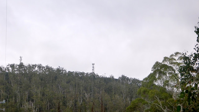
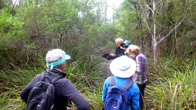
Today we're walking to the top of Herringback, just off the Huon Highway in Sandfly. Afterwards we follow some old tracks and trails around the area. Bob is our leader.
We park off Halls Creek or Halls Track Road. Take your pick they both appear as the name on different maps. Leaving the cars we walk up until it's time to turn left.
 |
| A number of regulars are away doing various things, so we have a small group today |
 |
| This was a nice scrubby area in the dim past |
 |
| We're off! |
 |
| Soon we reach the spot where I can take the obligatory photo of Mt. Wellington |
It's not overly populated up here, and after entertaining a couple of local dogs, we reach a spot where we start upwards.
This is a bit of a shortcut to the road leading up to the top of Herringback. I should explain that several communications towers occupy the top.
 |
| It's an easy walk for a while |
This leads to the top and walkers are allowed to use it. We notice signs that vehicles have been up here in the not too distant past.
 |
| View of two of the towers |
 |
| It's a large flat area at the moment and easy walking |
 |
| One of two gates we pass through |
This gate takes us into an olive grove. I assume someone still looks after it, but not often.
 |
| Young olives in red circle |
We pass a small machinery shed and begin our climb. This will take us to a switchback and the final track to the top.
 |
| We'll have to make do with our feet |
 |
| Looking back |
 |
| Getting ready for the final push |
 |
| It's an overcast day with some moisture in the air which affects the clarity of the view |
That's my excuse and I'm sticking to it!
 |
| Final climb |
When we reach the top we find a number of vehicles of various companies working on equipment associated with the two towers. A couple of Telstra blokes are at the top of their tower, and it looks like they are changing mobile phone network antennas.
 |
| My telephoto lens picks up this tech who appears to be wearing a very hi-tech helmet! |
We walk to a small building at the end with some dish antennas on it that belongs to the Tasmanian Fire Service. Here, we'll have Morning Tea. It's not as warm as below and there is a bit of a breeze so most of us take shelter below on the rocks.
 |
| Morning Tea |
 |
| Mountain River is down in that valley |
 |
| Morning Tea view |
 |
| Hard to spot but Chimney Pot Hill is visible in the centre |
I mention that fact because just last week that is one of the places we walked to. Chimney Pot has it's own communications tower and it's just 14.95km from there to the top of Herringback as Google Earth flies.
 |
| Chimney Pot Hill from Herringback |
We finish our break and head back down, leaving the workers to their job.
Through both gates and a little further before we turn off onto an old track.
This begins taking us down into the bush and will be a little overgrown, Bob warns.
 |
| New-old track |
There is evidence of much activity up here through the years, and as we walk one of our group, Wayne, finds some treasure.
 |
| Just sitting next to the track, this will find a new home |
Wayne will pick this up on our way back and it will start a new life as a flower display.
There is much evidence of fly tipping being done up here in the past, I suspect the good fences and locked gates have put a stop to this.
We're walking on, what was once, a well constructed road, probably for logging in the past. But Bob warns, it won't keep to the standard you see below.
 |
| A good section of an old road |
It soon deteriorates into a narrow, cutting grass covered track. There are, however, some marking tapes tied on bushes and some appear to be fairly recent.
 |
| I did warn you |
You don't grab this stuff if you have any sense. On a recent walk one of us needed stitches when they slipped and instinctively reached out to stop themselves.
Mindful of this lesson, I, of course, was cut when I tried to release myself from this wonderful plant. Barely a scratch.
 |
| We clear the cutting grass |
The track is barely visible now, and there is more older growth. I would like to find out the history of this area as there are many mounds and flat areas off in the bush that appear to be man-made.
 |
| The trees are getting older and more numerous |
Looking off to the side, the photographs actually don't show how dark the bush is as the camera's light gathering ability is so good.
 |
| We regroup |
 |
| There is some colour in the bush - Dianella tasmanica - Blue Berry |
There are tracks going in every direction. We just marked the one we came in on for when we come back.
 |
| Artificial lake |
We come out here so we head right for a quick lunch and begin our way back.
 |
| Heading back |
Now, President Tweet, uh Trump and his staff speak of "alternative facts". Well, we had some 'alternative navigation". As I said, there are tracks in every direction and we just took a little time to find the right one. I've put a link to an animated track at the end so you can see.
 |
| We wait while Bob scouts |
 |
| No problem, we're on our way again |
 |
| Over obstacles and... |
 |
| ...through bush |
 |
| But we get there |
As we're returning, I spot a couple of old arrows nailed on trees. The photo below shows the second one I thought might have come loose, but it's nailed in this position pointing to what appears to be a side track, very overgrown now.
It's about wombat sized.
I could only think it might have been for orienteering, but didn't know if they used such signs. I thought not.
 |
| Mystery arrow... |
 |
| ...pointing to this |
On the other side of that grass, it appears to open out somewhat.
On we go, back to the original road leading up Herringback. Here we head right, down hill to another turn which leads us down to the gate off Halls Track Road.
 |
| Cutting a corner to the access gate |
 |
| The sun is out and it's getting warmer |
 |
| Looks like a large number of organizations need access to Herringback |
You can see the unlocked lock that will enable our technical friends on top access. I blocked the numbers on the top lock in case the unlocking code was still displayed.
 |
| Back on Halls Track Road |
It's a pleasant walk back to the cars.
 |
| This leads to Krauses Road and the Huon Highway |
We had 9 walkers - several are away doing other things - and covered 11.83km in 4:59hrs. Don't forget your 1km for every 100 metres climbed rule.
This was a very enjoyable walk and everyone managed to laugh off any difficulties. Always a pleasure to walk with such people.
Click here to download GPX file
Click here for animated GPS track


