Today is the final walk of 2018, and we're walking in the Manuka Hills of Kettering, with a twist.
We meet at the Kettering Oval and when everyone's ready we head south along the Channel Highway towards Trial Bay. This is just a way of adding some distance to the walk.
The weather is cool and overcast with possible showers. That, however, never happened.
The first part of the walk is along the highway until we can move away from the traffic and behind a guardrail. There is a push by Kettering locals for a proper, safe walking track from Trial Bay to Kettering.
 |
| Kettering Oval with Manuka Hills behind |
We head around the bay to the start of the track that leads around Kettering Point, back to Kettering near the ferry terminal.
 |
| Trial Bay |
 |
| Old quarry |
The track is fairly recent, however there is an older one slightly higher up that was used before.
As we walk, I see another walker coming towards us. I make room so she can pass. This being Tasmania, I soon hear a loud "Hello!" from behind me as one of our group recognizes a friend.
On we go, I'm heading in a big loop back to the Oval for Morning Tea. Before that, we head to the lookout just off the track for a view of Little Oyster Cove.
 |
| Kettering Marina |
As the tide is out, Bob and I decide to explore the foreshore, a first for us.
 |
| Mostly rock shelf with a few rocks along the way |
 |
| The smaller ferry used to help out the bigger one in the summer |
We're getting near the jetty when I spot a way up which leads us to the road.
 |
| Coming up |
 |
| The end of the walking track just past that car |
 |
| The M.V. Bowen moored near the ferry terminal |
Is it there in case one of the two working ferries breaks down?
We continue along Ferry Road, heading towards the Channel Highway but will turnoff before that to take the back way to our break spot at the Oval.
 |
| Years ago there were about five boats moored in Little Oyster Cove |
Time moves on and there are many more boats and businesses located here now.
We make our way through the buildings and over the not very picturesque creek to our Morning Tea spot.
 |
| Morning Tea |
Tea finished, we head north, turning onto the old bit of the Channel Highway that takes us out of traffic for a short time and up to Manuka Road.
At Manuka Road, we usually turn right, but today we turn left, cross the highway and continue north through the Kettering cemetery.
 |
| Interesting grave marker |
Most of the time there is a wide grassy area for us to walk on beside the road. It varies from neglected and overgrown to well maintained near the top.
 |
| The northern entry to Kettering |
 |
| The view across the road |
We're heading to Dough Boy Drive near the top of the hill. Here we head up the drive via a nice little climb.
 |
| Dough Boy Drive |
 |
| A few houses enjoy this view |
Some of the front runners miss the start of the new track we're taking and have to be called back.
This is a part of the walking tracks network we haven't been on yet.
 |
| Track start in Dough Boy Drive |
This leads up and then winds between properties in the trees before finally joining a track we've walked many times before.
 |
| Oyster Cove |
 |
| Typical of the new track |
As I said earlier, we join a familiar track that takes us east After a while we come to a point where we make a right angle turn heading up, a climb we've enjoyed in the past. Today, however we turn left onto another track.
This is actually another branch of the Manuka Hills track and only runs a short distance before coming out on Balleny Drive, a dirt road which we head down.
It's only a short while before it becomes Warremar Way that takes us to Manuka Road. Right again takes us along a pretty dirt road around the coast, heading south.
 |
| Balleny Drive |
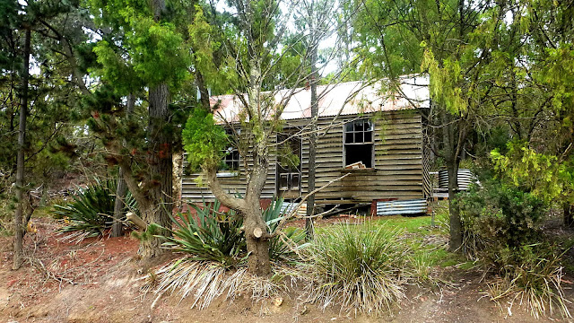 |
| Old dwelling beside Manuka Road |
There was another building in better shape as a private residence now on the other side of the road, next to the water. I haven't found anything about this place yet, a photo wasn't possible because of trees, I do have a very vague memory of hearing it was a church camp in the distant past, but I'm happy to be proven wrong.
We're looking for a place where we can reach the foreshore. The reason being that I read some time ago it's possible to walk the shore at low tide and reach the end of the d'Meure Track that has been constructed by locals, leading back to Kettering.
We soon find a track leading down which we take and arrive at the spot in the photo below just in time for lunch.
I should add that low tide today is at 11:59, perfect timing.
 |
| Lunch spot |
 |
| Looking back into Oyster Cove |
 |
| Plenty of seating available |
After lunch we begin walking south to find our exit point to the d'Meure Track.
 |
| The only soft spot we encounter |
Most of it will be rock hopping and rock shelves to cross.
 |
| I'm no geologist, but is that green a sign of copper? |
 |
| The only rocky beach we cross |
 |
| Oyster Cove is home to a number of boats |
I find several places that, if we walked further on the road, would have taken us down to the foreshore. But, who cares?
Finally, I see Bob ahead up on the rock shelf we were looking for, marking the entry to the d'Meure Track.
 |
| We pickup the coastal track at this point |
 |
| Looking south down the D'entrecasteaux Channel |
 |
| Our last pair of walkers |
Never worry about being slow, I'm often at the back and I would rather have you comfortable and safe than hurrying to keep up.
 |
| A short walk brings us to the remains of an old road leading down to the water |
This is a good track with lots to look at, both in the bush and over the water.
 |
| Little Oyster Cove |
 |
| A short walk along the shore brings us to the road again |
We walk to the end of Manuka Road at the Channel Highway and make our way back to the cars.
We had 11 walkers and covered 13.25km in 3:57hrs. Not a bad walk but you must not try it at anytime other than low tide!
Just for your interest, my day's walking which included the round trip from Woodbridge totalled 23km. Bryn the whippet DID NOT get a walk when I arrived home.
Click here to download GPX file


