Today we're walking from the Blowhole end of Blackmans Bay Beach to Fossil Cove and return, a walk last done in 2016.
On arrival at our usual meeting place, there were a couple of walkers waiting. I knew that two others were going to meet us at the walk start, so thought it would be a small group today.
I was wrong. There was a gang of people waiting for us to arrive and we ended up having a good number of walkers!
Last time we didn't actually have a look at the Blowhole, today at Wayne's suggestion, we did walk up and have a look.
 |
| Blackmans Bay Beach looking south |
We'll be walking that way shortly.
 |
| Heading for the entry to the Blowhole |
 |
| The coastline looking south |
 |
| The (not very exciting) Blowhole |
It can be much more active in the right conditions. I remember this was one of the places I was taken to on arrival in Tasmania many years ago. I seem to remember a rough dirt path and brambles. It's different now.
Suitably unimpressed, we head south, making our way down the beach.
At the far end we find signs for the walking tracks.
 |
| A number of tracks are available |
 |
| Looking back shows a snow dusted Mount Wellington in the distance |
We've had some interesting weather over the past few days with snow quite low down. Today is perfect for walking as you can see.
 |
| River Derwent. Hobart is up there somewhere |
We're walking along the coast between cliffs and houses.
 |
| Looking south |
The track takes us to the dog exercise area. Here we head around the fence to take a track that will lead us down to a rocky beach for Morning Tea.
 |
| Suncoast Dog Park (off lead) |
 |
| This little bloke is looking for Bob. Unfortunately Bob's away on the North Island |
 |
| Morning Tea time is getting close, so we head towards the water to find a spot to sit |
 |
| The track turns into a scramble down |
 |
| Morning Tea beach |
We weren't alone, a young bloke was enjoying the surf. He's welcome.
I think he really didn't want an audience, as he left soon after we arrived.
Tea finished, we make our way back up to the cleared area we left earlier. On the way I noticed Peggy on the phone and it turned out the lone boat in the distance was her son's.
We all joined her to wave to him. I had suggested a human pyramid, but no one was interested. If you look really carefully, you can just see a speck about the centre of the photo.
 |
| He's out there somewhere |
 |
| That's him! |
Excitement over we pickup the track and continue on.
 |
| It's stony ground and I'm surprised anything can grow here |
 |
| Popular cairn |
The track takes us to the road leading into the dog park and finally to Tinderbox Road where we turn left.
It's not a bad road for walking and there are some interesting houses along the way.
 |
| We saw two houses built on rock outcrops on our march |
After a while, we reach the turnoff for Fossil Cove Drive and head towards the water.
Walking down, walkers can see it ends in a cul-de-sac and are beginning to mumble in the background, questioning my ability to find the track.
This stopped the mumbling!
We start down the track, there are many steps as it gets steeper, but it's not difficult and the bush is interesting.
 |
| Looking back |
 |
| Looking forward |
 |
| There's a steep gully on one side of us |
 |
| Almost there |
It's interesting because on top of the point on our right is a house. They must have a great view.
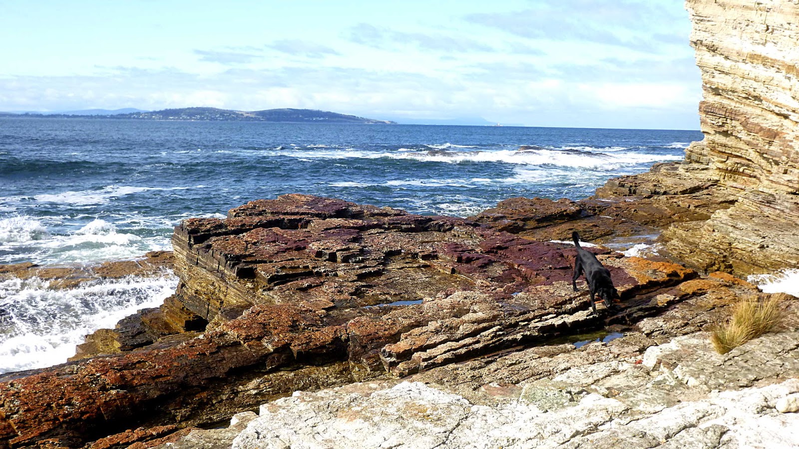
A final scramble down to the rocky beach and we've reached our destination and our lunch spot.
 |
| Fossil Cove |
Those with sharp eyes will notice another dog looking for Bob.
His owner was just around the corner, having a break. He soon finished and set off around us to have a look at the cliff shown below.
The tide was in making it chancy to walk through the opening. At low tide it's perfectly o.k. to do it.
Today our young friend made his way through, but the labrador wasn't keen. His master came back and called the lab, then disappeared back through. The dog was very confused and came to sit with us and watched the opening. I can only think he heard his master calling him as he finally left us and made his way through.
Did they survive? You'll have to wait to find out.
 |
| Opening is fine when tide is low and you only have to duck slightly to pass through |
 |
| The beach is made up of many small stones and shells |
 |
| You can usually step down and out onto the rock where the dog is |
 |
| But not today! |
 |
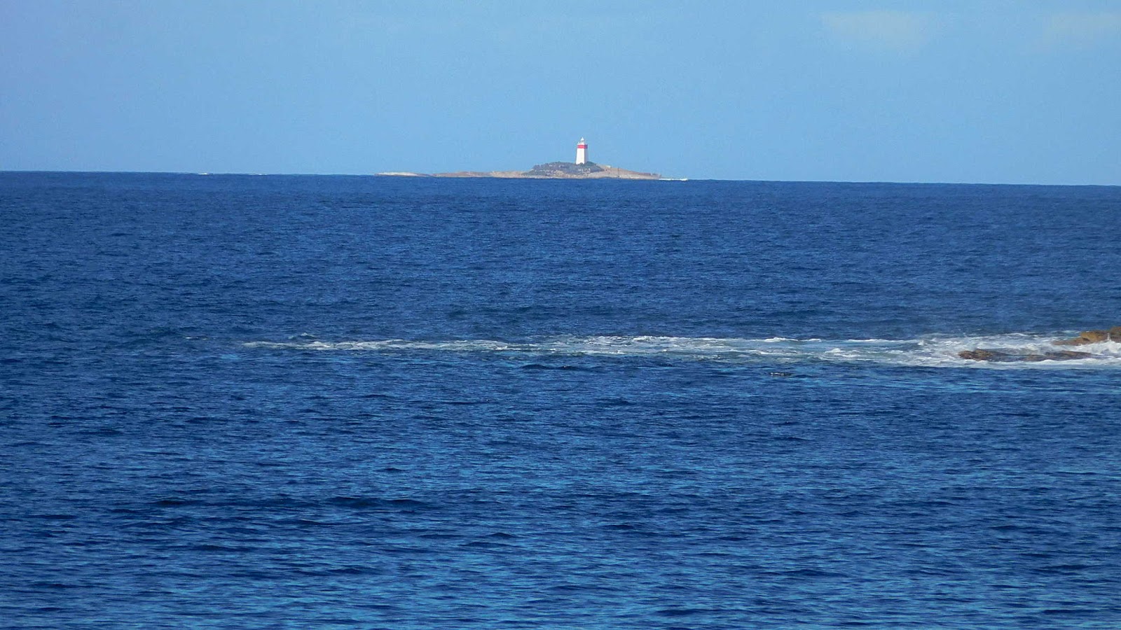
| Looking southeast, you can see South Arm and make out the Iron Pot Light as the white speck centre right |
Last weeks walk was from Pot Bay to South Arm and we had lunch just opposite the Iron Pot.
 |
| Iron Pot Light |
This area is called Fossil Cove because of all the fossil shell impressions in the rocks. The two photos below are just a small sample.
 |
| Typical fossil impression in the rocks of Fossil Cove |

 |
| Looking up the cliffs (house above) |
If you make your way around the corner there is a small channel with the water surging back and forth. If you look carefully just above the water is a white cylinder in the rock.
I've often wondered how this got here. Is it just a short piece of plastic someone wedged in an opening? Wayne braved the high tide to make his way around and check. Turns out to be firmly in the cliff with a semicircular cutout in the side at the bottom. House above, I dread what is/was drained down here in the present/past.
I've had a look for any info, but besides being mentioned by others who've see it, I can find no explanation for that pipe. Perhaps if we blocked it up, eventually someone would complain.
 |
| Wayne braving the tidal surge |
I used to post what I called artistic photos on this blog in the past, I'm going to restart that on this one.
Artistic photos below.
 |
| Nature created these groupings |
Lunch and exploration finished, we make our way back up the track. But not for long.
Bob took us on an old track the last time we were here, and I found the start when I followed the group down today. If you know where to look it's fairly evident where it is. Actually, it appears on my GPS map but not on List Maps, the Government mapping site.
 |
| We leave our original track and climb down into this gully |
Our way leads up to the left. A nice little climb!
 |
| It gets easier on top |
Up we go, following old steps cut into the clay. These soon disappear and we continue going up, sometimes on hands and knees through, around and under growth blocking our way. I didn't get any photos as it was very dark and I needed both hands to stop going down, rapidly.
People seemed to enjoy the adventure, however.
Back in 2016, we stuck close to the cliff edge which was a bit hairy at the time as the track sloped towards the cliff, but further research showed the land here was a conversation area and not private, so this time we went farther inland.
Making our way at the top, I suddenly noticed someone coming through the bush. It was our friend and his dog from the cove! I suspect they had made their way up along the cliff as we did last time. I offered to let him past us (younger and faster) but turns out he didn't know where he was going, so I was able to enlighten him.
So to answer the question re survival I posed before, as far as we know they survived.
We finally come out at the dog park and follow our way back to our cars.
 |
| Back to civilization |
 |
| Blackmans Bay Beach in the distance |
 |
| It's busier in summer |
We had 13 walkers and covered 10.17km in 4:26hrs. It's a good walk and even the clamber up the slippery hill was fun.
Thanks to Bob for introducing us to the variation we followed today.
Click here to download GPX file