The weather was a bit cloudy and cool, perfect walking weather. Bob's our leader and was taking us north of New Norfolk into the Black Hills to walk to Platform Peak.
We all met up just over the Derwent at the side of the Lyell Highway, before turning off onto the Black Hills Rd. through Magra to the turnoff onto Braslins Rd. Then bear left at Grahams Rd. and onto a convenient parking area just before you reach a gate blocking the road.
 |
| Getting organized in the parking area at the end of Grahams Road |
 |
| Views already |
 |
| Past the gate and up the road |
It's a steady but easy climb, the road wet in only a couple of places and getting rocky in the upper reaches. Views out to Mt. Dromedary and surrounding country side before the bush begins to block the sights.
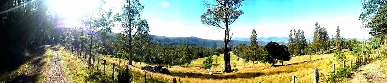 |
| Panorama of views |
 |
| Now it begins to get a bit rocky |
The traffic through Hobart was very busy, so by the time we started walking it was nearly time for Morning Tea. Bob promised us a good site, "Just 10 minutes more."
I'm not sure if it was 10 minutes, but it was a comfortable place to stop, Particularly as the track was starting to flatten out.
 |
| Morning Tea |
 |
| A little bush colour |
 |
| Yep. We're still having tea |
 |
| An old warrior who looks like he's been through a lot, but still going |
After the break, we continue on, and in a while the track opens up into an area that seems to have been used for collecting firewood. It probably still is.
 |
| Heads down, looking for that evil tripping stone |
 |
| View to the left of the track |
 |
| Lots of Bottle brush in this area |
 |
| Usual track marker, hanging on the Bottle brush |
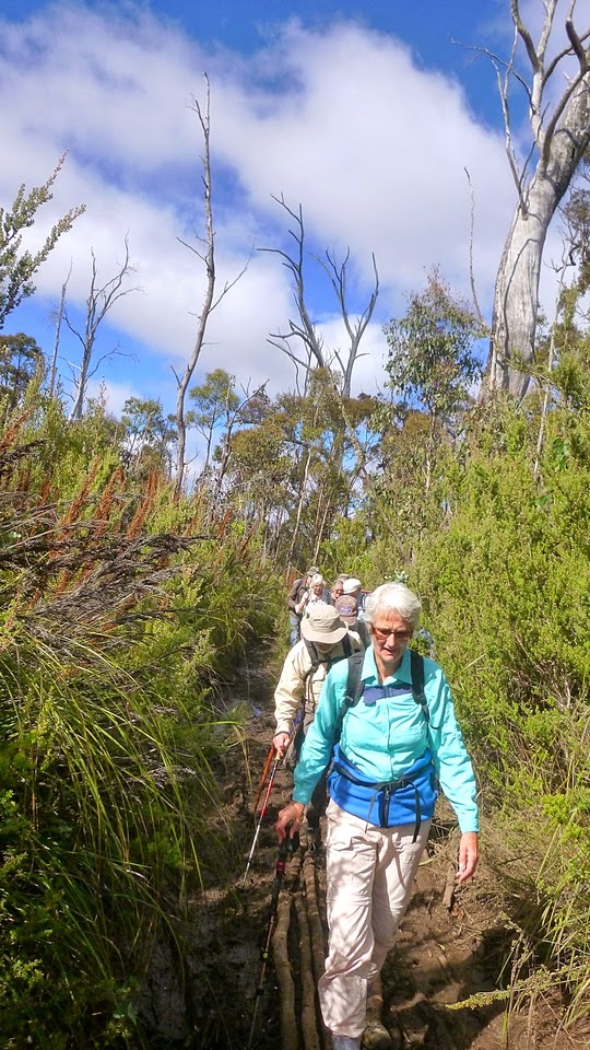
After a while, the track begins to close in, but not hard to follow.
 |
| I can still see you |
 |
| As usual, I stop for a photograph and everyone disappears |
There is a track there, but with us you just have to follow the sound! We only go quiet in the steeper uphill sections.
Eventually, it begins to open up a bit and we get to see the only fungus (foot for scale) and numerous ant hills. You don't want to stop on any of those!
 |
| Foot and fungus |
 |
| Foot and ant hill. Moving foot away quickly |
 |
| This was cut down a while ago |
 |
| Out of the narrow track onto a larger forestry road, near Big Marsh on the map |
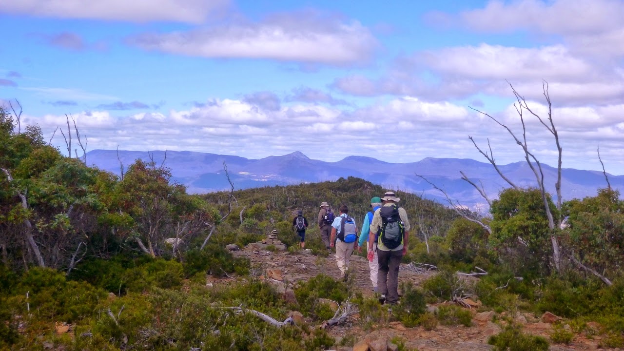
A short walk up the road comes to an area marked by a fallen log that is the beginning of the walk up to Platform Peak. You actually walk up to a first stony cap, down a bit then climb up onto the peak proper.
Some of our walkers decided to stay here and explore the road further, while the rest of us continued onto the Peak. The route up is well marked, a steady climb and few obstacles.
But before I get too far, the group that decided to explore the forestry road said it's an easy walk and they found a good place for their lunch, with views.
I'll let Sue G. take over the commentary and the photos below were taken by her, and forwarded onto me by Tas. Thanks to both.
Direction wise we were looking back down the slope over where our cars were parked and beyond to New Norfolk and Mt Dromedary. Mount Wellington in the distance.The couple of rocky outcrops were on the top side of the track.
 |
| Adie found his lunch spot |
Now, back to our climb up to Platform Peak.
 |
| Clear markings just off the forestry road. |
 |
| This is what used to be your usual track marker, and is still widely found on older tracks |
 |
| Now we go up |
 |
| Bob stops to check that, A. we're all here and B. we're all smiling |
 |
| Rock outcrop off to the right |
 |
| Typical bushwalk challenge |
 |
| It's no better off to the side |
 |
| Sticks are very useful |
 |
| This is the top of the first summit |
 |
| Great views all around |
 |
| Now we head for the main peak... |
 |
| ... and yes, we have to go down this rocky face first |
It's a short climb down the rocks and then along a stoney track that goes down then up again. It's rocky, but otherwise not difficult.
We began to get glimpses of the cairn on top of the Peak through bush, so it seems time for a little history. This is supposed to be one constructed by James Sprent, who was a temporary assistant surveyor in 1833, and who triangulated much of the southeastern half of what was then, Van Diemens Land. If you want to learn more,
Click this link.
This will give you a short but interesting biography of the gentleman.
 |
| Mt. Wellington in the distance |
 |
| First view of the cairn |
 |
| Photo by Sue M. That's me climbing up the final stage |
 |
| Photo by Sue M. Nearly there |
Here are some more photos of the top by Sue M.
 |
| Settling down for lunch |
 |
| Good photo of Tas, with John lurking behind |
 |
| and one of Irene |
Soon we come to a short, sharp scramble to the top of Platform Peak
and the large cairn. Here we stop to have lunch and enjoy the
tremendous views.
It was a bit breezy and cool on top but not bad at all. It began to be a
little cloudy, but this would dissipate on the way back and the sun
would come out again.
 |
| Views everywhere. Looking over the Derwent Valley |
 |
| Lunch by the cairn |
 |
| Sign at the base of the cairn |
There were names on the bottom board, but much too weathered to read at this time.
After lunch we made our way back down, following our track back to the others. It always surprising how steep a track appears when you're walking down!
 |
| Going down |
Meeting with the others, we made our way back the way we came, with only minor diversions!
 |
| Experiment gone wrong, back to the original track |
 |
| Through the open area before we start to head down |
On the way up, we passed some features I saved to now.
 |
| Water supply, catching water from a spring and feeding it into a plastic pipe. Unfortunately the pipe was in numerous pieces |
There was another barrel further down that seemed to be supplying another pipe that was in one piece.
 |
| Old shed beside road |
 |
| Old truck body, obviously an expensive model as you can see from the sun roof |
Pleasant walk down and back to the cars. We had 14 walkers and covered 11.65km in 4:47 hours.
As a matter of interest, those of us who completed the climb to the top are entitled to 1 (one) point as Peak Baggers. Only another 599 to become Peak-Bagger Supreme. If you're really interested, here's the link to the Hobart Walking Club webpage re peak bagging.
Click Here
Click here to download GPX file


No comments:
Post a Comment