After two cancellations due to unsuitable weather, we're finally going to do the walk at Platform Peak with Bob as our leader.
It's cold but beautiful in Kingston as we gather in the car park before setting off. Through Hobart with no traffic problems and out towards the northern suburbs. Oh dear, there's low cloud in the distance over the Derwent Valley where we're heading. It got worse the closer we got.
 |
| About to set off from the parking area |
 |
| Off into the gloom |
 |
| It's worse looking behind us |
Our only hope is that we'll climb above the fog. I suspect we will.
 |
| It's clear enough for some photos |
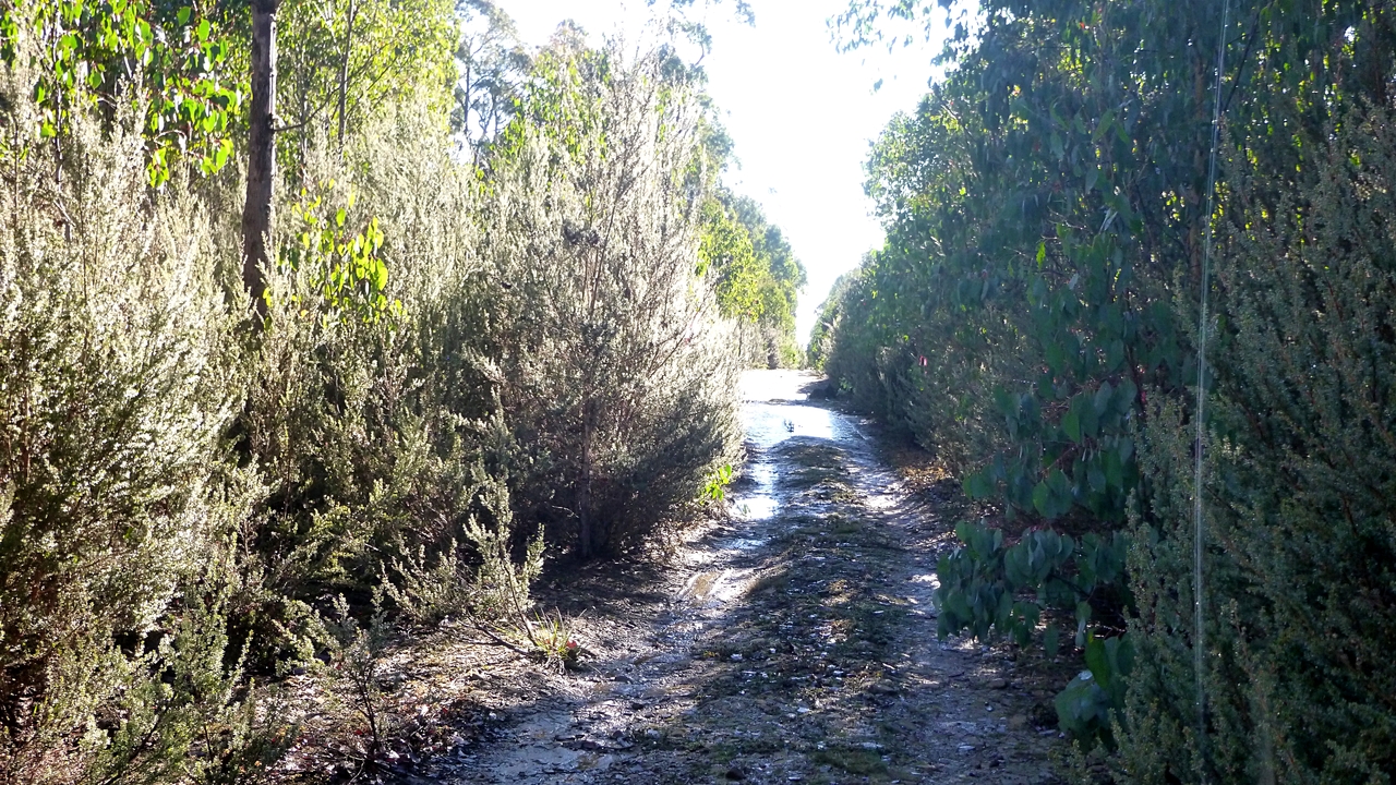
The road leads past a yellow gate and gradually up hill. Not a hard climb.
 |
| Bush water works |
There are a few properties below the road and apparently this supplies someone with fresh, cold water. There are a couple of these along the way.
 |
| There's a bit of frost along the way |
We continue climbing until we turn left and look for a spot for Morning Tea.
 |
| Nice old track |
 |
| Morning Tea |
As you can see, Bob chose a nice cold, frosty spot for our break. Soon we continue on.
Lots of young growth as this area had been logged in the past. Good variety also.
The track is fairly level now, just look out for small rocks. It's not long before we reach the sign to turnoff towards Platform Peak.
 |
| It's quite open bush here |
 |
| If you look carefully you can see the sign marking the turnoff |
The sign, if you look closely, is a crushed blue drink can on the end of a bent stick. Works for me.
 |
| The track begins to get a bit stony now |
The track begins to narrow down now, and we begin to follow the plastic tapes tied onto various bushes. You have to be careful as there are quite a few ribbons people have tied onto bushes for various purposes and not all lead to where we want to go.
 |
| Glowing fungus |
The low angle of the sun at this time of year makes taking photos in certain directions difficult, but in this case the oblique rays create an interesting effect.
 |
| Ten people walked over this and didn't break it! |
 |
| It's going to be another cold night |
 |
| Mother Nature is fighting back |
On we go. It's level walking but getting a bit overgrown.
 |
| Pushing through |
 |
| Winter but we still find some flowers |
 |
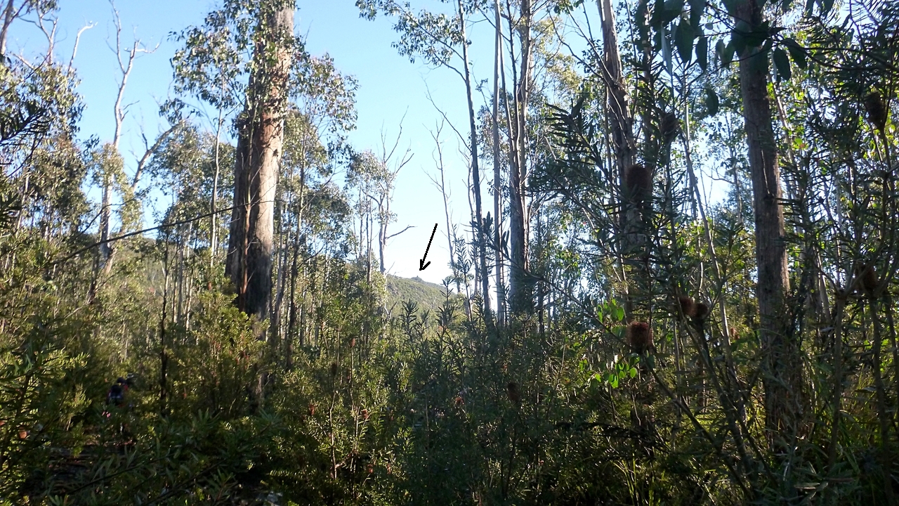
| If you have sharp eyes, you can see our destination |
OK. OK. Here's visual aid below.
 |
| Platform Peak |
As you can see, we're not there yet so on we go. Soon we come to an old forestry/fire trail where we turn left and walk a short distance to the start of the track up.
 |
| Looking back from the fire trail |
 |
| Water hazard |
 |
| Local colour |
 |
| We're starting up |
This track takes us up to a saddle between two hills and continues onto the first level. Neither of these seem to have a name. The track is a bit of a scramble over rocks and fallen trees.
 |
| It's a rocky area, looking off to the side |
 |
| Our first view |
That's actually Mt. Wellington in the distance. With the naked eye you can make out the transmission tower on top.
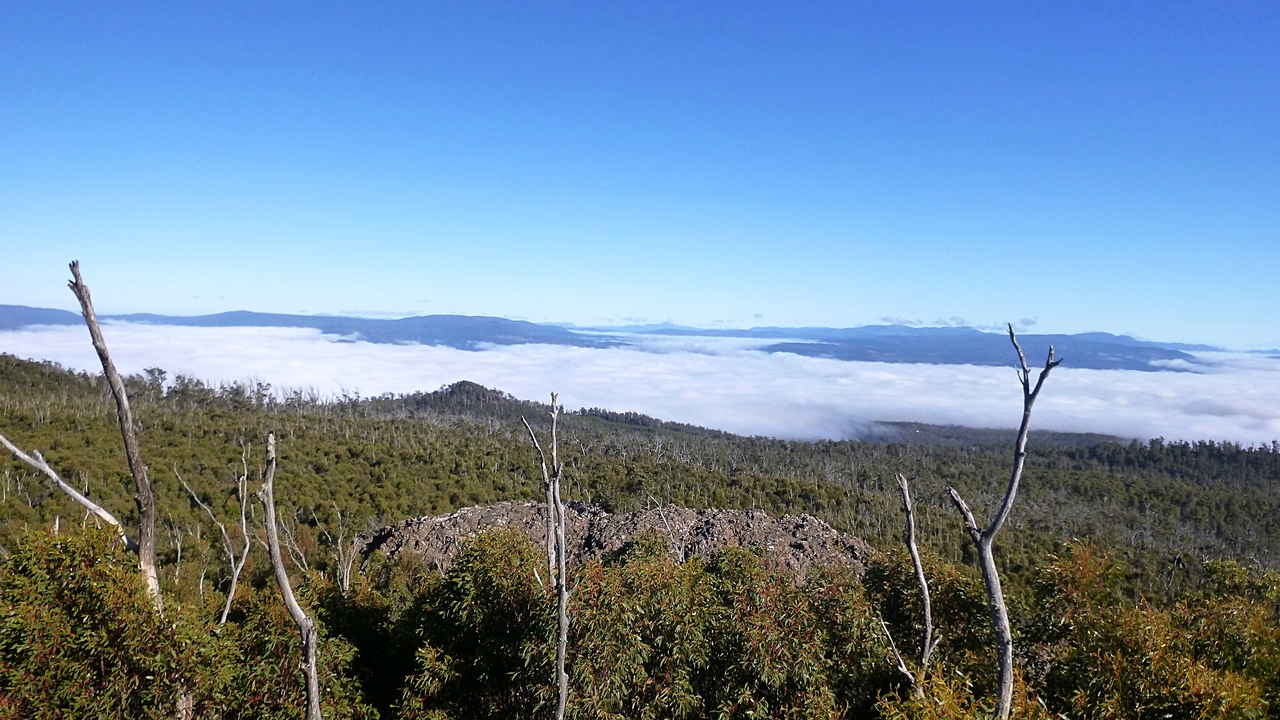
As you can see, we did indeed climb up above the cloud.
 |
| Mount Dromedary left of centre |
 |
| It's a large rock shelf we're on now |
A couple of our walkers make the decision to stay here and leave the final assault to the rest of us. The weather is fine and not even that cold, so they can enjoy the views until we return.
 |
| We're closer now. That's the cairn on top |
Before we get there, we have to climb down (carefully) a rock slope to a track at the bottom that leads to the final scramble.
 |
| Looking back, it's already hidden by the bush |
 |
| It's well marked... |
 |
| ...but very rocky so you have to watch your feet |
 |
| Yep, that's it |
 |
| A quick look round and the cloud to the east has disappeared |
 |
| Final climb up through the grove |
We reach the top and settle down for lunch with 360 degrees view. Clear on the east and cloud filled in the west and south.
 |
| West |
There's plenty of room at the top for everyone to have a comfortable space for lunch. The views are terrific.
 |
| The cairn |
These survey cairns were mainly built by two men (with help), James Sprent 1830-40 and Wentworth Hardy in the 1880s. There were actually 206 stations constructed on high points and these were used to map Tasmania with surprising accuracy. Sprent’s 8 inch theodolite is in the Tasmanian Museum. There is a theory that the cairn on Platform Peak was originally constructed by Sprent and reconstructed by Hardy.
Remember, there were no fire/forestry tracks and certainly no plastic ribbons in their day.
Lunch and history finished, we move back down and backtrack to pick up the others on the rock cap.
 |
| Hate to leave these views |
 |
| Going down |
 |
| As you can see, no sun strikes this spot |
I suspect it's going to be white for some months now.
We continue back down following our original route until we walk back along the old road to our exit spot. Somewhere along the way due to the conversation and abundance of plastic ribbons, we go slightly astray. Never mind, if we keep on this direction we should hit New Norfolk sometime.
Bob decided to look around instead and soon found our correct track just to our left. A small muscular emergency -cramp- felled one of our nameless number, but attention by others and a magnesium tablet I gave him fixed it.
Unfortunately, it REALLY fixed him and he took off like a rocket all the way back to the cars. The rest of us had trouble keeping up.
I would like to deny that the tablet I supplied was anything but magnesium and not some other invigorating tablet as was alleged!
That said, we had 11 walkers and covered 12.12km in 5:20hrs. You can use the rule of adding another kilometre for every 100-150 metres climbed.
A great walk and one of my favourites.
Click here to download GPX file


No comments:
Post a Comment