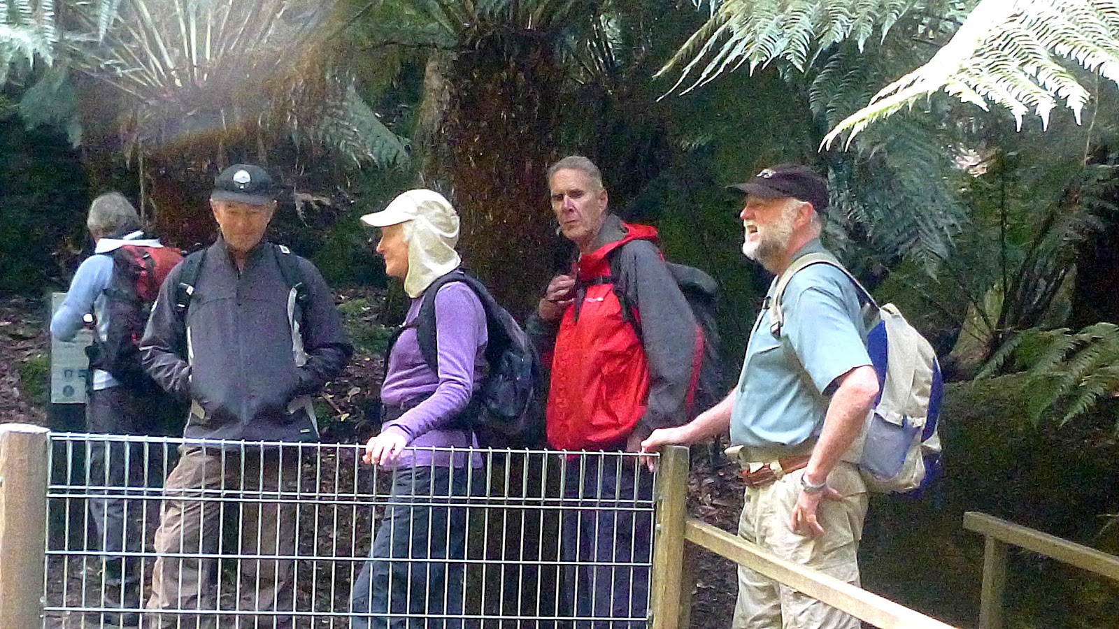
We park at the usual spot, the old quarry at Fern Tree, walk up the steps, making our way to the Pillinger Drive Track.
We're heading towards the Pipeline Track and Fern Tree Bower. It's a nice morning despite what the weather forecast said and it's a pleasant start to the walk.
 |
| Pillinger Drive Track |

 |
| Not Silver Falls |
 |
| Photo by Renate |
 |
| Nor is this |
 |
| This looks as if it might be the place |
 |
| That's it. Silver Falls |
We begin climbing now and really getting the blood flowing.


We reach the start of Reids Track, it doesn't look too inviting. Very steep and lots of slippery rock. Dogs and bikes are banned and the sign says the track is "Difficult". Well, I don't feel difficult today, so I change the route and we continue on to another way.
It's not long before we reach the Middle Track which will also take us towards the Springs, so we take it.
After a bit of a climb we reach Radfords Track and head for the Springs. Along the way we come to the other end of Reids Track and it doesn't appear any more inviting. I think I'll go down it on another time, just to have a look.


We continue on, heading for Morning Tea at the Springs.
We arrive and have a shelter all to ourselves. There are other people, mainly tourists, stopped here. Some are having a barbecue breakfast, some are lined up at the new cafe.
 |
| Morning Tea |
We pass a few tourists who have walked a little way on the track, probably to Sphinx Rock.


It's not too long before we reach Sphinx Rock ourselves and decide to have a look. First though, Wayne has to engage his inner child and get us through the childproof gate.

 |
| View from Sphinx Rock |

When we reach the view point we find a couple of ladies, babies and a little girl encamped on the rock. Alex engages the girl in conversation and finds they are from Queensland, but used to live in Tassie.
Wayne starts to talk about the make up of the rock we're standing on. In his book, Walk into History in Southern Tasmania, David Leaman, geologist, says it's a sandstone, the same as Crocodile Rock, which we don't visit today. If you want to know more, Wellington Trust have a paper online called "Geology, geomorphology and soils of Wellington ...- Mount Wellington" Click Here if you're interested.

During the discussion about the rocks someone tried to imitate the warning sign above. I can only stress how important it is that everyone keeps an eye out for any dangerous activity and immediately tell me so I can get the camera out. It could be a money shot.
Leaving the family group to enjoy the setting, we return and it's my turn to navigate the 'childproof' lock. Only took a few minutes and a couple of mumbled magic words and I had the gate open. On we go.
At this point I should explain that this walk was inspired by one I did a few years ago with our group, when we were led by Gordon, who has led us on walks in the past. I added a couple of changes to extend it a bit.
Getting back to our walk, we come to and begin to cross a boulder field. I was at the rear and became aware of a hold up ahead. I could see a couple of people sitting admiring the view, talking to some of our group's front runners. As I got closer, I thought "That hat looks familiar, so does the coat." The gentleman wearing those items stood up and turned towards me. Yes, it was Gordon. He was with another walker and tries to get onto the mountain every week. Now I should say that back in 2014 we had a walk to Thark Ridge and on the way we stopped and celebrated Gordon's 82 Birthday! Good on ya Gordon.
We reach and stop to have a look at one of the shelters on the way. This is the imaginatively named Rock Cabin.

I had a look for history of Rock Cabin and the only thing I could come up with in a short time is that in 1953 the Hobart Walking Club had several working bees to rebuild the cabin after it had been severely damaged by vandals.

 |
| Me, taking a photo. Photo by Renate |


It's not long before we reach another diversion, Lone Cabin.

 |
| Heading down |
 |
| Photo by Renate |
It's longer down this way than I remember, but we soon reach the cabin. Wayne goes inside and comes out with a surprise.
 |
| Wayne & myself examining his find. Photo by Renate |
 |
| Obviously a cache |

Not bad, it's been here since 2007 and the notebook is almost full of comments by people who have found it. Also a couple of business cards as you can see.

 |
| Lone Cabin |
I've had a quick look re the history of Lone Cabin. I know I've read about someone living in it. The information I've come across in the past is this from the Wellington Park Heritage Audit Vol. 2.
Lone Cabin
Built in 1911 by C. Drew, L. Griffiths, D. Griffiths and J. Lennox. Partly
rebuilt later (when or before occupied by D. Griffiths).
Burnt in the 1967 bush fires and rebuilt again in 1970. This timber & stone hut, with stone chimney, was at the head of Myrtle Gully. Davies (1972) states 'Lone Cabin was originally constructed with a bark roof, but later the bark was replaced by split palings, with some sheet iron as ridge capping. The cabin lasted until it was burnt down in the early 1930s. Soon afterwards it was rebuilt in
enlarged form by Danny Griffiths with help from friends. The rebuilt hut
had flattened iron sheet roofing and had a 'boulder veneer' construction of
clay bonded dolerite and a lining of split timber. R&K Davies (2001)
note that while Danny Griffiths was in residence the hut also had a cellar for alcohol.
In the 1960s the hut was beginning to deteriorate (some
stones lost from the chimney and a broken window) but otherwise in
good condition. Tracks were still clear and in use. The third version (post
1967 bushfire) was built by HWC members and friends – in 1967 the hut
was 'reduced to a heap of rubble and twisted tin' (Abrahams – only the
lower walls and chimney base survived), but the cabin was rebuilt (was
being rebuilt in 1969) – 'basically the same structure as before' but
designed more for the casual visitor. The rebuilding was undertaken by
Ted, Cornish, Frank Morely, Bill Waller, and Roy Davies and his family.
The HCC staff repaired the hut after fire damage to timber wall and
rafters above the fireplace in 1996.
Lived in for over 20 years [1930s-1950s] years by Danny Griffiths, a Hobart hairdresser, after his retirement (including when the land was bought from the Cascade Brewery). Was only one of 2 huts that were allowed to stay in private hands.
Griffiths was made an honorary ranger for Wellington Park. According to Nicholson (2001) one of his main tasks was to look after the tracks and he notes that Griffiths built the original Myrtle Gully Track. Nicholson (2001) also notes that Griffiths avoided visitors (other than those people he knew such as the
Nicholsons who helped him with track work) and came and went by
various routes so as to avoid having an obvious track to the Cabin; that
Griffiths would go down to Fern Tree every Friday night have a drink at
the pub and collect his supplies for the week, but otherwise did not leave
the mountain; that Griffiths had tamed many local animals; and that there
was a grassy area outside the cabin where Griffiths had placed an upright
post in the ground and he had nailed to them pieces of wood that
Griffiths collected from on the mountain that looked like animals.
Griffiths moved to the Fern Tree Hotel when he was too old to live on
the mountain (in his late 80s) and died there in 1957.
It's the fungus season and the photos below by Renate show some of the beauty of them if you stop and look.


 |
| All above photos by Renate |
 |
| Junction Cabin |
 |
| Lunch |
 |
| Interior |
We have a couple of cyclists pass us on the way down (they arrived at Junction Cabin shortly before we left) and one bald gentleman with pack and stick having a very loud mobile phone conversation. Just what you want to hear in the bush.


 |
| Hobart |


I know I've been this way before, but must not have been paying attention, because I missed this very tall gum tree growing in a knee formation.


 |
| Photo by Renate |
Now, a confession. I had hoped to walk this route before I led any group here, just to make sure of my mapping. Unfortunately that wasn't to be. When drawing my map on List Maps online, I made a mistake and connected the Circle Track to the North-South Track and not the Shoobridge Track. A small error but it took us out to Pinnacle Road before I wanted. Rather than walk back we walked down the road to the junction with Fern Glade Track.
Unfortunately, (I get to use that word a lot) back at the Springs I made the statement that we had finished all the hills and the rest would be cruising.
I had forgotten the little climb from the road up past the entrance to Rocky Whelan's cave. Still, everyone forgave me as Stewart and I led the way up. It was heart warming to hear all the cheers apparently of encouragement from those behind. Or where they jeers?
 |
| Hill? What hill? |
 |
| Starting our way down to Fern Tree |
 |
| Sunshine breaking through |
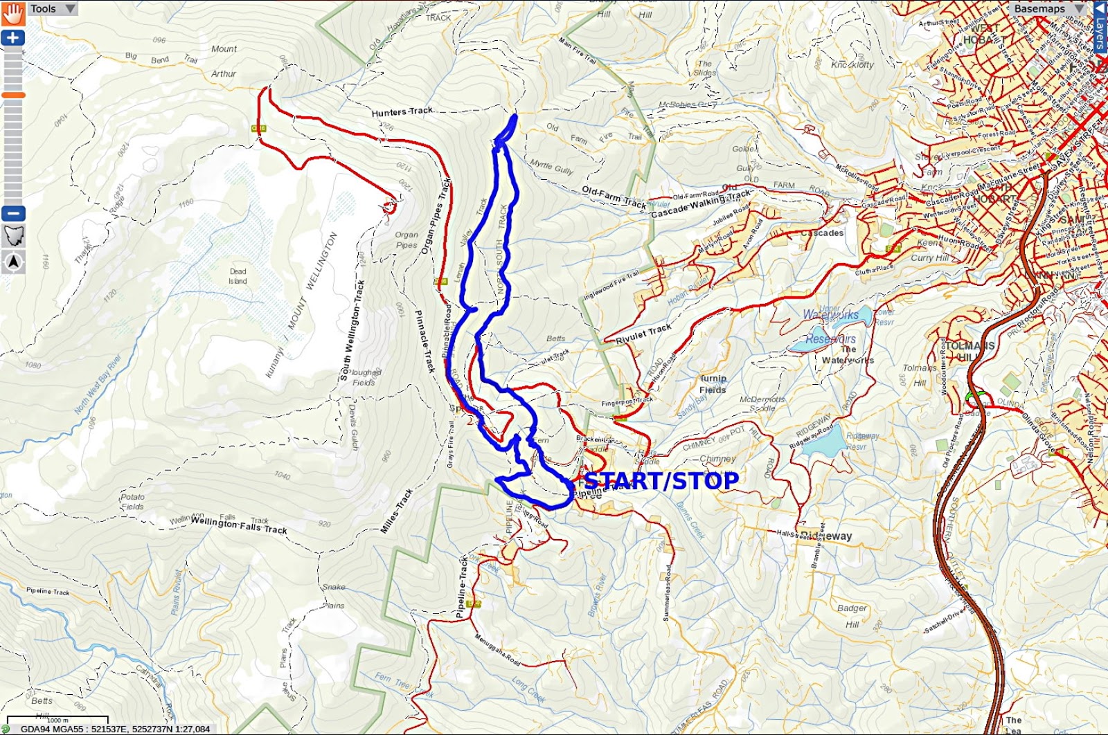
Click here to download GPX file


No comments:
Post a Comment