Today Bob was going to take us on a walk leaving from the end of Suhrs Road outside of Collinsvale, up to the start of the Glen Dhu Track which we would follow back down to make a loop. It's been three years since we've done this walk.
That was the plan. Unfortunately, whereas in the past the landowners had granted permission for walkers to cross their land and there were Parks signs indicating this was so, this time the signs were gone and a fairly explicit hand-painted sign told us where to go.
This indicated both the withdrawal of permission and the level of education of the property owner.
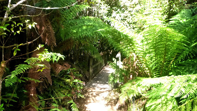
Making a quick decision, Bob took us around to the Myrtle Forest track, a short distance away.
The last time we were here was shortly after the floods of early last year. At that time the track was declared closed due to parts being washed away. We walked anyway.
No indication of any closure this time, and as we went it appeared to be in the same condition as last time.
The weather was fine as we set off and the temperature was good for walking.
 |
| Forming up at the car park |
 |
| Not much water in the creek |
 |
| This section was washed away in the floods |
 |
| Quite a job to cut a track through this |
We make our way to the viewing platform over the falls, but as I said, there is very little water.
 |
| Top of the falls |
 |
| Look carefully and you can just make out a splash of water |
 |
| Some of the track |
 |
| Only colour along the way |
The track climbs steadily, varying from a nice path to clambering up large rocks and over trees and roots. We continue until we reach the start of the Collins Cap Track, leading up.
 |
| Some stone steps at the beginning |
 |
| Rock clambering here and there |
 |
| Plus sections of ordinary track |
 |
| Also the occasional view |
The track also takes us through a variety of vegetation along the way.
 |
| Not so much steps as a means of keeping the track from washing away |
Trust me, the steps up are a lot higher than they appear in the photo.
Eventually we reach the Collins Cap Trail. If we could have taken our original walk, we would have walked up the Collins Cap Trail from Suhrs Road.
I notice the sign up here still indicates Suhrs Road as a destination.
It's easy walking now and Bob's plan is to follow the trail to somewhere past the junction with the East-West Trail and find a good place for lunch.
 |
| Collins Cap Track. Collins Cap is immediately to our right |
 |
| Mount Connection? |
 |
| Looking back at Collins Cap |
|
We're up high now, and there are plenty of views available.
 |
| Admiring one of the views |
Soon we find a pleasant spot for lunch, at the junction of the East-West Trail and the Collins Cap Trail. Lots of seating available and attractive bush.
 |
| Lunch spot |
 |
| The bush around us |
The red berries, lichen and colours of the silver peppermint trunk all make this quite a pretty garden.
 |
| eptecophylla parvifolia bush, Mountain pinkberry |
 |
| Lunch finished, we head back the Collins Cap Trail to retrace our steps back to the cars |
 |
| Trestle Mountain |
I'm probably wrong in my mountain identifications, but I suspect someone will tell me.
 |
| Mount Marian |
 |
| Dwarfed by Collins Cap |
 |
| Returning to the creek |
We had 17 walkers and covered 7.41km in 3:03hrs. Not a long walk, but strenuous enough for some of us (well, me). Quite a good walk with a variety of terrain to enjoy.
I've not put a GPX track for download as we walked on well known, well marked tracks.


No comments:
Post a Comment