Thursday, 13 December 2018

Christmas Walk and Lunch 2018

Today we're having our annual Christmas lunch but before that, Bob is leading us around the back streets and rights of way in Kingston and Blackmans Bay.

The weather is perfect as we move en mass from our meeting point in the Seniors car park down to the parking lot at Kingston Beach where we start our walk.

Parking at Kingston beach

There are roadworks going on, hence the large trucks
We join up and walk south along Recreation Street, turning up a right of way to Ewing Avenue. On the way up I get a call from Raoul, who's missed us, having been delayed by a traffic jam caused by an accident. Bob knows the area much better than I do, and arranges a meeting point where Raoul can join us. This works out very well, so increased by one, we head up Jindabyne Road and start our meanderings through the suburbs.


Looking back gives a view of Kingston Beach


More houses being built on the distant hill

The quality of the paths between houses varies

Looking at the ground which appears to be mainly sand, I wouldn't fancy living in a house on the side of this hill
On we go.


I don't have a name for this little park

Into the bush!
We exit on another street to make a little detour along the edge of a school ground, below a shopping centre and back onto a street.

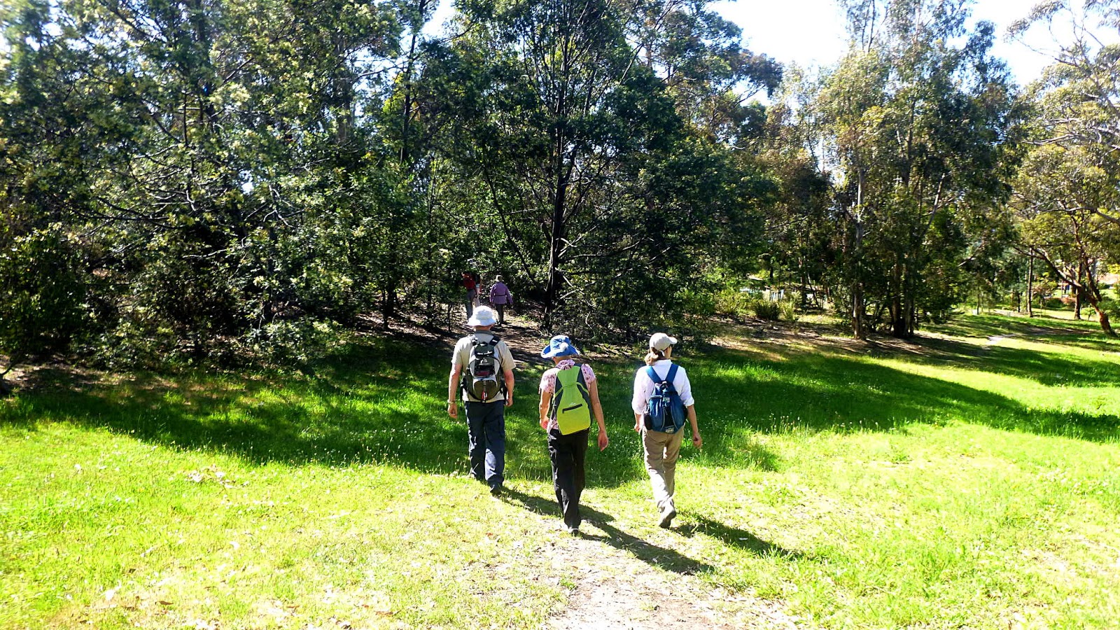
This photo should answer any questions re the headgear we wear on our walks
We stop to admire the blossom on the tree below. Not a native dogwood, but it does remind me of one I grew up with in the states.


Eastern shore of the River Derwent in the distance

More street walking

Our next track


The track leads us towards the coastal track


Nice little rocky beach
Just before we reach the coast, we swing off into a little park for Morning Tea. I think it's part of the Flowerpot Reserve.

We have two types of people on our walks.

The sunny types...

...and the shady characters.
That doesn't sound quite, but anyway, after our break we continue  along the Suncoast Headlands Track down to the beach.

Looking north

As we walked down the track
I became aware of eyes watching us and looked up to see this young sitting up there anxiously looking at us. I just got the camera out in time to see him take off up towards the houses above. 

Southern end of Blackmans Bay Beach
We have to clamber over the storm water pipe that, I assume, is the cause of a pollution warning for the south end of the beach.

Bob helps the ladies over, men are on their own.


Only one of those two are going to get a hand down
We walk along the beach, passing few people until we reach the rocky track leading up at the end.


Looking south
We make our way along the side streets until we reach the top of Mirramar Park and head down. The safety fence at the bottom has seen better days, looks like the floods in May took most of it out.


Mirramar Park

Not so safe safety fence
The fence was to stop stupid people from climbing on the crumbly cliffs. The part we are in is an open area and perfectly safe.

The drilling rig in the far left is here for maintenance, not exploration


The sunshine continues
Having seen the sights, we make our way up a very faint and unofficial track, coming out at the back gardens of houses on top.


We used to walk along bottoms of the properties and come out onto Aldinga Street via a right of way - which is still on the map I might add - today we take the walkway past the house on the end and enter Mirramar Park street? crescent? to find our way over to Aldinga Street.

We make our way back to the roundabout on Jindabyne Street where Raoul goes off to retrieve his car and others to return to the car park to pick up lunch goodies. The rest of us head down the Boronia Beach Track, following that around to the Osbourne Esplanade, turning off into our lunch destination which is very kindly supplied by Alex.

The others slowly arrive laden with food as we set up camp on Alex's veranda.

Heading down Boronia Beach Track
There are a couple of gates to pass through which keep local dogs away from the wildlife. I only saw the back of a wallaby as it hopped away from us.


Kingston Beach just ahead

Our destination
 On arrival I found Tas who took me on many fine walks when I first joined the group, and who now walks with the Wednesday group and Carol.

Some of the treats arrive
Plenty of room for all


We had 18 walkers and covered 10.54km in 3:17hrs on a perfect day.

I would like to thank Peggy for organizing all this, Alex for letting us grace her veranda with it's amazing views and all those who supplied a verity of delicious treats.

Special thanks to Bob for keeping us occupied all morning, getting us back for lunch right on time.

Click here to download GPX file


Sunday, 9 December 2018

Wellington Walk 2018


Today is just a short walk on Mt. Wellington. Originally called the Wellington Hut Hunt when we did it back in 2014, I've dropped the Hut Hunt part as we only visited one hut.

The weather looks overcast but good for walking as we gather at the top of Old Farm Road to set off along the Main Fire Trail. Easy walking for the most part.

Getting everyone into frame, I forgot to look for others who were not quite ready!

Off we go

We actually go downhill for a while. We'll pay for it later


The very top of Pottery Road

Junction with Main Fire Trail


Looking back
A couple of young cyclists make their way through us, but the track soon begins climbing and we catch sight of them pushing their bikes up.

Looking forward and up

Sandy Bay and the Casino below with South Arm in the distance
At last we come to a turnoff. It's getting near to Morning Tea time, but there is a cool breeze blowing here, so we'll wait until we make this little climb.


We slowly make our way up, heading for our reward at the top
Morning Tea out of the breeze
After Morning Tea we continued on towards Junction Cabin.


I accidentally overheard a conversation emanating from this group of walkers
Lyn explained very succinctly what would happen to my person if I divulged anything I might have heard.

Wanting to keep everything intact, I promised my silence and waived my usual fee.


Junction Cabin ahead
Busy day as there were walkers in the cabin, walkers approaching the cabin and cyclists arriving at the cabin. We didn't stay, but headed for the Myrtle Gully Track.

Just down from Junction Cabin, it doesn't even appear on some maps

It's a nice old track


It's a very pleasant walk down and after a while we start to follow the Guy Fawkes Rivulet. The recent rain has made the rivulet quite obvious as we descend.


Guy Fawkes Rivulet

The track continues down


It's quite a pleasant track


We soon stop for lunch, most of the area is in shade but the sun does break through a couple of times as we eat.

Flowers in Sunshine
It's not long before some of us begin to notice that we're not the only ones interested in having a meal. Yep, the leeches were out for a feed.


Friendly, local leech
Lorna tried to train it to sit up and beg with some success.

Lunch over, we continue down.


After a while, we reach Myrtle Gully Falls where the recent rain has created a pretty cascade.


Myrtle Gully Falls


If you want to see a REALLY good photo of the falls, ask Raoul to show you the one on his phone that he took with proper equipment on another occasion.

We missed the Secret Falls not far below Myrtle Gully Falls as everyone had disappeared by the time we spotted the side track. Next time.

We had 13 Walkers and covered 6.09kms in 3:13hrs. A short walk, but a good one. This left time for Christmas Shopping.

I found out a little history of the Myrtle Gully Track from Wellington Park Heritage Audit Report Volume Two, which was online.

Just a bit of interest in some of the history of the places we walk. Safe to skip if you so desire.

Myrtle Gully Track (Old)
The track was constructed as an unemployment relief scheme in 1930-31 (Lakin 2005), but is possibly older given the late 1890s/early 1900s huts near the track (the present track follows a different line from the original, although Lakin (2005) noted that Myrtle Gully was originally accessed by a track off the Middle Island Track and that the original main access route to the Junction area was the Old Farm Track.
 

The track was maintained by the Hon. Ranger Danny Griffiths who lived in Lone Cabin (for about 20 years (1930s-1950s). The Nicholson family (Sam, Walter and Walter's brother) helped Griffiths with track
maintenance as part of their hut (Madison Square) permit conditions
(which specified one day a month assistance with track maintenance)
(Nicholson 2001).


Nicholson (2001) comments that Griffiths did a lot of construction work on the track, building steps, often with tree fern stumps, in steep sections and building bridges across Myrtle gully (no longer part of the track now) which were well made, of timber, and with myrtle handrails. 


Luckman (2005) doesn't think the route changed much while being managed by Griffiths and that he mainly carried out maintenance on what was a boggy track, using corduroy of tree fern trunks in boggy places.

A photo (Davies Collin) shows a rough timber bridge, no rails across
Myrtle Gully.


Myrtle Gully Track (New)
The present track follows a different line from the original which was
constructed as an unemployment relief scheme in 1930-31 and then
maintained by Hon. Ranger Danny Griffiths until the 1950s. 


Nicholson (2001) notes that once Griffiths stopped working on the track the Council stopped maintaining the lower end and it was eventually closed. The track was little used through the 1960s-1980s, but in the 1990s was repaired and rebuilt in sections by the HCC using Green Corps labour supervised by an experienced National Park track worker (John Hughes).
 

Nicholson (2001) notes that this track bypasses the lower section of old track. (In the 1994 study the track is also referred to as the 'Sawmill Track').


Click here to download GPX file