Today we're walking from Patriarch Drive in Kingston and are being led -up and down, back and forth, side to side- by Tas.
Another good weather day for us. So much so, I had the thought: "Gee. I wish I'd worn my shorts today!". Inside of 5 minutes it changed to: "Gee. I wish I'd brought a machete today!".
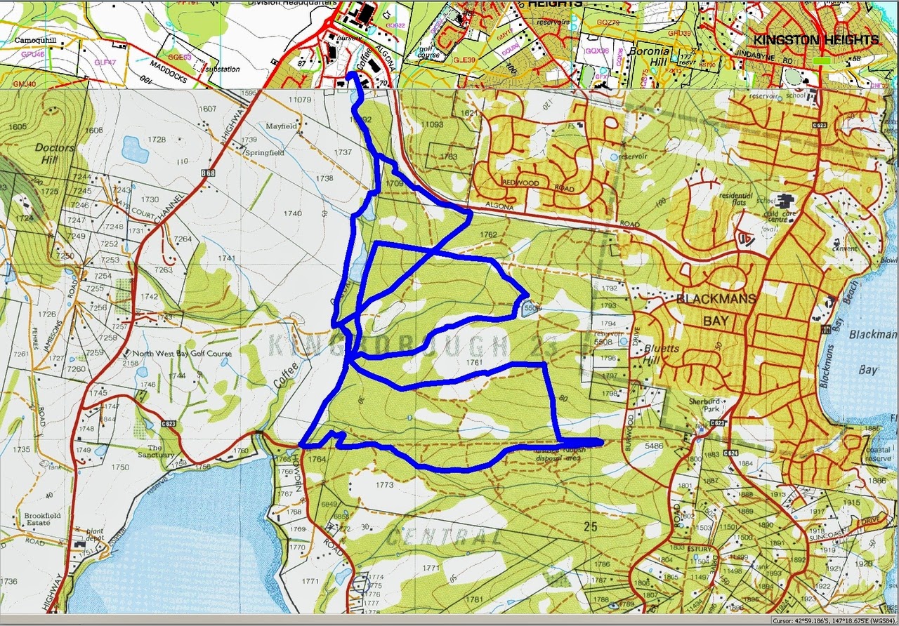
Tas was determined to find a track Bob hadn't run on before, and I think he definitely found one.
 |
| Leaving the cars and heading for the start of the track. |
 |
| Clearly marked |
 |
| Looks good so far |
 |
| Little did we know how many of these we would walk |
 |
| This doesn't look right. Shouldn't we be walking the wide, comfortable track? |
 |
| No |
 |
| Still near civilization, but this is a taster |
 |
| The only track here was created by animals. No offense to everyone in front of me |
 |
| Tas missed this side track |
 |
| John ponders the wisdom of joining our group |
Soon, however we are out in the clear and and on nice wide track. I think this is the Sandflats Fire Trail and then we turn off onto the Scarborough Fire Trail.
 |
| Sounds familiar |
Now we continue on established tracks, at least for a while. Soon we're off across country again, but not until a map is consulted.
 |
| This look serious. Unless you're Bob who laughs at maps! |
 |
| Decision made and off we go |
 |
| At least there's something to eat if worst comes to worst |
 |
| What little track there is has disappeared... |
 |
| ...but found again. So we head for Morning Tea |
Tas leads us to a road side spot with plenty of large rocks to sit on. After everyone is revived, we continue on.
 |
| These two tracks appear to be named after convict ships. Lady Penrhyn docked in Sydney in 1788 and she also sailed in the Atlantic transporting slaves. The Scarborough was another convict transport |
Leaving that happy note, we continue on, using more established tracks.
 |
| I think we've been here before |
We do cover tracks with the same name as before, but on a different section.
 |
| Looking south over Kingston Golf Course |
 |
| Wouldn't like to meet this gum tree on a dark night |
 |
| I think I heard Tas say this tunnel into a bank is the nesting arrangement of a Spotted Pardalote |
Unlike the Forty-Spotted Pardalote, it apparently has too many spots to count.
Now we take a very short walk along Howden Rd. and pickup the next track leading back into the reserve.
 |
| The next track |
 |
| Howden Track was too good to walk on, so we wait to turnoff when everyone catches up |
 |
| Tas says there are some native orchids along this trail |
True to his word, we find one. I managed to get a photo when my unsteady hands matched the waving of the orchid in a slight breeze. It only took about six goes. Thank goodness for digital cameras.
 |
| Native orchid |
 |
| Back on another track |
 |
| On the Middle Fire Trail heading towards Coffee Creek |
We're now making our way towards our lunch spot, which is off Coffee Creek.
 |
| Coffee Creek |
 |
| Penrhyn Pond |
 |
| The lunch spot |
We'd just settled down when a couple of gentlemen turned up and told us there was a race through the area that involved some teenagers and flour. They would try not to bother us. We'd noticed some tents on the grounds of Terremah School, so it must be them. In the end we really didn't see much of them and what we did see didn't involve much running. And no flour.
 |
| We have to keep some of our members caged when near the public |
 |
| The man in the white shorts is one of the race officials |
 |
| Selfie taken with the original organic selfie stick. A stretched out arm. |
 |
| This is the second photo. I charged $10 not to publish the original embarrassing one. Only $20 will secure a copy of the original to be emailed to you |
 |
| As requested, a Monet like reflection photo |
 |
| Purple Swamphen or Porphyrio porphyrio just to show off |
I think we had 15 walkers and covered 11.89km in 3:58hours. A very interesting walk with little overlap thanks to Tas.
Click here to download GPX file
For the Daring
If you want to see how we walked the track, download the GPX file, start
Google Earth, go to
File then click on
Open and navigate to, then open the GPX file you downloaded.
You should then see the track on Google Earth. Click on
Edit then
Show Elevation Profile. This will open a window at the bottom. Put your cursor over the left hand side of the graph and just move it to the right and you should see the cursor move on the track showing where we went and when.


No comments:
Post a Comment