Today we're parking at the northern end of Blackmans Beach and walking from the Blowhole to Fossil Cove with Bob leading us.
Actually, it's a bit of false advertising as we didn't walk up and look at the Blowhole first.
The weather was cloudy and rain was called for later in the day. The temperature was comfortable and you soon warm up when you start walking.
We walk south along the beach to pick up the start of the Suncoast Headlands Track. 'Suncoast' is a bit of a stretch today.
 |
| Looking back north at the beach |
The track takes us between the top of the cliffs and houses. There seem
to be more houses/units constructed since the last time we were here.
 |
| The path runs between a drop and a built place |
We enter the larger coastal reserve and continue along open ground past the sewage treatment works (Oh, the romance of open country!) to the start of the next part of the track.
 |
| A bit blurry, but you can see what the track is like |
 |
| We've been up here before, just wasn't a sign then |
This is just to add length to the walk. Everyone is getting warmed up so we stop to remove a layer.
 |
| I'll pull a veil over the disrobing and show you a badly constructed bush shelter someone built |
 |
| Off again |
The track loops around the hill and comes out next to the Dog Exercise Area onto a road with no name that leads up to Tinderbox Road.
 |
| A little welcome colour on the way |
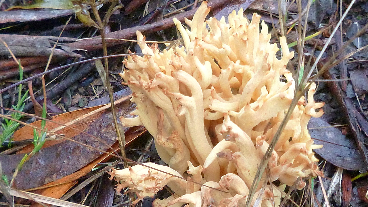
A couple of fungi were pointed out to me alongside the road.
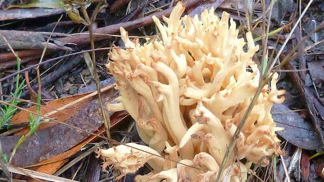 |
| Ramaria lorithamnus? |
 |
| I suspect if you ate one of these, you'd turn the same colour |
Passing the Blackmans Scout camp, we came to Tinderbox Road. Adie and I were at the rear and the rest were on the road. I distracted Bob and cut the corner while he was looking in another direction. I would have gotten away with it except for Adie - or as I call him now, Mr. Goodie Two-Shoes - taking the long way around and exposing my little diversion.
 |
| Adie showing off |
Never mind. We continue along to Fossil Cove Drive and turn down to pick up the start of the track.
We walk a short way and find a place for Morning Tea, before we start the steep descent, which involves numerous old steps cut into the hill. These are definitely not up to code and you have to look where you're going or you'll get there quicker then you expect.
 |
| Morning Tea |
 |
| I'll throw one of myself in every once in a while |
 |
| Very dry bush |
 |
| Looking across the gully |
 |
| Someone's home judging from the foot pad leading to the shelter |
 |
| There is a disused track going off to the right and several of us left our packs there before we climbed down to the cove |
It's another steep descent via rough steps down to Fossil Cove.
 |
| When you reach the cove you'll find a lovely collection of old fossils... |
 |
| ...embedded in the rocks. What did you think I meant? |
 |
| Interesting colour banding in the rock edges |
 |
| The fossils |
 |
| Looking southeast |
 |
| I'm not sure what caused the breaking up into groups |
 |
| North at the stone arch |
 |
| Dead now, but I couldn't help but be impressed by the root the old gum tree sent down for fresh water in the gully |
 |
| The loose beach material is interesting, too |
After a good look round, we climb back up to pick up our packs and turn right up an old track.
We cross an old wire fence to a grassy area with a picnic table. Looking at the map on the
LISTmap site, this is all reserve, not private.
Leaving here, we pick up what should be called an animal track, not a formed one and follow it along the cliff edge. Not my favorite as it slopes towards the edge and there lots of things to trip on. I found most of them.
 |
| The other side of the arch at Fossil Cove |
 |
| Our new track, made by adventurous animals |
 |
| You can see the slope |
 |
| Now you can see where you'll land |
We finally turn off and walk along near one of the ugliest brick homes I've seen. Never mind, we're soon in the bush.
 |
| Here we start down to another gully |
Lots of things to climb over, under and through as we start down another faint wildlife pad.
 |
| Looking down into the gully. It's farther then it appears |
 |
| Our track |
 |
| Interesting climb down with loose soil and bush litter |
We reach the bottom which is grassy and runs along the top of a stony beach. The group continues along a short way until it's time to climb up to avoid the bottom working part of the sewage works.
 |
| The bottom |
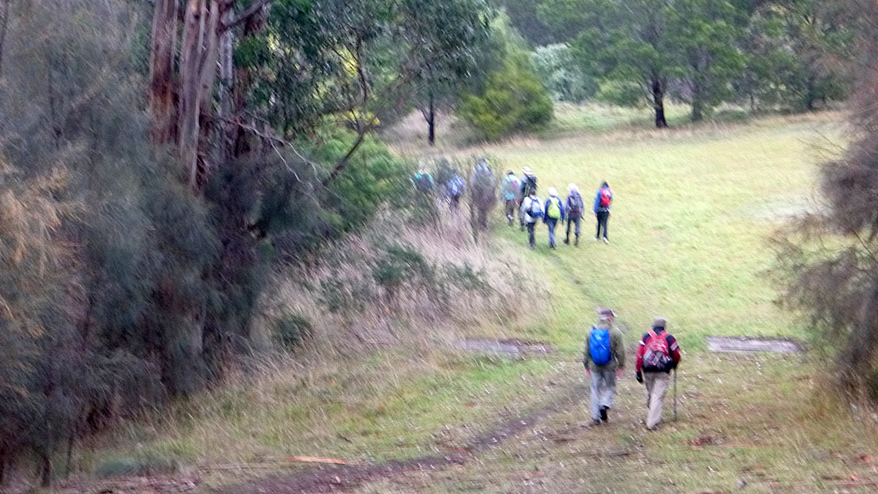
 |
| Bob doing a body count |
 |
| Soldiers Rocks |
 |
| A short, sharp climb up... |
 |
| ...and we have another count |
 |
| Looking around, I see a familiar grey post in the distance. It's the marker for the Bush Loop track from earlier |
From here we walk back along the same track to the northern end of the beach to have lunch in the shelter there. The weather is beginning to break up and rain is not far off.
 |
| Rain is coming |
 |
| We bid a fond farewell to Blackmans Bay Beach |
We had 14 walkers, one of whom dropped out because he had to be home to have his NBN connection installed.
My phone odometer said we covered 9.5km but the report says 8.99km in 3:18hrs.
An interesting walk with the added benefit of walking off grid so we didn't have too much of an out and back walk.
Click here to download GPX file


No comments:
Post a Comment