Traveling south from Kingston, it begins to sprinkle, then rain properly, but stopped by the time we arrive at the start of the walk. This is what we call Coningham No. 1 but with variations.


 |
| We'll be following the track to the right at the bottom of the hill |

It's easy walking as there are fire trails and fire breaks around the area. The ground and surrounding bush is very dry. There is some rain in the distance, but it won't make any difference.

 |
| North, up the Derwent |
 |
| We exit at this point and follow a road for a short way |

 |
| Obligatory view of Mt. Wellington |
 |
| Now we move off the street and onto another track |
 |
| Map of the Coningham area, but no 'You are here' information.... |


We pick up another fire trail, follow it for a while before diving off into the bush onto a smaller foot track.

 |
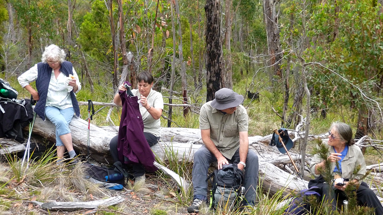
| It's about that time - Morning Tea |
 |
| Bob found a nice log for everyone |


 |
| If you lean in the right direction, you can see a bit of the Channel |

 |
| The track |

 |
| Tiny fungi (I think) |
Break finished, we continue on through the bush until we come to a large clearing where planting has been going on. There's a wooden construction concealing a small water tank with a space below for a watering can. A sign asks you to fill the can and water some of the plants.
It appears this is a project of the nearby Snug school.


The sign on the right says: "Snug Primary School Grade 6 WildsCOOL Project. Take a moment to water the plants and help them through the dry summer."
We didn't.

We continued on with rain in the distance appearing to get closer.


 |
| A bit of welcome colour |


We arrived at another turnoff when it began to rain slightly. Some of us changed into our rain gear immediately while others decided to wait.


 |
| We're going up the distant hill and then left onto another track |
I had only gone a couple of metres when a cry went up behind. I looked back to see a group gathered around, appearing to scrutinize something on the ground.
The cry had been a request for the photographer, a flower photo was required.
 |
| There were a couple of these growing here |
I was told the common name for these, and it was some sort of 'duck'. I can't remember if it was old, cold or dead, so I've looked it up.
If you want some fun, enter "tasmanian orchids with name of duck" into Google as a search term.
I remember now, it was identified to me as a Flying Duck Orchid or Caleana major (?).


 |
| I'm not sure what they're looking at |
That done, we continued the climb. Reaching the top, we walked along for a bit looking for the track we've done in the past. However it's very overgrown now, and we had trouble finding our way.
 |
| We've missed the turnoff we wanted |
 |
| Looking north towards Margate |
 |
| Low cloud in distance |


 |
| Standing lunch... |
 |
| ...with a view |


We did find a familiar track that took us to an old fire trail which led to a cleared fire break and lunch. We had missed a turnoff Bob had wanted to follow and despite his looking around we couldn't find the start.
Lunch was taken standing (for the most part) and the rain had stopped. It was one of the quietest lunches I've ever been on!
We were actually at the end of the track we missed so Bob asked if we'd mind walking back along it so we could find where we should have turned off.
Of course we said yes. I remember the track from the last time and it parallels a fence for a short distance. When I arrived at the fence, another photo opportunity was pointed out to me.
 |
| Following track to find where we should have turned off |

 |
| Photo op over fence. It wouldn't show its face |
 |
| We're coming to where we should have turned off the old fire trail |
Mystery solved we walked back down towards the fence, but turned off on a side track that Bob didn't know. I thought it would probably lead us to a track I had looked at during lunch and take us back to the lunch spot, which it did. We also passed another branch Bob hadn't been on. Something for next time.
We reached the lunch spot, crossed the fire break and picked up another track. This took us back to just above where the cars were parked.
All in all, it was a good walk. The rain didn't amount to much and the temperature was nowhere near what was predicted. Plus we have another track to explore.
We had 11 walkers and covered 9.85km in 3:45hrs
Click here to download GPX file
The walk became a little bit interesting near the end. so you can see it on the next link.
Click here for animated track


No comments:
Post a Comment