Today we're walking from the Waterworks to Chimney Pot Hill and return. We're led by Bob who's promised some tracks we've not walked on before. It must be true because we start off in completely the wrong direction!
 |
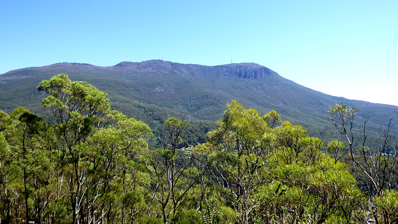
| That's our destination, the tower is on top of Chimney Pot Hill |
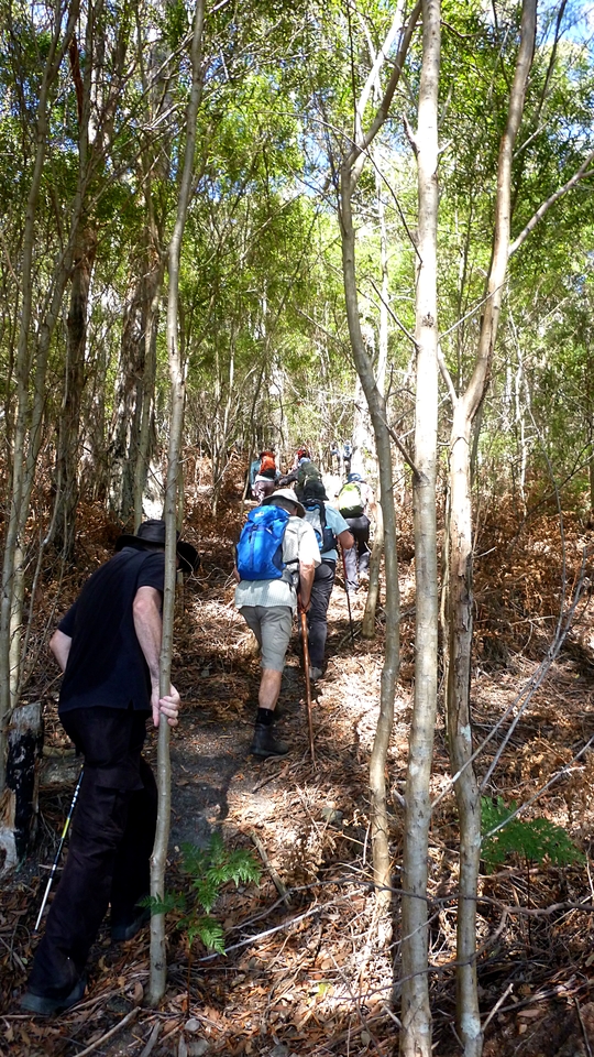
We set off from the car park, crossing the lower reservoir dam to pick up the track on the other side, following this through the bush above the reservoirs to a junction. This is where we usually turnoff and do a short, sharp climb up to the Huon Rd.
I'm not surprised when we turnoff and start up, but am when we almost immediately go right onto another track, one of the new ones as promised.
 |
| The tower's getting smaller all the time |
 |
| Up the bush track |
 |
| We start up the short, steep climb to the Huon Road... |
 |
| ...and almost immediately turn off onto another track |
This track winds and zig zags up until we finally come to the Huon Rd. It's a pleasant walk and less warming than our usual way. It does take us farther away from our objective however.
 |
| The colours of the gum trees are much more vivid in real life |
We reach the Huon Rd. and walk up for a short distance before crossing back over and up the bank to another track.
 |
| Chimney Pot is farther away than before |
 |
| This track is parallel to the Huon Road... |
 |
| ...and you can get a good view of Mt. Wellington |
It's a clear day and the organ pipes show up well.
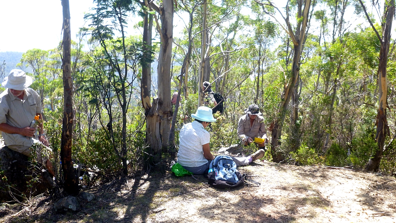
This track leads us onto to a grassy area just opposite the junction of the Huon Rd. and Strickland Avenue. This is where we'll have Morning Tea.
 |
| Many, many butterflies here |
 |
| Morning Tea |
If you read the Coningham Beach Circuit 2016 blog, you would remember my advice on watching the ground as you walk. In that instance I spotted a 5c piece on a bush track.
Well, as everyone was enjoying their break, I had a little wander around and just near the tree line I looked down and what do I see? A dollar coin with a two dollar coin close by. So I'm up A$3.05 in 3 walks. I wonder if I have to tell Centrelink?
Tea finished we get another surprise as we cross the road and start down Strickland Ave. It's new, but also goes away from our destination and down hill.
This is worrying.
Soon we come to a halt. It appears Bob's been distracted and lost the location of the track he wants to drag, sorry, lead us up.
 |
| Why are we going both down and away from our objective? |
 |
| Bob looking for his new track |
To be fair, it's not a marked track and not apparent at a glance.
 |
| We wait and mumble |
Soon Bob finds what he wants, so we all cross the road, clamber up the bank and into the bush.
 |
| Up the bank and into the bush |
 |
| Nice little climb up a new track |
 |
| Looking back |
 |
| Arrival at a fire trail |
It's a good climb up to the Bracken Lane Fire Trail. Everyone is happy as we walk along on the flat...for about 4 metres, then it's up again through the scrub.
Now we know why Bob put on his gaiters at Morning Tea! The climb leads us up to familiar territory as we turn left and walk along.
 |
| Good mountain views from here |
 |
| Oh good! Up again |
 |
| Now we know where we are |
We walk along, past the large water tank we usually have a break at, past the end of the Fingerpost Track that leads down to the Huon Rd., and on to the track junction.
 |
| We usually come up this way |
The above leads past some houses to the Huon Rd.
 |
| Track junction |
Here we set off onto the Bracken Lane Fire Trail which is the one we had joined before for a short time.
Off we go towards Fern Tree.
 |
| It appears closer, but that's a telephoto shot |
 |
| Over Pinnacle Road |
The track has become a dual use track, I suppose that means bikes and feet. We come across this sign just as we pass the house above.
 |
| There's no escape. Now, where's the camera? |
 |
| That's it. So I photograph it photographing me etc. |
We walk on and the waterways that usually have some water in them are completely dry.
 |
| Twisted tree |
 |
| Dry waterway |
We arrive at the steps down to the Glades entrance just off the Huon Rd. and walk up to cross and start down the Pipeline Track.
 |
| The church at Fern Tree |
We walk down and pass one of the old piers, then down a cool track to the aqueduct.
 |
| Old stonework and a pier just in the background |
 |
| One of the original piers |
 |
| Pleasant walk |
 |
| Stone aqueduct with newer iron pipe below |
After a short meeting, we continue on to Chimney Pot Hill Rd., then turning off into the old quarries.
 |
| Original Aqueduct |
 |
| Hand cut stone covering the original channel |
 |
| Up into the quarries at Halls Saddle |
We climb up and take another new track, although I may have been down this one in the past. This leads us around and finally comes out onto the access road for the communications installation on top of Chimney Pot.
 |
| Made it! |
 |
| Derwent River in the distance |
We walk up the road to a spot for lunch. There's an old stone shelter here that I can't find anything about. It has the remains of a couple of wooden shelves/cupboards inside and threaded rods stick up around the top.
I did find mention in David Leaman's book, Walk Into History In Southern Tasmania, of something that sounds familiar, and I quote in part.
"Imagine the the aerial railway which was authorized by Act of Parliament in 1905. It has yet to be built... Arguments and proposals continue; the latest being consigned to a dust bin in 1995."
Is anything new?
There are great views from here as we have lunch. Afterwards, we start down a track I've been down before a few years ago.
 |
| Lunch at the top |
 |
| View from my personal rock seat |
 |
| Stone hut |
 |
| Starting on the long walk down |
 |
| Glimpse of the upper reservoir, Bob wasn't quick enough to escape the camera |
We continue down turning left at the old farm and keep following the old road down to a track that leads us to the Waterworks.
 |
| Site of the old farm and a glimpse of the Derwent |
As we get close to the upper reservoir, there is a group stopped on the track looking down and calling for the photographer. It's the first wildlife we've seen.
 |
| Blotched Blue-tongue lizard or Tiliqua nigrolutea |
It must have been Bob's influence, because after we passed the blue-tongue it stopped crossing the track and turned up hill!
 |
| Onto the cars |
Now, before I give all the stats and maps, there is something to attend to first.
Yes, yesterday was Tas's birthday and he was
years old. If you can read that QR code you may (or may not) find out the answer. I hope Tas had a good day.
We had 14 walkers and covered 12.91km in 4:32hrs. The weather was warm and it appeared to be hotter then it really was because of the clear sky. My car said it was 24C when we got back.
I liked the new tracks and they made for a good enjoyable walk
Click here to download GPX file


No comments:
Post a Comment