DO NOT USE
THE TRACK ACCESS FOR THIS IS CLOSED BY THE PROPERTY OWNER.
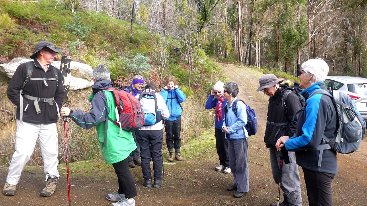
Today we're walking along the Ringwood Trail at Lachlan, which means a drive to New Norfolk. This means getting through Hobart, which wasted a lot of time due to traffic. We all fitted into two cars and Bob is our leader.
Taking the Lachlan Road out of New Norfolk, we turn off onto Ringway road and continue to the end, being careful not to run over any livestock on the way.
There's just enough room to park as the usual space is taken up by a bloke who's clearing around a paddock.
 |
| Parked and ready to go uphill |
Today's walk follows vehicle trails with no narrow tracks.
 |
| As you can see, weather was fine |
 |
| First fungus of the day |
I had prepared for it to be cooler up here than Kingston, but by the time we reached a spot for Morning Tea, I was ready to remove some gear. My polar fleece had a round trip without coming out of the pack.
We make our way around a couple of gates on the way up and come to the back door of Wellington Park and the Ringwood Trail.
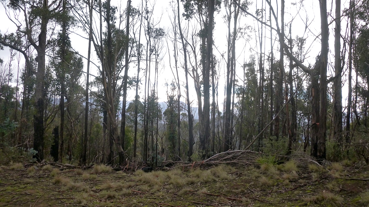
 |
| Occasional glimpses show how high we are |
 |
| Collins Cap off to our right |
There are a few large rocks scattered around the bush up here. One outcrop just off to our right appears to overlook the valley. I think next time we're up here I'll suggest we explore it a bit. It's not far and might be worth it.
 |
| This telephoto shot doesn't show how large this outcrop is |
Soon we reach level walking and it's a bit wetter up here.
 |
| Colourful little rock garden beside the track |
There has been a fair amount of wind damage up here, probably from last week. At one point the track is completely blocked.
 |
| Everyone is looking chuffed at navigating this formidable barrier |
On we go, passing signs of the past timber getting up here. It must have been a sight when all the gums were this size.
 |
| Notice the spring board slot used by the axe men to cut straight timber |
The circumference of this stump is much bigger than most of the young gums up here.
 |
| You can't beat a good lichen |
 |
| This is hung up on another gum |
|
It wasn't until we were coming back that I realized how little was holding this big tree up.
We're higher up now, and beginning to see signs of last week's weather.
 |
| Water hazard |
 |
| Just the right amount of snow, and off track |
 |
| The gums are getting taller |
 |
| You'd pay a lot of money elsewhere in the world for this garden arrangement |
Soon we reach our usual spot for lunch, complete with convenient fallen tree.
 |
| We had lunch next to this sign |
The track is blocked by dozens of fallen young trees. The last time we were here, we sent Bob to explore, but it was too difficult at the time. I seem to remember a waterfall marked on the map, but the track which is also marked, doesn't seem to go near it.
Bob offers to take us uphill (surprise!) after lunch to get a view. Knowing we'll all be in trouble if we don't agree, we set off.
 |
| This view doesn't count |
Soon, we come to a new barrier and make our way around it.
 |
| This was bigger than it looks |
You'd need a ladder to get over it, or walk half way back to New Norfolk to get around the top end.
Not sure what the plant is called, but it has lots of seeds on long fronds. Obviously from next photo, something enjoys them, but I don't think whoever it is gets too much nutrition from its meal. Regularity, perhaps.
 |
| More snow appearing along the track and down in the hollows |
|
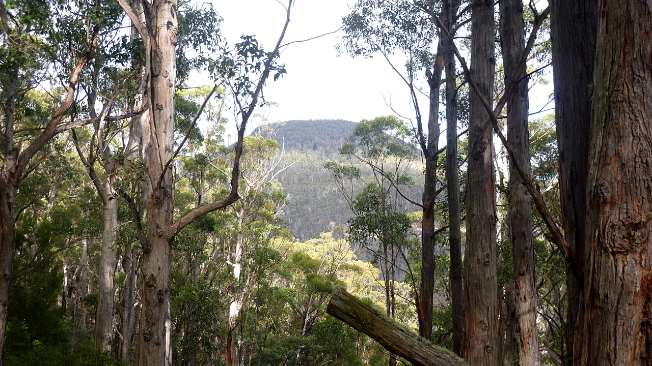
On we go and come to the view of.... a hill. I was out of earshot
when Bob told us the name, but looking on the map I think it's Mount
Marian.
 |
| Mt. Marian |
I had many 'helpful' suggestions about getting the best photo, all of which I managed to ignore.
Time was passing and due to our late start because of traffic, we turned here and retraced our steps.
 |
| More snow in the lower areas |
 |
| We take a slightly different track back, forming a loop |
How did he take that photo? I hear you ask. Look carefully, you're quite welcome to imitate my technique.
Soon we begin to have some views and some sunshine.
On the way back, I pointed out this hill to Bob and we spotted a track going up the side. I suspect that it's on private property, unfortunately.
It was a good day for a walk. We had 10 walkers and covered 14.16km in 5:05hrs. It's always nice to get on the mountain. Total climb was 1482 metres, so if you want you can do the maths and increase the kilometres. 100 metres climbed adds 1 km.
Click here to download GPX file


No comments:
Post a Comment