Today we're parking at Blackmans Bay Beach and walking from (near) the Blowhole to Fossil Cove and return. Bob is leading us.
You can tell Bob's our leader because we start off in the completely opposite direction, going north before heading south. Anything to build up the kilometres.
 |
| Heading north to go south |
 |
| Blackmans Bay Beach |
 |
| Flowerpot Point |
 |
| A couple of locals |
They look suspiciously like a couple of Haematopus longirostris or Pied Oystercatchers. They were very good at posing for photos.
On we go, heading for the start of the Suncoast Headlands Track, but before we get there, I spot this unusual track.
 |
| Either the very rare one-legged single toed wallaby or a walking stick |
 |
| Looking back |
We leave the beach and walk along the track which runs between the houses and a steep drop.
 |
| Soldiers Rocks |
This is easy walking and we pass several people with their dogs.
Disregard the map, we're walking with Bob, and we head off through a scrap of bush. We're soon back on track, however, and passing the off-lead dog area where we come to the next sign.
 |
| This takes us to the top of a hill and back down to the road leading to the dog area |
 |
| Scrubby bush |
 |
| Difficult to miss the track |
 |
| The other end of the dog area |
We walk up the road, past the scout hall and turn left on Tinderbox Road.
 |
| Best bit of colour we see |
Wattles may fall over if you sneeze near them, but they do provide a lift to the view.
 |
| Tinderbox Road |
There are a number of houses in the bush along this road, look on Google Earth and it's amazing what's back in the trees.
The one below is built just behind a large rock, but does have three happy goats.
 |
| Good climbing if you're a goat |
 |
| On we go |
We turn off onto Fossil Cove Drive, which seems to have lost its sign and head down towards the channel.
You can't miss the start of the track to the cove.
It's a steep incline with a number of steps and switchbacks so before we start, we have Morning Tea.
The bush is dry and there's little colour, so I took the photo below to brighten it up a bit.
Tea finished, we start down into the gully.
 |
| Heading down |
 |
| Small cave on the way down with animal track leading in |
 |
| Looking down into the gully |
 |
| The track levels out at the bottom |
We walk along this next to a dry creek bed, and soon reach a set of rough steps leading down to the cove.
 |
| Fossil Cove |
 |
| The fossils are impressions in the rock layers |
 |
| As you can see here |
 |
| Interesting vein passing through mud stone layer |
 |
| Bob and Gail make a discovery |
 |
| If you look upper left, you can see a plastic pipe |
This appears not to be just jammed in the cliff opening but coming down from above. If it is, it would have been drilled down quite a way as it's very high here, and there is a house up above.
 |
| Bob tells me there's a blowhole around the corner |
I have a look and find a channel leading into the cliff. You can hear the water entering some sort of cave and it would act as a blowhole with higher tides.
 |
| Looking towards South Arm |
 |
| A small dot in the previous photo becomes the Iron Pot Light |
 |
| The last fossil |
Before we leave, the tide is further down then it's been before on our past visits and Tas and a couple of others take the opportunity to pass through the opening below and look at the other side. It's much like this side but with more overhang.
 |
| The other side is much like this side |
We made our way back up the trail a short way and then took this old track that passes over the dry creek and up the other side. There are some rough steps carved in the side of the gully from many years ago.
 |
| Taking an alternate way |
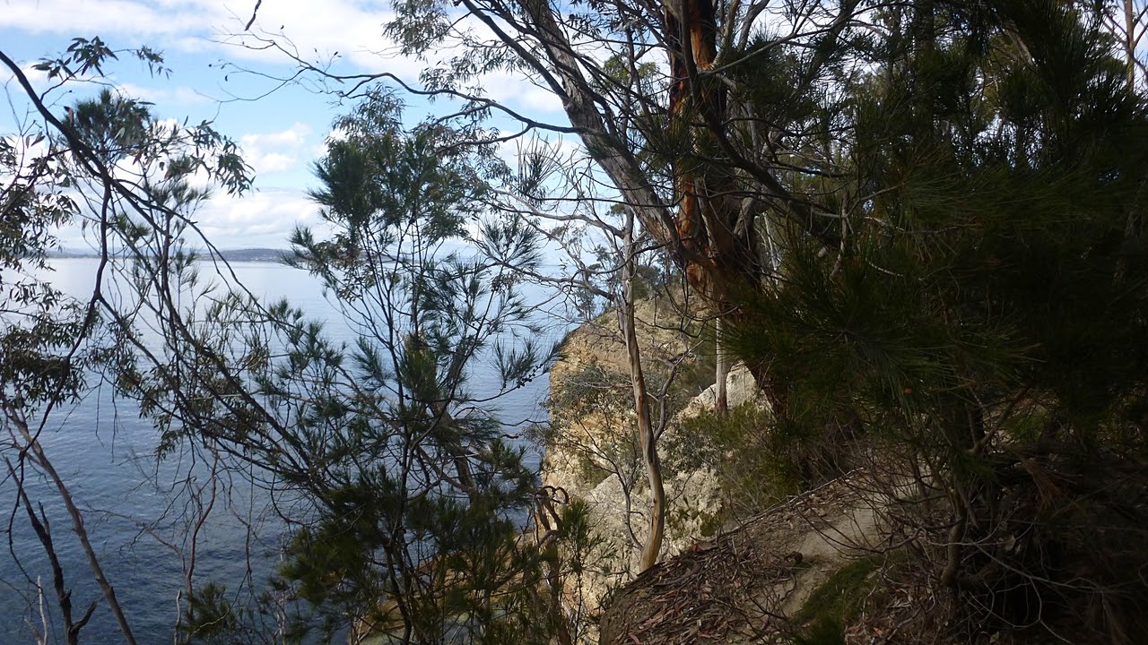
We've been on this track before and it leads up to a picnic table and a dilapidated fence. It then follows the edge of the cliff.
 |
| Looking down at Fossil Cove you can see how high we are now |
 |
| The track skirts the edge of the cliff |
We pass a large house at the top, set well back from the cliff. Some concern was expressed to me about how close to the top of the cliff the track goes. As it's slippery and sloped towards the cliff and there are few reliable handholds, I was concerned as well. Also I wondered what the property boundaries were.
I had a look and uploaded the GPX track on to the government List site. The map below shows we're not on private property, so I wonder if we could make a track higher up the slope as it's just open bush. Maybe next time.
We enter the bush again in a short while and follow animal tracks towards the channel. These meander around so you have to keep your sense of direction.
 |
| This is the easy part |
Finally, we find a steep descent that takes us down to the foreshore. This is marked as Public Reserve on the map. A short walk takes us past a very, dry gully and a scramble track that takes us back to the Suncoast Headlands Track.
 |
| Everyone has their own method |
 |
| Looking up from the bottom. Spot the track |
 |
| The foreshore |
 |
| This cutting is much larger than it looks |
 |
| Southern view |
 |
| This track leads us up to civilization |
 |
| No one seemed to notice that we ignored the track markers |
|
|
Instead, we walked up to the top of this field, along and back down to the official track. More distance added. Now we head for lunch.
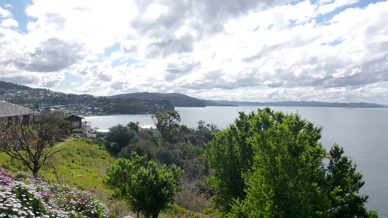
 |
| Mt. Wellington in distance |
We stop for lunch at a small grassy area with a picnic table and a view. After lunch Bob leads us on another indirect route before returning to the beach and our cars.
 |
| Another way to the trail. Adie holds the branch back so we can read the sign |
This is a good and interesting walk and Bob did his best to stretch it out.
We had 11 walkers and covered 9.31km in 3:41hrs. The weather was great.
Click Here to Download GPX file


No comments:
Post a Comment