Today we'll be walking from The Waterworks to Fern Tree and return. I must say, and I'm not alone in this, I was a bit concerned with the title of this walk. The sudden vision of some of our leaders turning up in frills created quite a scary image. Fortunately, it didn't mean that at all, but some added attractions. Tas is our leader.
Panic over (I may not need therapy after all) we assemble just outside the gate and set off.
 |
| It's a beautiful day for a walk |
Crossing over the lower dam, we head for the start of the track. Tas seems to have the bit between his teeth as in the time it took to take the above photo, the rest were off in a cloud of dust.
We take the track that runs parallel to the dam and head towards Mt. Wellington.
 |
| Looking across to the Receiving house |
The house is an interpretation centre now. In the past it's where the water from various sources was combined to flow into the reservoir.
 |
| As it was in the past |
The stone covered channel is apparent here as the white line heading up from the building. I think if you look carefully at the very top you can see water running down the channel cut in the rock.
We'll be looking at this shortly.
We come to the top of the reservoir where Sandy Bay Rivulet enters, and continue on, following it further up.
 |
| Over the creek we begin to climb |
Reaching the bottom of the first set of steps we begin climbing to reach where the water went into the covered downhill run to the Receiving House. The water bypasses this now and is taken down by pipe. While there, several walkers wondered what it had looked like in the past.
 |
| Peter looks at the stone groove that used to carry the water |
Peter has very kindly shared an early photo from around the 1920s of this in operation. I hope he doesn't mind that I fiddled with it to bring some of the details out.
 |
| Photo from Peter's collection |
I found another photo which is part of a stereoscopic slide showing an even earlier view.
The lower channel is covered by stone slabs now. The perspective makes the top rock appear quite small.
We stop and admire the view at the top, then continue on along the Pipeline Track, heading for Fern Tree. It's very easy walking now.
 |
| Looking at Mt. Wellington over the Turnip Fields |
 |
| Still small patches of snow |
 |
| Turnip Fields |
Around here I noticed the sun glinting off a couple of tail lights up above in the bush. Just then a loud motor noise began and speculation as to the cause started. Too high pitched for a chain saw, not the right pattern of noise as far as I was concerned for a brush cutter. I began to suspect something else and stayed back to see if it was little green men or something else.
I turned to look at the others and the photo below is what I saw.
Left to my own devices I finally managed to get a glimpse of the cause and get a photo.
 |
| A drone |
I suspect they were looking for areas to do fire reduction burns. All last Tuesday in the Channel there was a helicopter flying up and down doing the same thing. But who knows? A while later I saw a parked 4WD on Chimney Pot Hill Road and watched a bloke jump out clutching some sort of plans and climb up the bank into the bush. Cable car?
Enough speculation, I catch up with the rest (finally) and we head for our Morning Tea stop where the track crosses Chimney Pot Hill Rd.
 |
| We're on time this week! |
Tea finished, we cross the Huon Road and start up the new(ish) bike/walking track towards Bracken Lane. This will make a nice loop at this end of the walk.
 |
| Start of the track next to the bus shelter |
 |
| Looks like it's getting some use |
 |
| Modern track names leave something to be desired |
I mean, how sexy is a track called 'S56'?
 |
| It is easy walking |
 |
| Over a pretty little bridge... |
 |
| ...and into the end of Bracken Lane |
Walking up to Pinnacle Road, we turn left and reach the start of Pillinger Drive track and head down to Fern Tree.
We cross over the Huon Highway near the Fern Tree bus stop. A mere shadow of its former self, it still offers some comforts.
Now we start down the Pipeline Track heading back down towards The Waterworks.
 |
| Fern Tree bus shelter |
 |
| The Pipeline Track. What's wrong with this picture? |
Bob's missing. Taking advantage of Tas being somewhere in the front, Bob has ducked off onto another track, but will rejoin us lower down.
 |
| Part of one of the old viaducts |
We continue to the turnoff at McDermott's Saddle where we take the right hand track and head for our lunch spot on top of some cliffs.
The weather is still pleasant and we have comfortable seating and good views for lunch.
 |
| Looking down it's a series of ledges to the bottom |
 |
| Just so you don't forget what I look like |
Our other photographer, Renate, is away today so I'm having to shoulder the entire work load.
Lunch finished we head along the track and reach the next 'frill'. This will take us up to Sixpence Cave. There's a few new obstacles since the wind storms in the form of downed trees, so some of the party decided not to join us but continue along the fire trail.
 |
| The goal's in sight |
 |
| A couple of trees to negotiate |
 |
| Someone's been active here very recently |
I know this cave gets a lot of visitors. Sally had a story from the past about when she came across Santa Claus here. Seems the Hash House Harriers were having a Christmas run which included the cave.
 |
| That's a large garbage bag in the back |
I really didn't feel like looking inside it. They've also built up a large fire place in front.
 |
| That log was still smoking, and there are the remains of two potatoes and some clothing. |
I made the, semi serious, joke about someone burning his prison uniform here.
On we go, following the old fire trail below.
 |
| Leaving the cave behind |
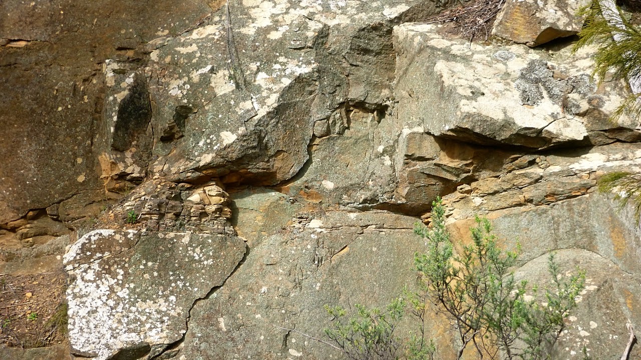
 |
| We go past an old quarry. I'm sure a geologist could explain the deposits between some of the rock layers |
 |
| I remember this descent from before |
It's very steep, but at least today it was just damp and not slippery. At the bottom we cross a little creek that runs down from Ridgeway Reservoir and joins the Sandy Bay Rivulet. Somewhere around here, Tas got a call from the other group asking for directions which he was able to provide. Seems they had thought we were coming back to them after we finished with the cave.
This is a very pleasant walk with different sections to keep the interest up.
We had 11 walkers and covered 10.45km in 3:55hrs.
Click here to download GPX file


No comments:
Post a Comment