To paraphrase the Two Ronnies (showing my age) "It's a packed blog today!"
If you remember from the description of today's walk, Bob issued a challenge to me re my research skills to identify our destination. Also, I received an email from Bob in which he comes out of the closet, and will include details at the end of the blog.
We travel to Tolosa Park at Glenorchy and park just outside the gate to the Mountain Park. Construction of an enormous water tank is taking place on the opposite side of the road. Weather is cool with promise of showers.
 |
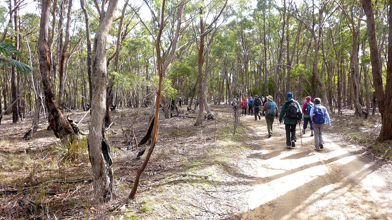
| Bob's mystery walk has attracted a good crowd |
We set off through the gates, past the shooting range and immediately Bob veers off into the bush onto a muddy track.
 |
| Into the bush |
 |
| My new boots and I just laugh at these conditions |
We don't walk through them, just laugh at them.
 |
| Mt. Wellington |
We're on open ground now and turnoff onto a bike track. Do the markings on the post mean bike riders can't read?
 |
| Bike track markers |
 |
| We go bush and walk along until we join a track leading up |
 |
| Now we're heading up |
 |
| Off track again into the open bush |
 |
| We've joined another bike track now |
 |
| As you can see, the sun is out at the moment |
 |
| There is a bit of colour in the bush |
 |
| I hope Bob isn't planning Morning Tea at Junction Cabin |
Fortunately, he wasn't. We walk along the North-South Track for a while before turning off onto an unmarked track leading up into the bush. It opens out at the top before continuing to climb.
 |
| Going up |
 |
| I haven't been able to identify this. Fungus or mould? |
 |
| The unmarked track leading up |
 |
| The bush is very young here |
 |
| Still going up |
 |
| Very artistic cairn |
The track is getting narrow and at this point Bob has to scout around to get his bearings as it's been a couple of years since he's been up here.
 |
| Bob's there in front of you if you know where to look |
 |
| We're on track |
There are some old orange tape markers on limbs here and there.
 |
| I can make out what looks like an old cairn |
|
|
As I get closer, I can see it's the corner of two stone walls. At this point, I'll give you the results of my research as to what this is. Just as we arrive we are hit by a small hail shower.
Some have asked what methods I use to do my research. Professor Google is first choice. The older methods were much slower, messy and unreliable. Also, the supply of sacrificial virgins has become very unreliable.
No maps I had access to, including paper, had any reference to these ruins. It took a while before I found reference to
Victor's Garden. Also known as
The Temple and by some bushwalkers as
Xanadu. The history is all anecdotal.
*********
The Temple had 4-5 terraces and a hut. It's thought the main two story hut was built by Victor shortly after the 1967 bushfires. There was a main hut as mentioned, at the end of the terrace was a lean-to workshop. A bunkhouse on stilts, painted to blend into the bush, was also on the same level. There was a cultivated terrace with a row of small pines (bigger now), two bee hives, a gate, a benched track and a man made water hole. Strawberries were reported as growing there by another visitor. Victor evidently kept an open house and there was a visitors book.
There are several ideas about the site pre Victor. 1. It was an old logging site. 2. That either during or immediately after WWII a sect established its self there, but abandoned it well before the arrival of Victor. This would fit with the name of "Theosophical Temple" given by the WPMT. That's the Wellington Park Management Trust. The Temple burned down c. 1985 and Victor moved to another hut he built.
Victor built Victor's Hut No. 2 after the fire and it's said he became a priest and returned to the Ukraine around 1988. There is an opinion that Hut No. 2 was the Temple.
I found the following on www.bushwalk.com, by Swifty.
My goodness that goes back many years. I used to attend a high school at the top of Tolosa Street, from where we could see the roof of Victors Hut reflecting the sunlight from the lower slopes of Mt Arthur. We are talking 1977! Needless to say, we wagged school one afternoon and followed the fire trails in the general direction and found the place. It was decorated out with religious themes which changed every few months - Buddhist, Muslim, Christian at different stages, and yes there was a garden below, all fenced in. It was a double story hut, quite comfortable really. Heard a rumour that council eventually got the structure pulled down. I think we even met Victor there once, a special sort of guy.
*********
It's amazing that it wasn't that long ago and so few facts are really known.
When we arrived and climbed the wall below. I immediately noticed a window opening in an adjoining wall with a bit of old clear plastic still attached. Thinking the walls were older, I put it down to more recent bushwalkers staying in the ruins. Later I saw a plastic pipe complete with valve leading from a higher water hole to a lower one.
 |
| Walkway on top of a wall |
 |
| Many sheets of roofing iron lay around |
 |
| Doesn't belong here |
 |
| Old fireplace with bread oven |
 |
| One of the hand dug water holes |
 |
| Wolf spider lair in one of the walls |
 |
| Many walls and diggings are to be seen off in the bush |
 |
| A good view of Glenorchy |
 |
| We're heading down another wall back to the track |
 |
| Ron and I found a large well constructed drain leading through this wall |
I find it difficult to believe Victor was responsible for all this construction. His hut, yes but not the rest of it. There must have been something here earlier.
Leaving the mystery behind, we continue on back to our original track.
 |
| Looking back |
We reach a clearing and have lunch. Afterwards we return via a slightly different route to the North-South Track.
 |
| We leave the main track to take this one up hill |
We take a mountain bike track down. It's a weekday and we're in little danger of being overtaken by anyone on a bike.
At the bottom, we take to the bush again before gaining a road leading down to the Mountain Bike Park where we make our way back to the cars.
We had 14 walkers and covered 10.66km in 4:58hrs. Total ascent was 1589 metres, so adding a kilometre for every 100 metres up makes it a good walk.
The fact that it was a mystery walk captured everyone's imagination.
I received a couple of emails from other walkers, but I didn't see them until late Wednesday night so I can claim I found the identify of Bob's mystery on my own.
I said at the beginning that Bob outed himself, so don't skip the rest of the maps but continue reading below them.
Click here to download GPX file
Now to Bob. Those of us who were on the walk not long ago at South Arm remember the orchid photographs trouble, well I've had an email from Bob saying he'd caught the disease from us and it caused him to take orchid photos on his recent visit to Bribie Island. You didn't think Bob was outing himself for any other reason, did you?
Bob's Orchids:


wow that's very beauty nature
ReplyDelete