Today Bob's taking us to the 'Magic Forest' which is an unofficial name for an area near Macgregor Peak just south of Murdunna.
We leave half an hour early, making our way to a meeting point at the Dunalley Hotel. Bob offered us two choices, continue on for the walk or stay at the pub. The walk won by a narrow margin.
We head south again towards a turnoff onto Macgregor Road which is a gravel road off the Arthur Highway. You have to look carefully, but it is marked.
It's not in bad condition as we make our way about 2km to a parking area just before an open gate. The land around us is listed as
Permanent Timber Production Zone Land. A short distance after we pass through the gate, heading right, it becomes
Future Potential Production Forest (Crown).
All I can say about that, having seen just a small part of the area is:
"Leave the Bloody Trees Alone!"
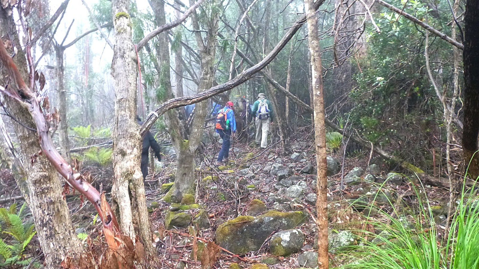
Right, back to the walk. We walk up the road a short distance before turning off onto a track leading up hill.
The weather forecast is possible early showers, before clearing and reaching 20C. Sounds good. In reality, it was overcast, misty, drizzling, and 12C. In Tassie you have to come prepared for any type of weather. Hence the wet weather gear.
 |
| Heading up Macgregor Road |
 |
| We're heading to the fire tower. There's a buried phone line under this track. |
 |
| Mostly young growth |
 |
| First of many trees of all sizes we'll clamber over today |
 |
| Looking back. You can see the mist and there'll be no views today |
The track becomes steeper, but Bob said it will be much better later on and only little climbs. I should have recorded him.
On we go.
 |
| First zig zag |
 |
| We're near the top of this track |
 |
| No change in conditions |
 |
| At this point, we turn off onto a narrow track that leads to the fire tower |
 |
| It's only a short walk and we stop here for Morning Tea |
The tower is used only for emergency situations, the views would probably be great from the upper landing.
 |
| Sign near the tower |
 |
| Bob using his preferred method of keeping dry |
Someone, and it wasn't me, compared Bob to a certain nanny who appeared in a fantasy movie of years ago which also starred Dick Van Dyke as a most credible cockney chimney sweep [sic].
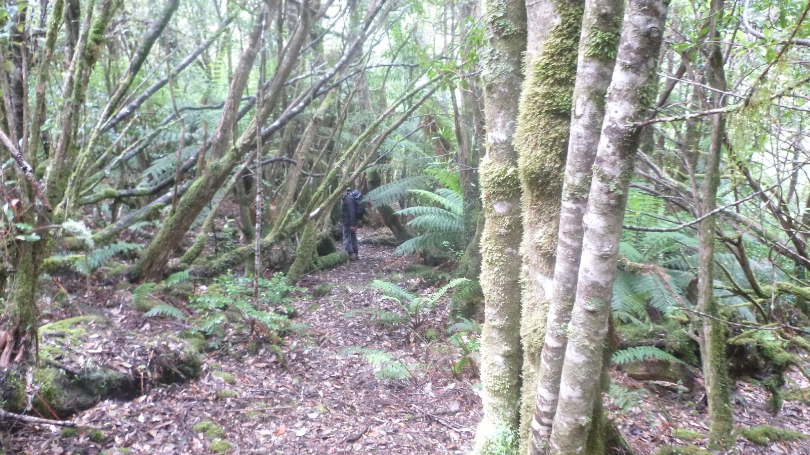
Tea finished we move on. The track is now marked by a variety of tapes and occasional plastic arrows, plus the old reliable stone cairns. Keep your eyes open and it's pretty easy to follow.
 |
| The steep climb is in the past and it's fairly easy now |
 |
| Old reliable track marker |
 |
| First of several rock climbs today |
 |
| The bush is beginning to thicken |
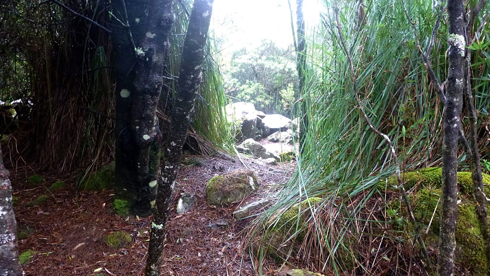
We make our way along then start down, all the while the nature of the bush around us is changing.
 |
| We start heading into the Magic Forest area |
You can see one of the track markers in the form of an orange arrow on a tree.
 |
| Every thing is covered with an abundance of growth |
The photos below don't really do justice to the area.
 |
| Native Laurel (Anopterus glandulosa) |
The whole area is very old and made up of Sassafras, Musk and Native Laurel. It would be interesting to see it again when more fungus is about.
On we go.
 |
| There's an abundance of moss covered rocks of all sizes |
 |
| Giant Grass Tree, Pandani (Richea pandanifolia) |
 |
| Being limber is a big help! |
 |
| Only a few fungus were in evidence |
 |
| This was a bit of a challenging rock climb |
That climb above takes us to the trig point at the true summit of Macgregor Peak, 591 metres.
 |
| This way to civilization. We ignore it |
 |
| Expensive construction over trig point |
There is a short walk out to a rock lookout that gives you views to the south. But not today.
 |
| Most of us are still smiling |
We head off on another track leading to more interesting sights.
 |
| I haven't been able to identify this |
 |
| The unusual green caught my eye |
 |
| Another large, slippery log to conquer |
 |
| We're beginning to find more man ferns now |
It seems to be getting lighter and we're looking for a place for lunch. Soon, we find a pile of mossy, slippery rocks with a view and settle here for our break.
It is indeed beginning to clear now and by climbing up onto a large rock I can see south.
 |
| Cape Hauy and The Lanterns |
 |
| Pirates Bay |
 |
| Fossil Island |
 |
| Osprey Head? |
It wasn't a clear view as much vegetation grew between our rocks and the scenery.
 |
| Richea dracophylla |
Soon, we pack up and continue on our way.
 |
| About to head off into the bush again |
It becomes a different sort of track now, more open and filled with many fantastic twisted Man fern trunks.
I can make few comments and will just let you browse the following photos.
 |
| I assume this is some sort of bracket fungus that has taken a fall. Larger than my hand and very solid |
 |
| A Man Fern that has created an almost complete circle with its trunk |
 |
| Man fern arch |
 |
| Hanging moss |
 |
| There were some very large trees here in the past |
 |
| We've entered an old selective logging area as you can see with this massive stump. Much taller than a person. |
 |
| A slot cut for a springboard for the logger to stand on and cut |
|
|
Around here, we had a little problem as there were several tracks in the area and what markings there were became confusing. Tapes leading one way, arrows leading another. Fortunately, we had Bob and he found the right way.
We climbed down a steep bank and found the track we wanted. I suspect many of the other tracks that appeared to be older were related to logging in the past.
Soon we reached this sign and a road. Schofields Road and we turned left to follow it.
 |
| Schofields Road |
As you can see, the sun has come out and the temperature is rising. I stopped for a break and to take off my wet weather jacket and naturally the others keep walking. Cooler now, I stepped out to catch up with them. Fortunately, I suddenly heard a short laugh and caught a glimpse of colour up above me in the bush. Otherwise I would have missed where they turned off onto another track, leading up hill (Who would have guessed?)
Soon, I caught up and we continued the climb - not as long as the one in the morning. Peter and I had been joking about having to go up hill before we could return to our cars, we were right!
 |
| If you look carefully, you can see what remains of a quarry from the past. |
|
|
Reading other accounts of this part of the walk, the quarry gets a mention also a large pile of old sawdust where a mill had been in the past, which I missed. I've found little online information re this area and its history.
However,
just to make you feel better, I did find a series of articles called Bush Rambles by J. E. Calder in the newspaper. Calder was
a Surveyor General of Tasmania. He published several articles about leading a party of 11 convicts to repair trigonometrical survey stations in the Channel, Huon, Betsy Island etc. that had endured 11 years of wind, fire and other damage.
I should point out this was in 1876 in the Tasmanian Tribune, this is a summary of what he says about Macgregor Peak.
"I found it troublesome to ascend, its slopes and ravines being covered with a profusion of close-growing scrubs and forest and the usual quantity of fallen trees and branches, all very impeding; but the worst obstruction of all was the amazing abundance of a low kind of fern, about knee high, in which our feet were entangled at every step. Our advance - all being heavily laden - was very slow, I suppose about a mile in three hours."
That's about .5kmh
They spent two or three days on top doing work. Calder says the peak was named for a Lieutenant of the 21st Fusiliers at the time, who may have been in command of the soldiers at Eagle Hawk Neck. Back to the present day.
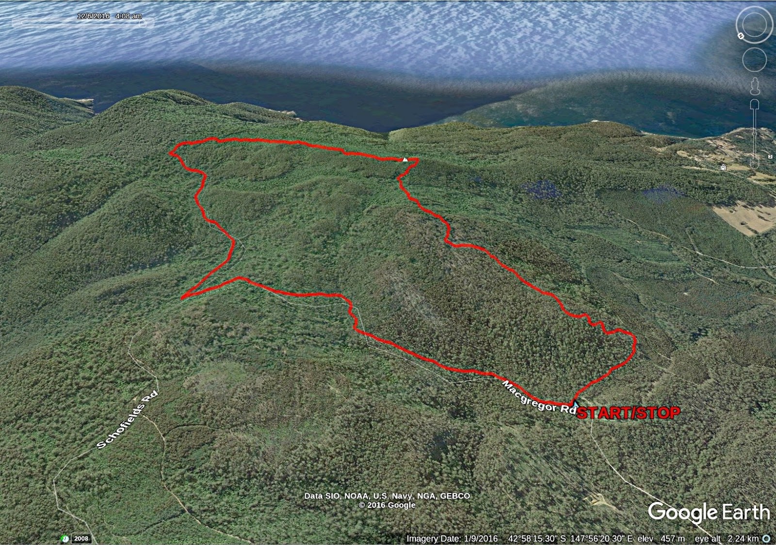
We completed the walk with a long descent that came back into Macgregor Road near the cars.
We had 12 walkers and covered 9.17km in 5:03hrs (4:11hrs moving).
Excellent walk and it was nice to get into the bush. Bob did a great job leading and no map was harmed (or used) in the completion of this walk.
In answer to your unasked question, yes there were leeches. Some people seem to attract them while others not. I thought I had one on my hand, but it turned out to be from a couple of scratches obtained when I took an imaginative descent down a muddy, slippery slope. On my back.
There is talk of mounting a photographic expedition back to this area sometime in the future. This would concentrate on the Magic Forest area and enable using tripods etc to take photos. Anyone interested can talk to either myself or Peter.
 |
| Frank must have been impressive |
Click here to download GPX file


No comments:
Post a Comment