After several days of rain, Bob has put in a good word for us with the weather god and we have sunshine for our walk at South Arm.
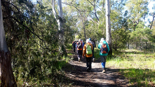
We park at the junction of Rifle Range Rd. and Gellibrand Drive, gear up and set off.
 |
Setting off
|
 |
Looks a bit wet
|
 |
A nice, but temporary waterfall
|
 |
We do a little street walking to get around the worst of the flooding
|
It's not long before we move off the pavement and onto the track.
 |
Back on track
|
It's also not long before Peter spots his first orchid.
 |
First orchid of the day
|
 |
Wax Lip Orchid -photo by Peter
|
On we go, striking some more wet areas before it all becomes a bit drier.
 |
It becomes drier as we climb
|
 |
Wonder if it starts?
|
 |
Plenty of water in the road drains
|
We make our way to Moola Close and pick up the Tangara Trail again.
 |
The flat twin green leaves are orchids
|
 |
| Multiple Wax Lip Orchids -photo by Peter |
 |
About as difficult as obstacles get
|
 |
More orchids
|
 |
Looking off track
|
We're making our slowly down towards Mortimer Bay.
 |
Sand mining took place here in the past
|
This explains the dug out areas between us and the beach. I suppose the pines were planted to stabilize the dunes.
 |
We've come through here and reach our Morning Tea spot
|
 |
Plenty of nice comfy rocks for everyone
|
 |
Not sure what these two have done
|
Perhaps there weren't enough seats with the others.
The sign below shows the entrance to where we've come from.
Tea finished, we make our way down to Gorringes Beach on Mortimer Bay and continue on our way.
 |
That's right. Mt. Wellington in the distance
|
 |
We'll move away from the beach onto a bush track
|
 |
The views never stop
|
 |
There are other flowers besides orchids
|
 |
Nice to see some larger gum trees
|
 |
First wet spot for a while
|
 |
We're heading down for lunch
|
The other beach was made up of manly small shells, our lunch beach, which is on Ralphs Bay, is mainly worn stone, perfect for skipping across the water.
 |
I can tell you many were skipped over the bay
|
 |
Lunch
|
 |
Ralphs Bay and our view
|
Lunch finished, we make our way up steps suitable for giants to the track, crossing over and heading up.
It becomes a bit more open now, and Peter finds some more orchids.
 |
| Donkey Orchid -photo by Peter |
 |
| Pink Fingers Orchid -photo by Peter |
 |
We reach Gellibrand Drive, turn left until we reach this spot
|
Here we turn right and start heading down hill.
 |
Going down
|
 |
We pass a pleasant farm dam
|
Just past here, our track becomes seriously wet as you will see.
 |
Some give up and just walk straight through
|
We reach a section where, on our right appears a desolate area, flooded with many dead trees and not a blade of grass in sight. The enclosure fence is quite high and I couldn't remember what lived in here.
I see something lying next to the fence and it appears to be an Emu, a large flightless bird endemic to mainland Australia, but extinct in Tasmania since European settlement.
CLICK HERE to learn more about the Emu.
It wasn't moving and I wasn't sure it was breathing until it suddenly lifted it's head. It appears to be on a nest that's partially flooded and not at all the sort of environment it should be in.
 |
I first thought it dead, but it did lift its head
|
 |
There were two more farther on
|
I'm trying to work out where this property is as this isn't good enough for these birds.
On we go, still navigating flooded tracks.
 |
| Nodding Greenhood -photo by Peter |
 |
Finally we reach another part of Gorringes Beach
|
 |
Local seahorse
|
 |
Very shallow here
|
 |
Approaching a car park at another part of Rifle Range Road
|
 |
Joining Rifle Range Rd.
|
This will lead us back to our cars.


No comments:
Post a Comment