Today Mendelt is taking us over the Tasman Bridge and down to a vineyard called Bangor. We're not taking up wine tasting, but exploring a new area.
The best thing I can do is quote from their website:
Bangor is a 4 hectare vineyard and a beautiful 6,000 hectare farming property that is managed for its' stunning natural environment. Located on the Forestier Peninsula in Tasmania's south east, Bangor has over 35 km of breathtaking coastline, 5,100 hectares of native forests and 2,100 hectares of private nature conservation reserves. These precious forests are home to a large number of birds and animals, including some of Tasmania's most iconic species such as the wedge-tailed eagle, and the Tasmanian Devil.
Bangor and the Forestier Peninsula also have a long and proud cultural history, from Tasmanian Aboriginal heritage, to the first European explorers visiting Bangor's shores in 1642, to whaling in Lagoon Bay in the 1830's and the development of farming land to supply food to the convict settlement of Port Arthur. The Dunbabin family started managing Bangor in the late 1800's, and the property remains in the family to this day.
To find out more about the local environment CLICK HERE.
We shall draw veil over the happenings of the morning. Lets just say that emails were lost, and a traffic accident blocked the main highway into Hobart for many kilometres.
We meet at the vineyard shed and Mendelt picks up a key as we're not walking from there. It's a 17 kilometre drive over rough dirt roads before we reach the point where feet can take over.
Parking, we gear up and set off.
 |
| Ready for the off |
 |
| Getting close to the beach |
We've had several light showers that have amounted to nothing, but there is black sky around.
We've come down onto the shore of North Bay and there's a nice little beach walk ahead of us.
 |
| It's called Two Mile Beach. For a reason |
 |
| North Bay |
 |
| Break in the dunes from Swan Lagoon |
 |
| Visscher Island |
On we go, it's actually not bad weather for walking and a little bit of low cloud on the distant hills looks good.
Finally we reach the spot to turnoff the beach and begin climbing the headland. It's well marked.
 |
| Turn up here |
 |
| A relatively easy climb up |
 |
| There is no scrub bashing with clear stony areas |
 |
| Looks worse than it is |
 |
| Only the odd fallen tree to cope with |
 |
| Old style track marker |
Not far now to the monument.
 |
| The monument |
 |
| This water stain appears to be the shape of Tasmania |
"At this spot the expedition under
ABEL JANSZ TASMAN
Being the first white people
to set foot on Tasmanian soil
planted the Dutch flag
on December 3rd 1642
As an memorial to posterity and to the inhabitants of this country
This stone was erected by The Royal Society of Tasmania 1923"
Quest for history for filled, it's time for lunch. Mendelt suggests some shelters evidently built by Boy Scouts sometime in the past, so off we go.
The shelters are perfect for our purpose.
 |
| Lunch |
Everyone sated, we start our way back, retracing our steps to Two Mile Beach.
We reach the beach and everyone has their own pace. While all of you innocents are having a carefree walk down a long beach, do you even give a thought as to what's happening behind you?
Where is your leader?
I'll answer that question with a photo below then I'll head off to therapy.
 |
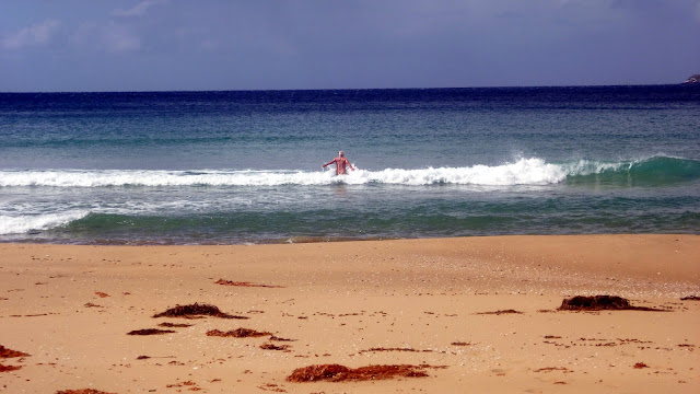
| Our leader. Aren't you glad I didn't use the telephoto? |
I catch up with the others just as someone decides to have a look over the sand dunes.
 |
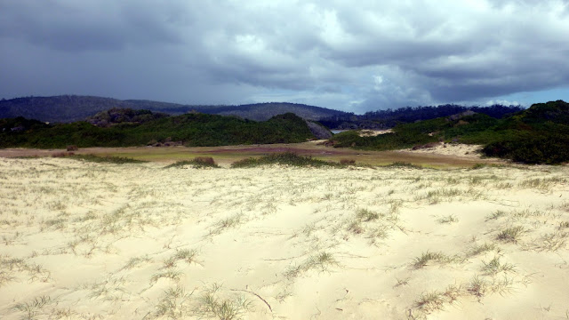
| What's over there? |
 |
| Salt flats. I do believe there is a small lagoon just out of sight |
 |
| On we go. We still have a lot of beach to cover |
 |
| End of the beach and the climb up to the track back to the cars |
We had 16 walkers and covered 10.81km in 3:44hrs. Not a difficult walk, but the beach gets a bit boring.
We had some very light showers and sunshine which made it a good day for a walk.
Click here to download GPX file


No comments:
Post a Comment