Today was scheduled for Pot Bay-South Arm. However, after the previous weeks walk which involved a fairly lengthy beach trek, I was bailed up by a couple of walkers and informed in no uncertain terms that beaches were out of the question on my walk today. So, having had the frighteners well and truly put on me by a couple of our stronger walkers, I changed it to walking around Arm End, avoiding beaches.
Unlike the previous week when we had traffic problems in both directions, today was pretty much a clear run to the end of South Arm Road/Spitfarm Road where there is plenty of parking.
The weather was a bit overcast with a slight breeze, but good for walking as we set off.
 |
| Geared up and ready to go |
 |
| Walking today will be in the open grassland |
 |
| Shelly Beach |
 |
| If you want a hill you have to go inland |
 |
| Looking back at Opossum Bay |
These would have been weekend shacks in the past, but from the looks of some of the houses more people live here permanently now.
There are plans to develop Arm End as a recreation area for bikes, walkers and a golf course. The land belongs to Parks & Wildlife who have leased it to a Tasmanian Business. You can find out more and also watch an interesting drone video if you CLICK HERE.
Morning Tea time arrives quickly and we settle down on the grass for our break.
 |
| Morning Tea |
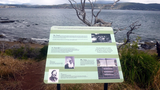
This land would have been forest until the arrival of European settlers. In 1824 a well connected settler named William Gellibrand was granted 2000 acres/809 hectares and given 10 convicts to clear the land and begin farming.
William, who was a merchant and exporter, treated his convicts very well by all accounts. He built a home overlooking Mary Ann Bay and it was said that after breakfast every morning he would dig the vault that we'll see later.
CLICK HERE to go to the Friends of The Arm website where you can read more of the history.
Morning Tea finished, we continue on.
 |
| Mt. Wellington is hidden in the distant clouds |
 |
| The Spit. A bird breeding area best avoided |
 |
| Looking across the River Derwent to the Alum Cliffs near Kingston |
Kingston is where we left this morning. Keen eyes will see the Shot Tower as a vertical line on the right side just above the cliffs.
We're about to go around Gellibrand Point at the tip of Arm End.
 |
| We've turned the corner |
 |
| Looking upriver |
 |
| Mary Ann Bay |
If you look carefully about the centre of the photo, you can see a white object. This is William Gellibrand's tomb.
 |
| A closer look |
We make our way down onto the beach.
 |
| Northern end of the beach |
 |
| Photo of me by Bob |
Due to erosion, the tomb is off limits but I've have a couple of older photos below.
William's house would have been above this spot.
On we go, looking for a good spot for lunch.
 |
| Looking for lunch. Down onto Mary Ann Bay |
 |
| Looking south |
We walk down the beach and find a sheltered spot complete with swing and plenty of sheltered seating. Unfortunately, somehow I neglected to photograph it.
 |
| I did get a photo of Marilyn enjoying the swing |
Just before we walked down to the beach, we saw that the track after lunch would take us up a nice little hill.
 |
| Nice little hill waiting for us after lunch |
After lunch however, Marilyn told us she knew of another way up that was easier. And it was!
We made our way along the beach and with a little rock hopping, found an old track that will lead us gently up to a short scramble which takes us to the top.
 |
| Looking back |
 |
| The old track |
 |
| From above |
We come up near a communications installation onto the main track leading back to the cars.
 |
| A final view of the Alum Cliffs |
Quite a pleasant day and location for a simple walk. I had hoped I would find some early photos of the original Gellibrand house, bit did not.
We had 14 walkers and covered 6.64km in 2:36hrs.
Click here to download GPX file


No comments:
Post a Comment