Tas was our leader for this walk.
Today was very overcast with the odd spit of rain - not what we usually expect of weather on the eastern shore. However it redeemed itself before the day was out, as you will see.
To get to the cape we cross the Derwent and travel south to Clifton Beach. Some of us travel somewhat further then others.
After parking the cars we made our way to the beach which consists of red sand and is a popular surfing beach.
 |
| Parking off Bicheno Street in Clifton Beach. |
 |
| Beach track |
 |
| Onto the beach. |
 |
| Some impressive (to me) breakers, but no surfers. |
Walking up the beach to pick up the track, we constantly had to dodge the crowds. Well, there was a bloke coming the opposite way.
 |
| If you magnify this about 500 times, you can just see someone in the distance, nearly hidden in the spray. |
Passing the sign saying the lookout was closed, we made our way up an old track to the lookout. Looked alright to us and the couple that were there already.
 |
| Track from beach to turnoff for lookout. |
 |
| Watsons Hill |
 |
| Clifton Beach |
The lookout is located in a muttonbird rookery, hence the sign. For those who don't know what a muttonbird is, I'll describe it.
The muttonbird lives under ground in burrows, and retains its curly down feathers for life, giving it the appearance of being covered in wool. It has a long face and markings on its chest that appear to imitate front legs. The cry is very like a bleat.
If you believe all that, send me your account details and passwords, please.
The muttonbird in Tasmania is actually the Short-tailed Shearwater and does indeed, live in burrows. During the season, licensed people stick their arms down the burrows to take the chicks, which were originally used for meat, oil and feathers. They're welcome to it as the burrows also provide a haven for tiger snakes! I've never had a taste of the muttonbird, but understand it is very oily.
 |
| Muttonbird burrows. Ghostly image is rain drop on lens. |
 |
| Addie found this for me. |
Making our way back to the track, we continued up to the top of the cape and began walking along, near the cliff tops. The reserve is fenced off from private land which gives a strip to walk on.
 |
| Top of cape, looking along where we'll walk. |
 |
| Looking down from cliff, this is NOT a man made window. |
 |
| Looking across Frederick Henry Bay towards Tasman Peninsula. |
 |
| Getting ready to rain. |
 |
| Looking towards Clifton Beach and Pipe Clay Lagoon. |
 |
| Yep, it's raining. |
 |
| We're following sheep tracks now. |
Crossing a couple of stiles, the slope of the land increases down towards the cliffs, as we walk on sheep tracks.
Along the way the weather became worse and a light rain began to fall, so we stopped to put on our wet weather gear. Except for one who decided to wait until Morning Tea and see what the weather was like then.
I had a good excuse, as I had only repacked my spray jacket the day before. It's one of those that disappears up its own pocket. With force.
 |
| Comfy spot for Morning Tea. |
 |
| Looking towards Primrose Sands. Not very good weather. |
 |
| I'm holding the end of my monopod (photographic equipment) and taking a selfie for the first time. |
 |
| This was to be an overhead shot. I think I need to practice. |
By the time we found a spot among the she-oaks, the rain had stopped. So there!
After tea, we made our way along to a spot where the reserve ends, and Pipe Clay Head is on private land.
The no trespassing sign warned us off, and the sudden appearance of security set our decision in concrete.
 |
| As far as we can go. |
Evidently, Richard was talking to someone re the sheep trails, when he heard a bleat. Turning around, he saw this mob of sheep appear around the other side of the hill.
Calls of "Jack! Jack!" went up and it was a moment before I realized I wasn't required to run and bark at the sheep, but to photograph them.
 |
| Here comes security to make sure we don't trespass. |
 |
| Now we're getting eastern shore weather. |
 |
| Julie demonstrates how to cross a stile with grace and agility to Richard & Peter. |
 |
| Another view of Clifton Beach & Pipe Clay Lagoon in better weather. |
 |
| Time for lunch |
The weather improved on the way back, as you can see from the photos,
and we found a place for lunch after a while. This was on the top of a
cliff with a view of Frederick Henry Bay. It included a couple of blowholes
at the bottom of a nearby cliff that went off every couple minutes.
 |
| First this one went off... |
 |
| ...then this one just behind the one above. |
After lunch we took another path through the bush -there are plenty to choose from - and made our way back to the cars.
There were a few flowering plants and a yellow fungi that Addie pointed out to me.
 |
| Bottle brush |
 |
| Don't know the name, Sally will probably tell me it's introduced and I should have ripped it out! |
 |
| Addie pointed these out to me. |
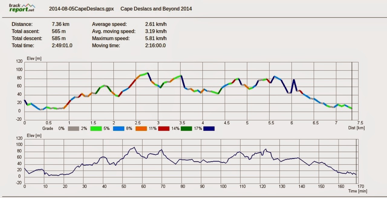
We had 13 walkers and covered 7.36km in 2:49 hours. Despite some little rain at the start, it was a very enjoyable walk.
Click here to download GPX file
Although no one on the North Island
admitted it, Hobart was the second warmest capital city in Australia.
Darwin was the first.
Darwin is about 1370Km. from the equator and Hobart is 4773km.


No comments:
Post a Comment