Today we're travelling out to Granton to walk up Snake Mount. Bob is our leader.
The weather isn't too flash at Kingston, with a forecast of showers, but it looks lighter to the north so we're in with a chance. As it worked out, we had a few drops driving to the start and another light shower as we were heading for lunch.
Bob appears to be getting soft, as we drove up to the end of pavement on Black Snake Rd. and parked. This missed out on about half the climb, but I don't really think anyone felt cheated. It's a steep drive up, and this meant the walk started out steep giving no chance to have an easy beginning.
 |
| We're off |
 |
| Stony, dry bush |
 |
| Looking back |
 |
| Side track. There are tracks everywhere as we shall see. You can see the slope angle and spot the little figure top left. |
 |
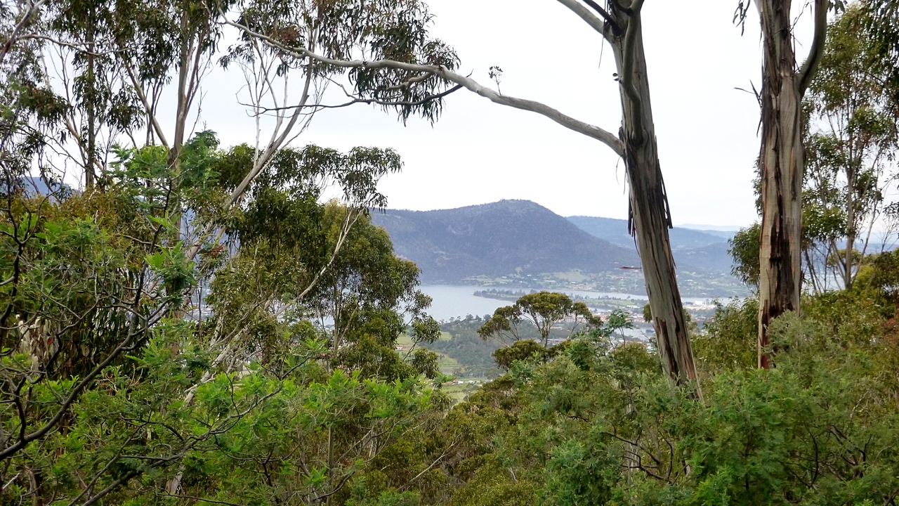
| We're up high enough to begin getting views |
 |
| The slope has become easier and it's good walking for a while |
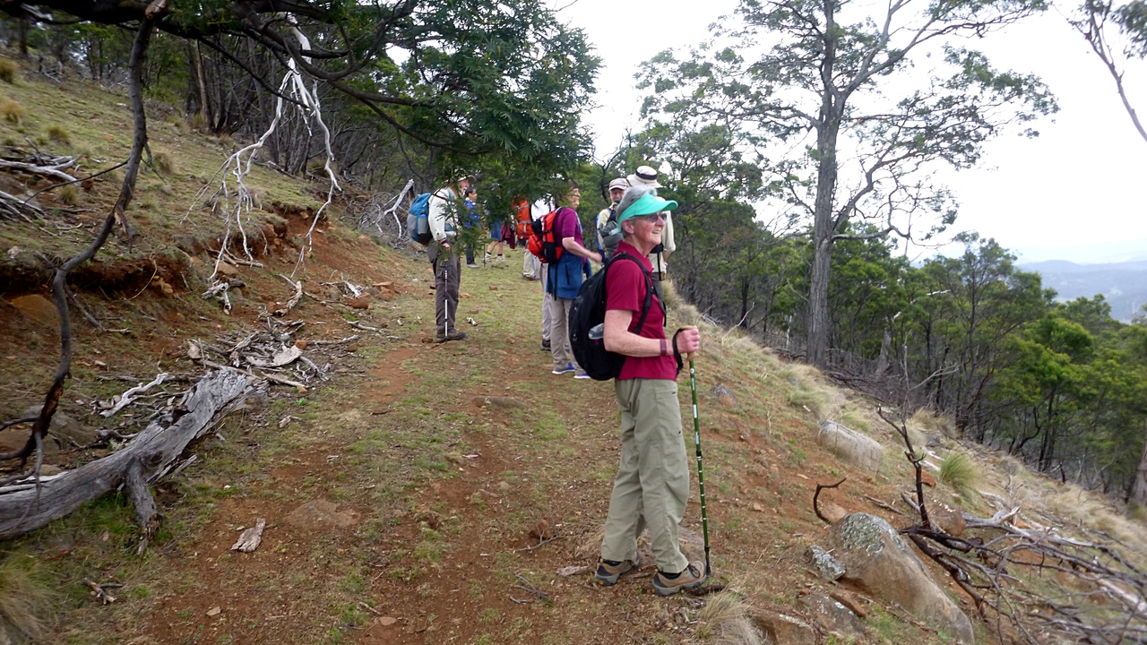
We soon come to a place where we turn off and head up again. It's pretty steep and some were worried they would hold others up. We're retired! Who cares! Besides I'm secretly happy for any chance of a breather, so don't worry about it.
 |
| Take your time |
 |
| That's Mt. Direction. We were on top of that last week. |
 |
| I asked for everyone to look like they were enjoying themselves. They did a great job |
 |
| We saw the same red crop netting from Mt. Direction last week |
 |
| Many hills left to walk up |
We're heading up towards the top, but it will be a while yet. The steep climb brought us to this track which we follow while looking for a spot for Morning Tea. It's easy walking.
Just a bit farther, Bob decided he better look ahead to make sure it wasn't too windy around the corner for us to stop. To the dismay of the rest Bob took off running. That's just showing off! While we waited we admired the views.
 |
| One of our group is moving to a unit here |
 |
| Now June knows where she can go on her morning walks, thanks to us |
 |
| Mt. Dromedary |
 |
| Morning Tea |
The walk is now fairly flat as we head towards the summit.
 |
| Short uphill section ahead |
 |
| That's the summit of Snake Mount with the large cairn on top |
 |
| It needs a bit of TLC on this side |
 |
| A short, easy climb up to the top gives great views |
We spend a short while enjoying the surrounding sights before we move back down to the track.
 |
| Mt. Dromedary again |
 |
| Bridgewater bridge |
We return to the track and continue on past some private property and down to our next diversion.
As I come down I see Bob has stopped to put on some gaiters. This wasn't in the walk description! I took mine out of my pack this morning to save some weight. In the end, it didn't matter as we didn't need the extra protection.
 |
| Rock formation just down from the summit |
 |
| We continue on past a fence line which is behind us |
 |
| Bob putting on his gaiters and frightening everyone |
 |
| We turn off onto a very old, disused track. Still going down |
 |
| Interesting sandstone cliffs across from us |
 |
| Relatively fresh Wombat scat. Neatly packaged in square bundles |
 |
| Every once in a while we pass interesting rock formations off to the side |
Now we reach a spot where a decision has to be made. Bob gives us a choice of continuing on or making a side detour to a cave for lunch. As it's beginning the one shower we have doing the walk, and because we want to see the cave, the choice was easy.
We climb up through a creek gully, under the remaining strand of old barbed wire until we reach the cave. It's not a long or difficult climb and the scenery is interesting.
 |
| Bob giving us a choice of going to a cave |
 |
| Easy choice, we all want to go |
 |
| There's an ancient strand of barbed wire to pass under |
 |
| These rock steps in the water course appear to be man-made but I'm sure are natural |
 |
| We soon reach the cave. It's been 12 to 18 months since Bob was last here, and apparently part of the roof has collapsed. A LARGE part of the roof |
 |
| We move around to the other end to get up to the entrance |
It's raining lightly now, so this will give us a comfortable lunch. But first it's time for a couple of group photos.
 |
| Bob volunteered to take one with me in the front |
Lunch was had.
 |
| Very large and interesting rock. Just needs some eye shadow and lipstick |
 |
| Settling for lunch. Rocks provided |
 |
| Interesting green rock covering |
 |
| Part of the roof. It's a good size opening, The gully is narrow here making it almost impossible to show it all in one photo |
Lunch finished, we climb around to the side to go up on top.
 |
| It's a short steep climb on a loose surface |
 |
| Bob and Ron have reached the top. It's a bit precarious with little room to stand. Also the surface is covered with moss which is dry at the moment and slips underfoot very easily |
 |
| I asked for a heroic stance |
We make our way back down and continue on around the back of the cave.
 |
| A bit of colour in the bush behind the cave |
 |
| It's a bit of a scramble down a steep slope with loose covering to make it interesting |
 |
| We go back to where we turned off before lunch |
The old track continues down past ferns, rock formations and places where people have been cutting firewood. We find the first old car wreck from many years ago just off in the bush. Soon we begin to find signs of 'civilization'.
 |
| Much greener on this side of the hill |
 |
| Peter and I discussed what make this is, and I thought it was an Austin |
 |
| At Home Val decided it was an Austin A40. Just needs a little work. |
 |
| Abandoned farm buildings |
We continue past some houses and more junked cars until we hit pavement. After a while we come back to Black Snake Rd. and start the long climb up past some encouraging locals.
 |
| There were 3 of these, all friends of Bob, who cheered us on our way |
 |
| We're well below where the cars are parked, so it's a long slog up |
The GPS lost sight of any satellite while we were in the cave and gully, so I've had to edit the track and the distance isn't accurate. But good enough.
Click here to download GPX file
It was a good walk in an area many of us hadn't been before.
We had 10 walkers and covered about 6.22km in 3:27hrs
 |
| What happens when you lose satellite connection |
 |
| Corrected map |


Austin A40 Devon. 1950 thereabouts.
ReplyDelete