Just when I thought I was safe until next year, I received an email from Our Dear Leader, otherwise known as Tas, saying several people wanted to do a walk on Tuesday to Handsome Caves. Was anyone else interested?
I think I replied "It beats going to the Tip!". Which says it all.
Tas had gotten directions from a couple of people, one of them for a circular route which we didn't do in the end. It's all on private land and the owner has closed the road with a gate where it meets Back River Rd.
So, off we go to Magra.
I remembered where we parked before on Back River Rd., just before the turnoff to Handsome Caves Rd.
Now, here's the thing. The Tasmanian Government map shows Handsome Caves Rd., but it's not. That is, it's incorrectly marked on the map. It was incorrectly marked back in 1999 as David Leaman makes plain in his book,
Walk into History in Southern Tasmania. Just as well we knew where the start was. Perhaps the Government left the error to confuse any invading force.
On arrival I opened the back to get the packs out and discovered why the car appeared to be tail heavy on the way up.
 |
| Social Huntsman, Delena cancerides |
The others stood well back and offered advice while I did battle. I didn't want to hurt it so settled with finally knocking it off the car, onto the ground. Job done.
It ran under the car however, so I suspect it found his way back inside and is just biding its time to drop into my lap at the worst moment.
Never mind, off we go.
 |
| That's the start of Handsome Caves Rd. just up on the right |
 |
| I suggest the 'THROUGH' should be removed from this sign |
 |
| There were a number of beagles and they were disappointed Bob wasn't with us |
 |
| Looking back |
 |
| First of several reasons 'THROUGH' should be removed |
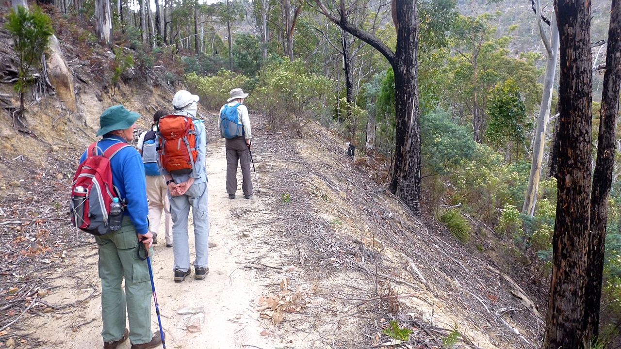
It's a steady climb up what becomes an old track.
 |
| We begin to see some views |
 |
| I think this is the mislabeled road in the distance |
 |
| Looking back |
 |
| This front was coming towards us |
The front was moving very slowly and then began to move south so didn't bother us at all.
 |
| First barrier |
I remember we had come to a gate the last time we were here, this seems to be its replacement.
 |
| As it was a year ago |
 |
| The sign is still here |
 |
| Addie watches the rest navigate the two logs |
We continue on and the track gets narrower and more overgrown. We're passing through private property, while the caves are on the Mt. Dromedary Conservation Area. Soon we have a first sight of the caves.
 |
| Handsome Caves |
 |
| The track is getting overgrown now |
 |
| Rock formations appear on our left |
 |
| Large gum growing on a rock shelf |
The photo doesn't do justice to the size and weight of this gum growing this rock shelf.
 |
| This gives some scale |
 |
| The rock is quite hard. Addie tried to scratch some graffiti with the hardened tip of his pole and it didn't make a mark |
 |
| Looking back |
We follow the old track, which appears to me, to predate motor transport, and climb to the first caves.
 |
| Up to the first caves |
 |
| You can see the distinctive feature of these caves |
It being a little early for lunch, we go exploring to the right side of the cliffs where I followed what appears to be a faint track.
We followed it around, but it didn't appear to go any where and became more difficult.
NOTE: That night I read the description of this walk on
Hiking South East Tasmania by Denis who called this way "a bit hairy". I concur.
 |
| Distant hills |
 |
| Tas looking at another route |
We turn back to where we first started and go up into the caves.
 |
| The floor is very fine soft sand left by the erosion which is caused by water |
David Leaman gives the explanation of the forces at work in his book mentioned above and which is available in the library or should I say LINC Tasmania to be politically correct.
 |
| My walking stick leaning against the fallen portion gives some scale |
 |
| The circular protrusion part way up left of centre must be much harder rock |
 |
| This appears to be a vertical dinosaur footprint and a heart |
Actually it appears to be more the shape of Tasmania - given a lot of imagination. I found another slightly larger close by. Some of the erosion occurs from behind before breaking through.
Tas and I explore the other end of the cliff, where I find evidence of, what was probably, a goat.
 |
| Cloven hoof... |
 |
| ...with another close by |
I think it's the wrong type of terrain for sheep.
Going back, we settle down for lunch. It's fairly cool up here at the moment, but it will warm up when we go down later.
 |
| Closeup of some of the holes |
 |
| This was a larger one... |
 |
| ...and this is what it looks like inside |
We can see evidence of birds nesting in these holes, and a small bird is just flitting from tree to tree quite near us at the moment.
We lose track of it when suddenly we become aware it's actually quite close to us, checking we're no danger before entering its nesting hole.
I grabbed a quick photo, not one of my best as I was quite rushed.
 |
| Limit of zoom with my little camera, plus the little bird moved and became blurred. If any other excuses are required, just contact me |
We've been here before on January 21, 2014 which was BB - before blog. The photos are much the same except for the two below. I recognized the shelf on our current walk, but no owls in sight.
 |
| 21-01-2014 |
 |
| 21-01-2014 |
After lunch we explore the old road a little further. It's solidly made with sections supported on rock walls which are still in good condition.
We decide to turn back and pass a rock cairn we ignored earlier. With hindsight, we would have known this marks a track to the top of the cliff. I'll know next time!
Now we find our way back down to our original track to walk towards Back River Rd. This time we take a loop we had bypassed in walking up.
 |
| Exploring east |
 |
| Nice deep gully |
 |
| Heading back |
This is a good walk and the weather was nice. The area has scope for further walks on public land.
We had 5 walkers and covered 6.74km in 3:16hrs.
Happy New Year
Click here to download GPX file


No comments:
Post a Comment