Today Bob is leading us to a couple of special sites, the location of one I will not publish in order to protect it. Both are located on the side of Mt. Wellington.
It looks like a good day with unseasonal hot weather forecasted for Hobart. We park near the beginning of Shoobridge Track off Pinnacle Road and head for Junction Cabin.
 |
| Not a prayer meeting, Bob's briefing us on his plans. On second thoughts.... |
 |
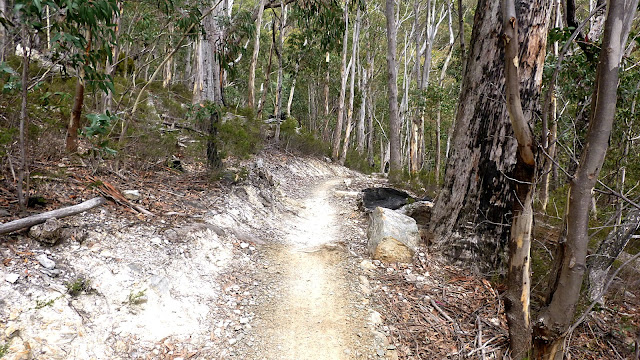
| Entering the track... |
 |
| ...heading for Junction Cabin |
 |
| It's a great day to be walking on the mountain |
 |
| A short diversion around the Octopus Tree |
So named because it sits on top of a large rock outcrop and envelopes it with tentacle- like roots. Difficult to get a good photo because there is little room in the bush to backup and frame it all. Really need a chainsaw and a tripod to do it justice.
 |
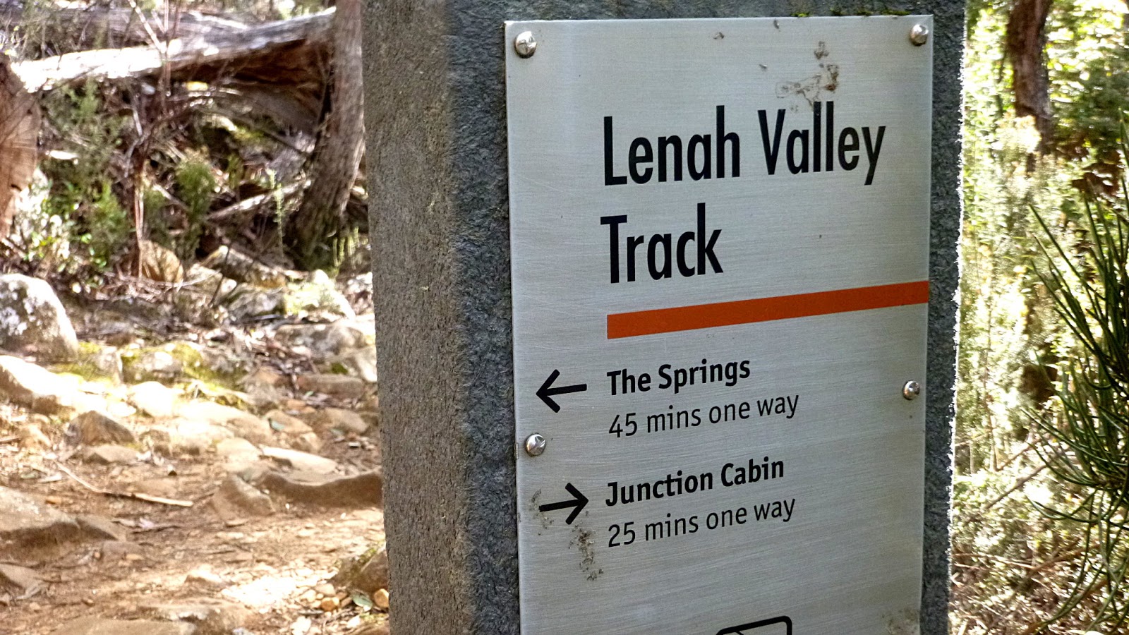
| Onto the Lenah Valley Track to the cabin |
 |
| Across the first of the rocks for the day |
 |
| Miniature forest atop a large rock beside the track |
We arrive at Junction Cabin and Bob calls an early Morning Tea.
 |
| Bob calls attention to the early break |
 |
| Who's worried? |
 |
| A stealthy thief is lurking around our packs |
 |
| A Black Currawong or Strepera fuliginosa |
Tea finished, packs intact, we start down Breakneck Track, heading for our first site.
It's not long before we reach an old sign at the start of Wiggins Track, so off we go.
It's pleasant open bush, but very dry. In fact, there are bushfires burning not too far away on Tolmans Hill, but we're in no danger.
 |
| At least one map calls this Wiggins Track, so I'll use that title |
 |
| Looks like a tailings pit |
 |
| More signs of workings, it was back in the early 1830s |
 |
| We're on an old road, looking down |
 |
| Old working face |
 |
| This sign is next to the work face |
I've tried to find out more about Robert Barter Wiggins and had little luck. The only one I can find was a builder and pub owner in Hobart. He owned several, such as the Ocean Child. According to information, he was eight and arrived in 1834. So, no help there, unless he was really precocious!
No record online about the quarry, just a mention somewhere that it was poor quality. I did see that nearby was a hut, the base of which may still exist. More exploring next time.
Back up the track we go, our next stop will be New Town Falls.
 |
| Turning off towards the falls |
 |
| Occasional glimpse of distant hills |
 |
| Walking between a rock and a steep place |
We reach the falls and I take a photo before I climb down. I hear someone ask Bob where we're going and I, jokingly, point out the faint foot pad just next to me, heading up.
You guessed it, that's where we're going. Up to the top of the falls we're looking at!
 |
| The falls actually is made up of several steps |
 |
| This flows down to the next step |
 |
| Not exactly roaring down |
We clamber up a faint, slippery track and reach the next step.
 |
| Looking up from our original spot |
I climb up and join the others. You had better be careful here because, although, there's not much water, if you do step in the wrong spot it's very slippery. Not a pleasant drop to go over.
 |
| Another step above us |
 |
| Waiting for me to get out of the way |
We're going higher still, doing a little bush bashing to reach a higher track.
 |
| Look carefully just above centre and you can see someone climbing up |
 |
| Looking down. Not a tourist track |
 |
| Civilization again! |
We head along this track and this is where we go dark as somewhere we head into the bush again for our other destination.
 |
| Into the bush |
 |
| Interesting marks on this rock. About .5 metre long |
There were other fossil- like marks on it also.
 |
| On our way |
 |
| Rock cliffs above |
We're heading for a place called Larkin's Lair.
 |
| Lakins Lair |
When we arrive, Bob tells us the story summarized below.
"The Caves area is part of a sandstone outcrop and Lakins Lair is one of its features. The Lakins Lair rock shelter was built by Fred Lakin and family in the 1930s. Fred's father, Noel Lakin was one of the early Mountain Park's Honorary Rangers."
There is a stone fire ring behind the stonewall which creates a sheltered room with a natural chimney at the end. A Mercury newspaper from 2013 is the only item that doesn't belong there. Used as a fire starter I assume.
 |
| Looking along the cliffs |
 |
| Looking back at the lair |
 |
| Making our way along the cliffs |
 |
| You just know we're going to go up another slippery slope |
We reach the top of the cliffs and make our way, heading for a marked track some way off.
 |
| Walking up here is quite easy |
After some casting about, we find our way to the track we wanted and make our way up to Junction Cabin for lunch. More people are showing up, both cyclists and walkers out on a beautiful day.
 |
| Taking the sun on the cabin wall |
 |
| We leave Junction Cabin on the North-South Track |
We pass a couple out walking who enquire who we are and encounter a large group of high school kids on their mountain bikes out for a run with a couple of teacher. All were polite and friendly as walkers and cyclists made way for each other.
 |
| The cyclists need a smooth run |
We make our way back to the cars.
A very interesting walk with new places and some scrambles.
I will regrade it to a G3 the next time we do it, though. I think that in future if there is any element of a higher grade track, the grading will be elevated to that grade. If you know what I mean. Just so people get what was advertised and don't get caught out by something more difficult.
Because of the sensitivity of one of the sites, there is no proper map or gps track to download. The Report is for the actual track we followed.
We had 11 walkers and covered 11.35km in 44:51hrs.


No comments:
Post a Comment