We were going to walk from the Waterworks up and around Chimney Pot Hill. However, I decided to change it for two reasons. One, Bob was going to lead us and can't and Two, the weather forecast is for a hot day and strong winds with a chance of a thunderstorm later. By hot I mean around 32C or 89F in the old money.
So all things considered, I decide to move our outing to the Kaoota Tramway Track outside of Margate. It's not as steep and will be shaded for most of its length. I sensed some relief when I passed on the news to the group gathered in the Denison Street Car park.
I'm not going to make it too easy so we park at the end of the Nierinna Creek Track on Lawless Road. This gives us a nice little climb before we reach the start of the track.
 |
| The start |
 |
| Looking south |
The road climbs through a poultry farm that now looks as if it's closed. I suppose that means it will all be subdivided in the future.
As we walk we also pass the parking area beside the road for people doing the track. This is only for wimps.
 |
| Through the old poultry farm |
We reach a level with several tracks leading off and a sign marking the beginning of the track.
We've done this track a couple of times before so I'm not going into a lot of detail re the track or the history of it. Suffice it to say that it used to be a railway track to a coal mine. If you want to know more:
CLICK HERE
It's a pleasant walk, overcast and not hot at all.
 |
| Easy walking |
I spot a farm down in a valley as we walk and I remember seeing something about this property in the past, but the only thing I can remember is that it is an organic farm.
 |
| Organic farm down in the valley |
 |
| Can't make out what they are harvesting |
I hope they have good fences because we scare up a few wallaby as we walk. It's getting close to Morning Tea time and I'm keeping an eye out for a good place.
Found one!
 |
| Morning Tea |
 |
| Interesting tree trunk |
Break finished, we move on. You can sometimes find relics of the old railway if you look carefully. Old sleepers, sometimes a spike and there is even a piece of rail lying beside the track in one place.
The photo below shows where a trestle once crossed a gully.
 |
| The track used to run on top of the mound you can see on the left |
 |
| Lots of man ferns |
Looking off to the side reveals some interesting sights.
 |
| The area is usually fairly damp most of the year |
 |
| Looking down |
 |
| A good track for feet, bikes and hooves |
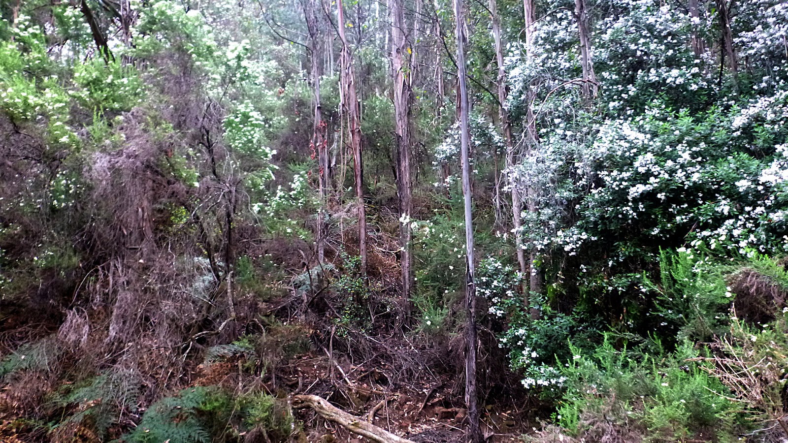
Appropriately enough, there a number of Prostanthera lasianthos - Christmas bush or mountain lilac along the way.
 |
| Christmas bush/Mountain lilac as identified by Alex |
We're getting close to the end of the track where we'll have lunch.
 |
| Most likely introduced, but colourful |
There are a couple of benches and a picnic table set up here for our enjoyment so we settle in for lunch. A very pleasant spot as at the moment there is no motor noise, the weather is pleasant and a couple of birds can be heard singing.
 |
| Lunch view |
There is some mist around in the distance, but we only get a couple of tiny drops.
 |
| Sleeping Beauty in the distance |
This end of the track has a wallaby lawn as I've heard it called. You can go farther as we've done before. But it's road walking and you can't get into Kaoota as you're blocked by private property.
Lunch finished, we set off. It's actually a bit cooler now and at least one walker puts on a jacket.
 |
| There is a mix of old and new houses up here. But not many |
 |
| We step out on the way back and set a record (for us) for the return |
As we get near the cars, I head off as I want to check out something I noticed this morning.
 |
| Nerinna Creek |
When we left the cars this morning, I noticed a small white triangle with the figure of a horse on it nailed to a tree.
 |
| Look carefully and you can see a marker on that tree |
It looks like a horse trail continues along the creek. I can find no indication of it on any map, but the area it follows between the property creek and the other side of the creek is a public reserve, according to the map.
It appears to connect with Cuthberts Road which runs into Nierinna Road and down to Lawless Road. Looks like a little exploration is needed.
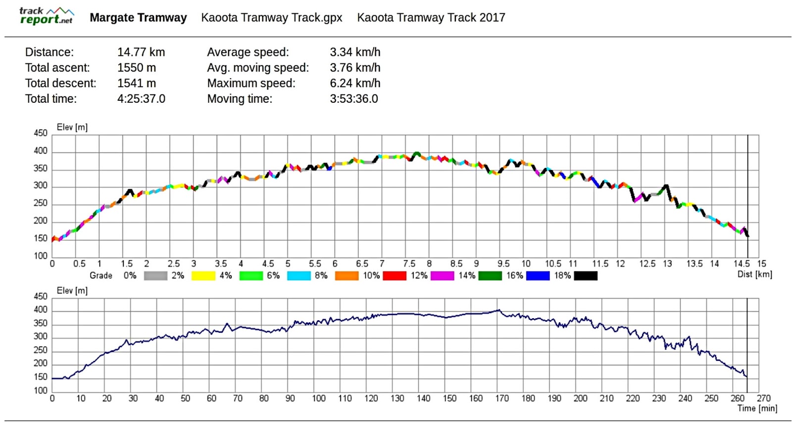
We had 9 walkers and covered 14.77km in 4:25hrs. A very enjoyable walk was had by all.
Some discussion was had about the speed of our return so I've provided a graph of what the GPS saw.
Click here to download GPX file


No comments:
Post a Comment