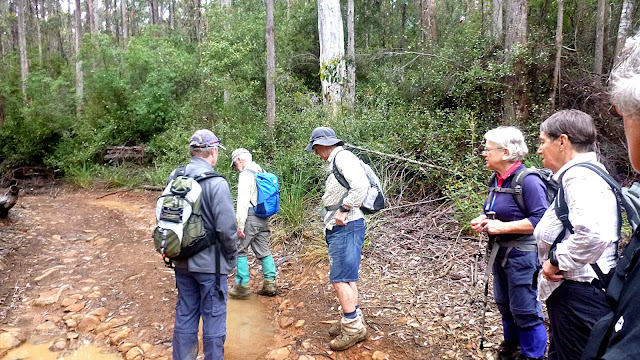
Today we're walking into Pelverata and Slippery Falls. Usually we start at the end of Van Morey Road in Margate, but I had a look and it's in bad condition. I may have a 4WD but I'm not taking it up there.
About five years ago we walked in from the end of Umfrevilles Road in Kaoota on an old road that had been recently closed. Today we're going to repeat that experience.
There's limited parking at the start so we did well to have just two cars.
 |
| They left a gap for walkers so it must be o.k. |
The track heads down into wet bush and continues along for a while. It was a stony track as I remember and becomes quite steep after awhile. THAT I remember!
The Snug Tiers area was extensively logged in the past and this would have been part of that.
 |
| You won't find trees of this size here any more |
It's a warm, humid day and that along with all the wet greenery means we're under attack by many leeches. I think everyone probably had a couple of bites.
Still, think of what you would pay to have medical leeches applied by a doctor.
Soon we reach the start of the climb and it does seem to go a long way. I also wonder what condition the track would be in. Last time it seemed wider. Certainly it has narrowed and we had to duck under several trees that had fallen over the road, but it wasn't too bad.
For myself, I didn't find it as much of a strain as I did the first time I climbed it years ago.
Peter's on the lookout for any orchids and spotted these leaves.
 |
| Bob missed these |
I should point out that the Snug Tiers are a recognized 4WD drive area. You don't want to mess about with it though as evidenced by the following headline from 2015.
Two bushwalkers rescued at Margate, 4WD group winched from Snug Tiers
I should mention that the winching was done by helicopter and these were separate incidents behind Margate.
On we go, making our way around muddy flooded sections of the track.
We finally come to a large fairly flat area of rock that's the junction of several tracks and we set off on the wide track heading towards Pelverata. The leeches are going to have to fly to reach us now.
The flowers are out and it's not bad walking. I expected more damage by the 4WDs but it's not too bad.
We reach another junction of tracks and are surprised by the installation of signs! Getting a bit civilized up here.
 |
| We're on the right track |
 |
| I've not been on the Snug Tiers track. Another time |
On we go, passing the site of an old sawmill. As we were looking around, we heard the sound of a motorbike starting up. I had noticed what appeared to be fresh tracks leading in.
We found the rider just as he was going to turnaround so we stopped for a chat.
He grew up in the area and was enjoying his birthday which his employer had given him off. He set off in the return direction while we continued on.
 |
| Sawmill site |
 |
| Old boiler |
Asked what the track was like I explained it ran through a logged area and contained remnants of old machinery along the way.
I said I was going to photo some 'old boilers' along the track which generated a guffaw from a couple of our female members.
Above is the old boiler I meant and I deny any other meanings!
I didn't even give into the temptation of asking them to pose next to it.
On we go as I carefully choose every word I use.
We soon come to a spot where we had Morning Tea in the past. This is where Pelverata Creek crosses the road and continues through the bush to the waterfall. Back then, it was almost dry, today looks like it might be better.
I suppose you could follow the creek through the bush to the falls. If you never wanted to be seen again. We'll keep to the track.
 |
| Pelverata Creek crossing the track... |
 |
| ...and disappearing into the bush |
 |
| An example of a sawmill up here in the past |
By the past, I mean the late 1800's up to around 1920-30.
There's a bit of a climb after the creek then downhill until we reach the turn-off to the falls.
You used to be able to walk to Cygnet, but I believe a couple of private properties now prevent that.
I remember the track to the falls as being in poor condition the last time we came here, and it stood up to that memory.
 |
| Orchid |
 |
| Track into top of Pelverata Falls |
At least there's a bit of space on the side for walkers. We reach the spot where a track leads down to the top of the 114 metre high Pelverata Falls. Possibly the highest in Tasmania.
Bob is leading and makes the decision to continue on to Slippery Falls where we will have a view of Pelverata Falls.
Slippery Falls isn't as popular and the track is fairly rough and gaiters are recommended.
 |
| Pelverata Falls to the right, Slippery Falls into the bush at left |
It isn't much of a track, ribbon markers are getting old and disappearing so you have to look carefully.
 |
| A couple of walkers in the distant centre |
 |
| We pass a gap and I photograph Slippery Falls |
 |
| Slippery Falls is at the top of a deep gorge and Pelverata Falls is further down on the other side |
 |
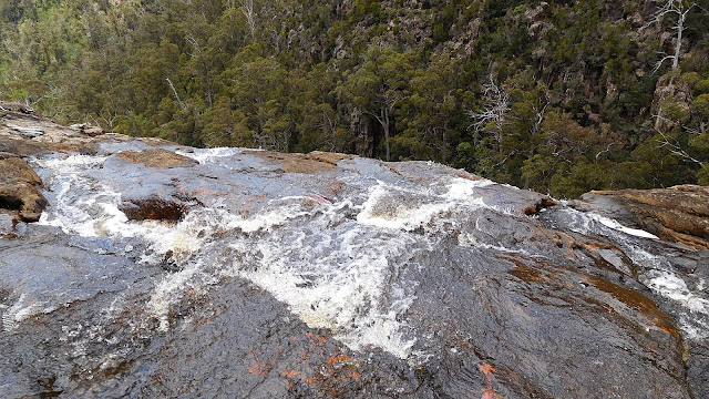
| Top of the well named Slippery Falls |
 |
| Great views for lunch |
 |
| Long shot of Pelverata Falls |
 |
| Pelverata Falls from several years ago |
 |
| Looking down the valley |
Lunch finished, we make our way back along the same tracks.
 | ||
| Peter spotted another orchid |
Mind you, I'm not sure how much scent warratahs have.
 |
| Past the old sawmill site |
 |
| Past an old forest ghost |
 |
| Past the puddles |
 |
| Myself. Photo by Bob |
We had 9 walkers and, wait for it, broke our 18km barrier by covering 18.13km in 6:26hrs.
We climbed just over 2km.
The weather was just right for the walk and despite the leeches, I think everyone enjoyed it.
Click here to download GPX file


No comments:
Post a Comment