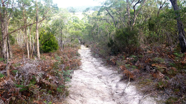
We meet at the end of Patriarch Drive in Kingston to take the start of the Coffee Creek Track.
A word to the wise, there is parking here but the land next to the business is private land and they don't like just anyone parking there. Park on the other side of the dirt track, closest to the creek and you'll be o.k.
 |
| Where to park in the future |
 |
| Everyone set?... |
 |
| ...Off we go |
 |
| Nice map. Too bad it doesn't show a 'You are Here' marker. This can have consequences as we will see later |
There is much pipe laying in and around the reserve, heading for the sewage works. We come to the Scarborough Fire Trail to find it's blocked by flags and rope. We were planing to follow this to our next turn off, but that seems unlikely.
Fortunately, a kind gentleman let us walk down the track to Lady Penrythn Drive and up to another track entrance that will take us in the right direction.
There's a pumping station in there with much work going on enlarging and cleaning out the spillage pond.
We continue on, passing large machines before finally getting onto a welcome bush track, leading uphill, of course.
Bob stops and informs us that this is the highest point of the walk. Every thing else will be downhill. Sort of.
 |
| Highest point. Oxygen not required |
 |
| Heading down |
On the way down, Amanda makes a new friend living nearby.
 |
| Friendly local |
 |
| Large fungus hiding in the grass |
 |
| Morning Tea |
 |
| Tack this onto the photo above. Peter has the best seat in the house |
 |
| You could probably make some interesting bowls from those burls |
 |
| Great looking tree, dwarfing walkers behind |
Making our way down a steep track into a gully and back up again. On the way I attempt to take photos of some tiny fungus, but had the camera on the wrong setting. As I was well behind, I had to hurry to catch up.
I did spot this rare earthball fungus. If you look closely you can see the markings that identify it as the Tiger Woods ball fungus. The SD 90 is a dead giveaway.
 |
| Rare Tiger Woods ball fungus |
Using a app on her phone that, evidently, translated her spoken words into something on the screen, she tried to communicate with us.
Fortunately, Amanda was going to return to the cars early and volunteered to take the woman back.
I believe she was looking to get back to Roslyn Avenue, even if she had come across one of the map signs such as we saw at the beginning of our walk, she would have had no idea where she was, due to no 'You are Here' markings.
 |
| Lost Chinese lady being conducted to safety by Amanda |
 |
| Gum tree dropping its bark |
 |
| Surprising green view looking towards the Channel Highway |
 |
| Starting down |
 |
| Going back up, heading for lunch |
We've made a loop and head to the Coffee Creek Track via small tracks and the Middle Fire Trail.
On the sandy fire trail, someone spots this track, I said it looked like a miniature mountain bike, as it's only about two fingers wide.
Then the creature below was spotted. This was our track maker.
 |
| Mystery track |
 |
| The culprit |
We reach the Coffee Creek track again and turn right to find a lunch spot.
 |
| Lunch |
 |
| Large branch about 10 seconds after dropping |
 |
| Like the Southern Outlet in the morning, a queue has formed to climb down and cross Coffee Creek |
It was a bit of a scramble, but I think everyone managed to make it across with dry feet.
Over the creek and up the bank takes us to an open fire trail. The sky has a number of Lenticular clouds in it which are quite interesting.
We follow the road until we strike more orange flags and ropes. No one around, just a sign saying to take the alternate route, but no directions as to where it is.
On we go, regrouping behind Tarremah Steiner School.
Now, you may think our adventure crossing the creek was the only one we were going to have. Think again. In order not to retrace our steps, Bob leads us along the creek, just behind the fences marking the boundaries of the business located there along a very narrow strip.
 |
| Breaking new ground |
Soon, we cross another loop of the creek on large rocks and finish the short distance to the cars.
Surprisingly, the 'lost' Chinese lady was just on the other side of the creek inspecting a re-vegetated area. Hope she made it home in the end.
A good walk with 17 walkers. We covered 12.89km in 4:56hrs. That includes breaks.
Amazing how much you can cover in such a limited area. As it's a loopy track, you can see how we did it by clicking below. Thanks to Bob for confusing us all.
Click Here to see animated track.
Click here to download GPX file


Thoroughly entertaining! Thankyou.
ReplyDelete