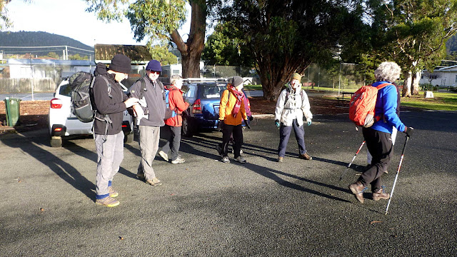
Today we were supposed to be walking in the Rifle Range Road area, but for the second Tuesday in a row, an accident on the Southern Outlet has blocked the access to Hobart with a traffic jam causing a backup for several kilometres.
Not knowing how long it would last, (several hours) Bob suggests we head down to Snug for a walk, because getting through town would be impossible.
The weather is clear and is supposed to stay that way until later this afternoon.
We park at the car park at Snug Beach and set off.
 |
| Mouth of the Snug River and start of the track |
The track leads back to the Channel Highway which we cross to pickup the track on the other side. This runs along the boundary of Snug Primary School to a footbridge leading over the river.
Turning left on the other side, we pass an area that, according to a small sign, is a Bush Food Classroom for the school.
There is a track leading up river from here.
 |
| Bush Food Classroom |
 |
| The track, quite clear at the moment |
 |
| Snug River |
The track climbs to get over a small hill, coming down on the other side. The descent is a very slippery and muddy slope with some bottom sliding by some.
 |
| Starting down |
 |
| It doesn't look very impressive in this photo |
At the bottom, the track begins to deteriorate, obviously it isn't being looked after as it has been in the past. It finally disappears altogether.
There are several fallen trees to go over or under before we come to a clearing.
 |
| The track disappears about here |
 |
| Clearing |
On the other side of the clearing the track is gone. Bob sets off to look for an old fire trail we've been on before.
 |
| Waiting for Bob to report back |
Bob found the track he wanted, we had walked past the end of it just before stopping.
 |
| Going up again |
 |
| No wonder we missed it, it's almost completely overgrown |
 |
| It comes up to another fire trail, I remember the last scramble up from before |
Wayne says all these fire trails date from the 1967 bushfires which almost burnt out Snug along with many other places in Tasmania.
 |
| Looking south at O'Briens Hill |
We head along the track to a dam, also dating from the bushfires, for lunch.
 |
| Good spot for lunch |
 |
| While they relax behind me, I look for some interesting mosses |
Lunch finished, we continue along the track, coming to a fence we can step across.
The track continues for a short distance before bringing us to Jarvis Road which we follow back to the Channel Highway.
 |
| Jarvis Road leading back to Snug |
 |
| North West Bay |
Reaching and crossing the Channel Highway, we start up the old road which has been converted into a dual use bike/walk track. This joins up with the new track leading to Margate.
We walk through Electronia, now called by the developer and newbies Peggys Beach. It was called Electronia because it was a factory town for workers at the nearby Carbide works.
 |
| Carbide Works, Electronia |
Carbide was produced from limestone and coke in electric arc furnaces. This was quite a sight at night. Carbide was used to produce acetylene gas. As a kid I had a miners lamp which used carbide. You put the carbide in and filled a reservoir with water.
The water dripped on the carbide, the rate of dripping was adjustable, this generated Acetylene gas which was lit to produce quite a bright light.
We make our way through the houses to a track leading down to Peggys Beach.
 |
| Peggys Beach |
At the end of the beach we scramble up to the track leading around the point in the photo above.
We needn't have walked down to the beach, we could have just walked above the beach to the track but where's the fun in that?
 |
| Going up |
 |
| Peggys Beach Track |
 |
| Margate Marina in the distance |
We reach a spot for lunch, the council have kindly installed two picnic tables for us.
 |
| Lunch |
I walk down to the foreshore and find a large rock and a nice sandy pool. If only it was warmer.
 |
| Room for two people and maybe a couple of very small children |
 |
| Looking south it's a stony beach |
I have a look around during lunch, off track and find a small grave. I suspect it's for someone's pet.
 |
| Grave? |
After lunch we start back and as we walk back towards Snug it begins to drizzle. The forecast is right.
 |
| Through the bush and over the hill near the old factory site |
We had 9 walkers and covered 9.66km in 3:30hrs. It was quite a good walk, I didn't mind climbing through the bush near Snug River. A good choice by Bob.
Click here to download GPX file


No comments:
Post a Comment