One group would do a G5 rated walk, our toughest rating, while a smaller group would peal off onto a G2 rated track. Why anyone would give up the opportunity of walking 2.5hrs uphill on a steep and stony track is beyond me. But some of them chose not to do so.
I should mention I wasn't there that day so no one knows what I would have chosen.
To produce this blog I've had the help of three people, Peter for photos of the G5 walk, Jenny G. for photos of the G2 walk and Ron for a gps track of the G5 walk.
I'll let Peter describe the longer walk below.
The day was mild but fairly wet.
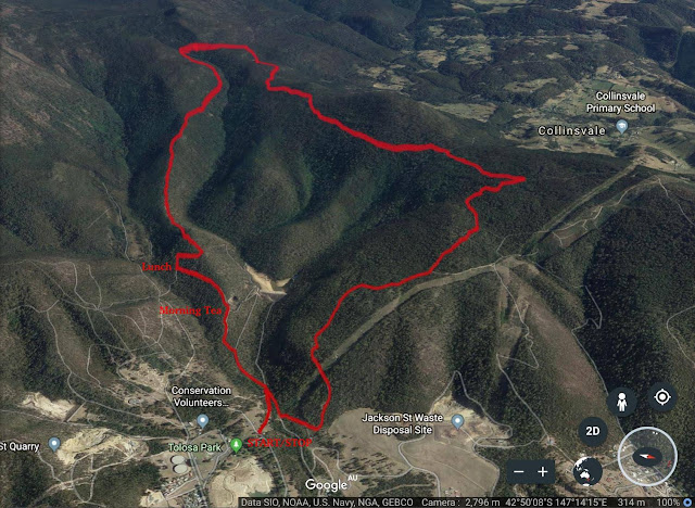
We had 13 walkers and Ron has sent you the route, time and distances.
As you know the walk was in two parts a Level 2 which had 5 walkers and the remaining 8 on the Level 5.
Initially we walked about 2 km had an early morning tea and the party then split. I haven’t heard but I assume Sally got them all back to the car.
The rest of us continued up the mountain for 2.5 hours by which time we had covered approx 5.5 km.
The walk up was actually quite good although long and everyone was quite stretched.
The track up the hill was actually closed according to a sign although we went through the closure and then at the top found that it was closed to enable the workers to rebuild a creek crossing very near to the top.
After lunch the walk down was a fair bit longer than the climb up.
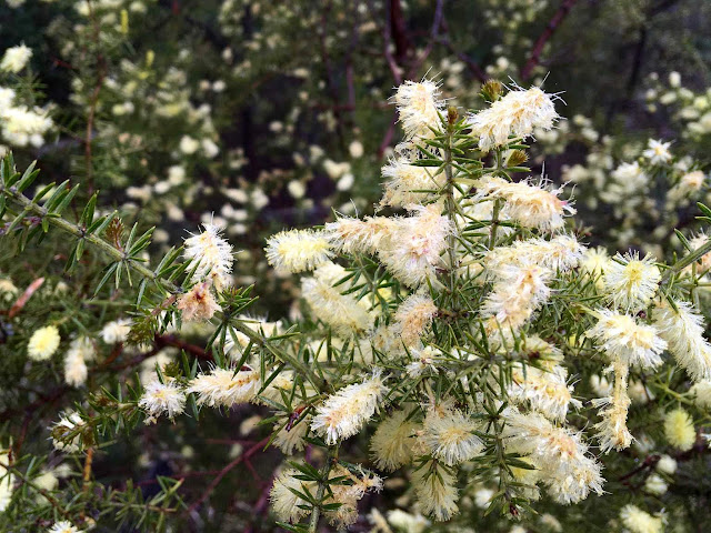
There was a considerable amount of wildflowers out in the area which made for a pleasant and distracting walk.
 |
| Weather, worried looks or was it the hill? |
 |
| Starting on the track |
 |
| Tolosa Creek |
 |
| The first hill |
 |
| An early Morning Tea before splitting into two groups |
 |
| The level two walking group |
 |
| Following Bob up a Wee Hill |
 |
| Mountain mist moving in |
 |
| Happy to be past the workman resurrecting a creek crossing |
 |
| Lunch spot by the East-West Track |
 |
| Heading downhill at last |
 |
| Mountain berries |
 |
| Onto Big Bend Trail |
 |
| Pittosporum Bicolour - Cheesewood_ |
 |
| View through the trees |
 |
| Water for firefighting |
 |
| Fern Garden |
 |
| Hakea Microarpa_copy |
 |
| Old Man's Beard |
 |
| Onto the Montrose Trail |
 |
| Wattle forest |
 |
| Then finally the Goat Fire Trail |
 |
| G5 track |
For some reason the track goes flat as you can see from the graph. We'll blame the satellite, not the smartwatch.
The other walkers did a G2 track and Jenny G. kindly sent me photos from that walk. It does look interesting, too.
Looks an interesting walk, also. I wonder what the building ruins were?


No comments:
Post a Comment