I'll open with the weather, you must be as bored reading this as I am writing it. We had good weather for our walk on the lower tracks of Mt. Wellington. As usual.
If we had gone up to the top, it would have been a different story, but now's not the time of year for long walks up there.
We were being led by Gordon and we started off at the cutting just below the Fern Tree Tavern. I, and several others, had been in two minds about carrying more wet weather gear and gloves, but didn't, and didn't need them. It was a little windy at the start which cooled things down, but as it was all uphill, it wasn't too long before clothes began being shed.
 |
| Everyone getting kitted up. |
 |
| Some kind soul left his stick there for another walker. |
 |
| Up the stone steps into the gloom. |
The Fern Glade track was a little muddy in places, but really not bad at all.
Leeches are always a worry, but at the end of the day I don't think anyone had found one.
The climb continues up towards O'Gradys Falls & Betts Vale tracks, through the bush to pick up the Shoobridge Track leading onto Lenah Valley track.
 |
| Looking off track |
There are a myriad of tracks in this area, and I'm having trouble making various maps agree. So just look at the photos and enjoy.
 |
| Left over from the 1967 fires. |
 |
| Now we know where we are. |
 |
| Up again |
 |
| Lots of Man Ferns here |
 |
| Large old gum that recently came down |
 |
| For scale, it's nearly head height lying on the ground. |
The U.S. may have the tallest trees (just) but Tasmania has the tallest hardwood.
 |
| Just when you thought you got away, here's a Urnula campylospora |
 |
| Growing in the top of a stump |
 |
| Morning Tea |
Morning Tea was taken on the way. After tea, we continued on to pick up the Lenah Valley track. Passing over old avalanche sites with glimpses of both Hobart and the Organ pipes.
We walked down past an old cabin picking up the Finger Post track.
 |
| Rock Cabin |
 |
| Looking over Hobart, River Derwent to the Eastern Shore. |
 |
| Heading down for lunch |
 |
| It's fairly steep with muddy places and rocks to trip you up. |
Heading down the Finger Post track, we turn off for our lunch destination at Rocky Whelan's Cave.
 |
| Rocky Whelan's cave |
 |
| It's called the back entrance, but you'd have to be a Hobbit to use it. |
 |
| Detail of cave roof. Possible art shot |
Rocky Whelan was a Bushranger and not a very nice one. John "Rocky" Whelan was big for the time, over 6 feet with a big build. He had a couple of bolt holes, here on the side of Mt. Wellington and another near Kingston. He would murder then rob his victims. For more information this website of the Hobart Walking Tours gives a colourful description.
Just click here Rocky Whelan bio
After lunch, we continued on our way down past Radford's Monument. No good comes of running, you see. Stick to walking.
 |
| Radford's Monument |
 |
| Moving on |
After a while we came to a turnoff to the top of Sphinx Rock, which gives a good view over Hobart. As several of the walkers hadn't seen it, some of us undertook to show them.
It's been a while since I've been there, the nanny state has taken over and put up a child proof gate. I guess the large number of children running along the path and straight over the cliff got to the authorities. Must have happened, well, never that I know of.
Despite being young at heart, we had trouble defeating the childproof lock on the gate, but we finally got the bloody thing open. Too bad we didn't have a child along to show us what to do.
Once there, it is a great view, but Carol wanted some action photos which follow.
 |
| I was asked to point my stick at Wellington, which I did while throwing in my best Fu Manchu impression. However... |
 |
| This wasn't accurate for Carol, so I drew on my old Army training and tried again. But... |
 |
| Everyone's an expert! Unfortunately this has put paid to my dream of a precision pointing team. | | |
Finally, we leave and continue down to Fern Tree and a short walk along the road to the cars.
A great day was had by all. Thanks to Gordon, none of us got lost.
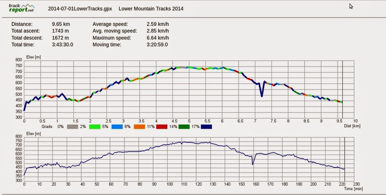
We had 16 Walkers and covered 9.65km in 3:43 hours.
Click here to download GPX file