You'll notice the word "Not" in the above title and there's a simple explanation for this. We didn't do the walk.
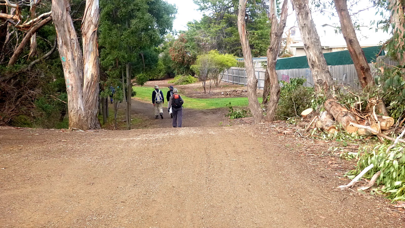
We've walked here in the past, 2014 & 2016 with no problems. It did involve crossing private property but there was a sign pointing the way and the owners allowed walkers access.
Today on arrival at the end of Ringwood Road, we began to see new looking "PRIVATE - KEEP OUT" signs near the houses at the end of the road. There was another where the road divides and where we park, replacing the sign that used to point the way to the trail.
To cut a long story short, a bloke turned up in a 4WD and told us we could no longer have access to the Ringwood Track from there. It was "Private property", Parks & Wildlife had no right to put a sign there and the gentleman had removed it, and "Walkers were lighting fires and leaving them burning" - a silly accusation when applied to us. No amount of talking would change his mind so we left, heading for Jefferys Track, which I remember hearing about, and Bob had a vague idea of the location.
We made our way to the road marked Jefferys Track, going down it until we found a sign with "Jefferys Track" marked on it at a junction. No indication of which way to go, and we had no map, of course. Bob went exploring up one road that looked newly graded and I had a look down the other. The decision was taken to go up the newly graded road and look for a track and a place to park.
We found a boundary sign for the Wellington Range and started up the track it was on. It was pleasant bush and started to make up for missing the Ringwood Track.
The story starts from here.
 |
| I.D. Photo |
As we gathered after parking the cars, I asked everyone to turnaround and face the camera so that, if the camera was found in the bush sometime in the future, we could be identified!
 |
| A good start |
 |
| Easy walking |
 |
| The track curved around here, and I spotted this chain, one end in concrete, lying in the litter |
I suppose there was a gate here in the past, but no other sign of it.
We found a spot for our much delayed Morning Tea. Due to the circumstances, no demerit points were awarded to Bob for the lateness of the stop.
Break finished, we continued on to a junction. First we turned left and headed down, remember - no maps, but as it appeared to go nowhere, we turned back and headed up instead. Looking at Google Earth after the event showed the downhill track curved back to our original starting track.
After a while we came to a cable blocking the way and another sign marking it as Wellington Range.
On the way up, Ron had spotted something off in the bush that looked like a cabin of some sort, but we continued on.
 |
| All we could see of mystery shelter in the bush. More later |
Eventually we came to a wide area with a track leading left, straight ahead and to the right.
 |
| We chose right |
 |
| The bush is fairly open with mostly young growth. |
As we climb we see signs of civilization (if you can call it that) beside and just off the track. Old loading ramps point to past timber harvesting and the photo below may indicate the position of an old takeaway.
 |
| A kitchen sink - in good order and an old chair. I also found a good steak knife just beside the track. |
|
|
No, I didn't bring it back.
 |
| Better than looking at junk |
On we climbed until we came to a large cleared area.
 |
| Off track |
 |
| We're starting to see a lot of ferns |
 |
| Beginning of the large cleared area I mentioned above |
Perhaps there had been a saw mill here in the dim past, now it's home to everything plus the kitchen sink. On we go.
Looking back into the bush, among the young gums you can see some large blackened giants showing how the area must have looked originally.
You can see the slot cut for a springboard used by the loggers to, I assume, cut the tree where the timber is straight, not curved out into the stump.
 |
| By Charles Kerry or Kerry and Co. via Tyrrell Photographic Collection, Powerhouse Museum - Felling a gum tree via Powerhouse Museum from Sydney, Australia. |
Bob spots a track leading through the ferns on the left, so we leave the main track to explore, finding this fine example of bush construction.
 |
| Nice open design |
 |
| Obviously the builders were very fastidious! |
The G cramp is interesting as it has part of a star post welded to it, ending in a point you could drive into a stump. Why, I don't know. I used the term cramp here instead of clamp just to start an argument as to which it's called.
 |
| This area is covered with the most magnificent ferns |
 |
| Something has been turning over stones and earth for a feed |
An echidna?
We return to the main track, continuing along for a short distance before deciding to turn back to the large clear area for lunch.
 |
| Plenty of room for lunch |
There's a track just to the right of the photo leading down which I decide to explore. More signs of occupation, in this case a fenced area which I took to ba a chook pen, but could have been for something more illegal. I don't think so, though, as it showed no signs of being cultivated.
 |
| Chook pen? |
 |
| Old giant |
 |
| Following the track down comes to a steep descent |
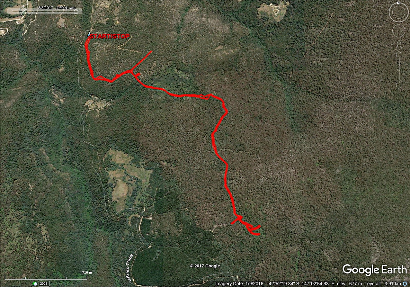
Loading the GPX track into Google Earth shows it eventually reaches a dirt track around a plantation timber site.
 |
| Looking back up the side track |
After lunch, we begin to make our way back. I made the comment that the hill seemed steeper going down. On our way Ron kept a lookout for that mystery shelter we saw a little while ago. I said there would be more later, and here it is.
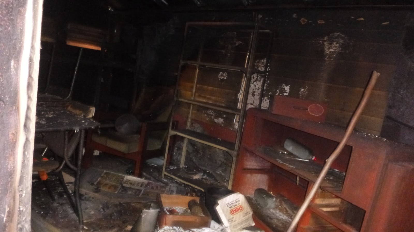
We followed a track through the bush and came to ...a railway car. What else to you expect to find up here in the bush. All rusted steel and doors chained and locked, but partially open. It appeared to me to be some sort of livestock car.
Ron pulled out a torch and had a look through the gap in the doors. I stuck my camera in and took a couple of flash photos of the inside. The photos were the only thing that was flash!
 |
| Nice comfy chair and plenty of storage on the left |
 |
| More seating and a table on the right, plus a woodstove out of sight |
 |
| Buffers, not much use now |
 |
| It had a couple of logs as a foundation, but they have mainly collapsed now |
The boys of the group had a good time exploring around the car and area, the ladies, however, were not amused, remaining in a disapproving group! It's a boy thing, I guess.
On we go, heading down as I checked the track I had recorded on my GPS on the way up to make sure we turned off when we should.
I made the comment on the way back that I was looking forward to loading the GPX track on a map to see where we'd walked. I had a look that night and, clunk-grind, immediately remembered that Jefferys Track is not a walking track, but a 4WD track that leads from Crabtree in the Huon to Lachan in the Derwent Valley. The road we parked on WAS Jefferys Track.
Thanks to Bob for dragging up an ancient memory and getting us climbing a steep hill in the bush! It actually was enjoyable doing a bit of exploring and there may be opportunities for other walks in the area in the future, just depends if I can find some tracks that suit us.
It all turned out O.K. and we had 12 walkers and covered 8.53km in 3:38hrs. We can add about 12.5km to that using the uphill rule that makes us all feel better.
Click here to download GPX file